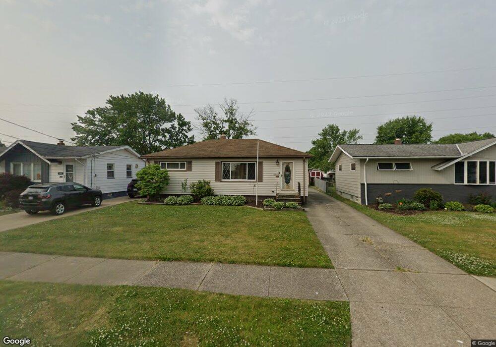
15667 Paulding Blvd Brookpark, OH 44142
Estimated Value: $215,159 - $231,000
3
Beds
2
Baths
950
Sq Ft
$236/Sq Ft
Est. Value
About This Home
This home is located at 15667 Paulding Blvd, Brookpark, OH 44142 and is currently estimated at $224,540, approximately $236 per square foot. 15667 Paulding Blvd is a home located in Cuyahoga County with nearby schools including Berea-Midpark Middle School, Berea-Midpark High School, and Huber Heights Preparatory Academy Parma Academy.
Ownership History
Date
Name
Owned For
Owner Type
Purchase Details
Closed on
Jun 1, 2018
Sold by
Pasek Paul N and Noel Heather T
Bought by
Pasek Paul N and Pasek Heather T
Current Estimated Value
Purchase Details
Closed on
May 8, 2002
Sold by
Gramm Carol A and Mochko Carol A
Bought by
Mochko Phillip P and Mochko Carol A
Purchase Details
Closed on
Jul 24, 1979
Sold by
Gramm Ross E
Bought by
Carol A Gramm
Purchase Details
Closed on
May 16, 1977
Sold by
Perhacs Ellen E
Bought by
Gramm Ross E
Purchase Details
Closed on
Jan 1, 1975
Bought by
Perhacs Ellen E
Create a Home Valuation Report for This Property
The Home Valuation Report is an in-depth analysis detailing your home's value as well as a comparison with similar homes in the area
Home Values in the Area
Average Home Value in this Area
Purchase History
| Date | Buyer | Sale Price | Title Company |
|---|---|---|---|
| Pasek Paul N | -- | None Available | |
| Mochko Phillip P | -- | -- | |
| Carol A Gramm | -- | -- | |
| Gramm Ross E | $42,000 | -- | |
| Perhacs Ellen E | -- | -- |
Source: Public Records
Tax History Compared to Growth
Tax History
| Year | Tax Paid | Tax Assessment Tax Assessment Total Assessment is a certain percentage of the fair market value that is determined by local assessors to be the total taxable value of land and additions on the property. | Land | Improvement |
|---|---|---|---|---|
| 2024 | $2,560 | $60,550 | $12,880 | $47,670 |
| 2023 | $2,284 | $46,660 | $9,380 | $37,280 |
| 2022 | $2,293 | $46,660 | $9,380 | $37,280 |
| 2021 | $2,279 | $46,660 | $9,380 | $37,280 |
| 2020 | $1,933 | $37,030 | $7,460 | $29,580 |
| 2019 | $1,875 | $105,800 | $21,300 | $84,500 |
| 2018 | $1,867 | $37,030 | $7,460 | $29,580 |
| 2017 | $1,783 | $33,710 | $7,320 | $26,390 |
| 2016 | $1,769 | $33,710 | $7,320 | $26,390 |
| 2015 | $1,778 | $33,710 | $7,320 | $26,390 |
| 2014 | $1,778 | $35,490 | $7,700 | $27,790 |
Source: Public Records
Map
Nearby Homes
- 16051 Holland Rd
- 15924 Richard Dr
- 6195 Hardin Dr
- 14890 Holland Rd
- 6363 Lockhaven Dr
- 6378 Edgehurst Dr
- 6470 Sandfield Dr
- 6054 Langer Dr
- 14237 Starlite Dr
- 14344 Fayette Blvd
- 15446 Sheldon Rd
- 14417 Parkman Blvd
- 6366 Sandhurst Dr
- 5677 Gateway Ln Unit E504
- 16193 Emerald Point Unit 16193
- 14055 Donald Dr
- 5966 Engle Rd
- 6710 Woodruff Ct
- 6537 Liberty Bell Dr Unit 160
- 13971 Park Dr
- 15691 Paulding Blvd
- 15647 Paulding Blvd
- 15715 Paulding Blvd
- 15621 Paulding Blvd
- 15650 Sylvia Dr
- 15741 Paulding Blvd
- 15690 Sylvia Dr
- 15589 Paulding Blvd
- 15730 Sylvia Dr
- 15656 Paulding Blvd
- 15632 Paulding Blvd
- 15755 Paulding Blvd
- 15682 Paulding Blvd
- 15606 Paulding Blvd
- 15704 Paulding Blvd
- 15760 Sylvia Dr
- 15569 Paulding Blvd
- 15724 Paulding Blvd
- 15779 Paulding Blvd
- 15588 Paulding Blvd