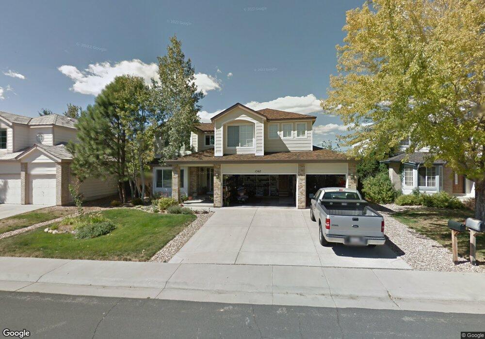
1567 E 133rd Ave Thornton, CO 80241
Hunters Glen NeighborhoodEstimated Value: $691,105 - $724,000
5
Beds
4
Baths
2,968
Sq Ft
$238/Sq Ft
Est. Value
About This Home
This home is located at 1567 E 133rd Ave, Thornton, CO 80241 and is currently estimated at $707,276, approximately $238 per square foot. 1567 E 133rd Ave is a home located in Adams County with nearby schools including Hunters Glen Elementary School, Century Middle School, and Mountain Range High School.
Ownership History
Date
Name
Owned For
Owner Type
Purchase Details
Closed on
Jun 10, 2019
Sold by
Drean Jason and Drean Michelle
Bought by
Cooper Kelly and Cooper Brandon
Current Estimated Value
Home Financials for this Owner
Home Financials are based on the most recent Mortgage that was taken out on this home.
Original Mortgage
$361,000
Outstanding Balance
$315,422
Interest Rate
4.2%
Mortgage Type
New Conventional
Estimated Equity
$391,854
Purchase Details
Closed on
Jul 19, 2013
Sold by
Mcdonald Phillip Dewey and Mcdonald Kay
Bought by
Drean Jason and Drean Michelle
Home Financials for this Owner
Home Financials are based on the most recent Mortgage that was taken out on this home.
Original Mortgage
$351,500
Interest Rate
3.94%
Mortgage Type
New Conventional
Purchase Details
Closed on
Oct 27, 2011
Sold by
Parsons Michael H and Parsons Diane A
Bought by
Mcdonald Phillip Dewey and Mcdonald Kay
Home Financials for this Owner
Home Financials are based on the most recent Mortgage that was taken out on this home.
Original Mortgage
$215,500
Interest Rate
4.13%
Mortgage Type
New Conventional
Purchase Details
Closed on
Apr 4, 1998
Sold by
Ketchmark Timothy D and Ketchmark Janis C
Bought by
Parsons Michael H and Parsons Diane A
Home Financials for this Owner
Home Financials are based on the most recent Mortgage that was taken out on this home.
Original Mortgage
$219,500
Interest Rate
7.17%
Purchase Details
Closed on
Feb 24, 1994
Sold by
Richmond Homes Inc Ii
Bought by
Ketchmark Timothy D and Ketchmark Janis C
Home Financials for this Owner
Home Financials are based on the most recent Mortgage that was taken out on this home.
Original Mortgage
$173,800
Interest Rate
7%
Purchase Details
Closed on
Jul 13, 1993
Create a Home Valuation Report for This Property
The Home Valuation Report is an in-depth analysis detailing your home's value as well as a comparison with similar homes in the area
Home Values in the Area
Average Home Value in this Area
Purchase History
| Date | Buyer | Sale Price | Title Company |
|---|---|---|---|
| Cooper Kelly | $511,000 | Land Title Guarantee | |
| Drean Jason | $370,000 | Fidelity National Title Insu | |
| Mcdonald Phillip Dewey | $319,000 | Fidelity National Title Insu | |
| Parsons Michael H | $243,900 | -- | |
| Ketchmark Timothy D | $220,375 | Land Title | |
| -- | $173,600 | -- |
Source: Public Records
Mortgage History
| Date | Status | Borrower | Loan Amount |
|---|---|---|---|
| Open | Cooper Kelly | $361,000 | |
| Previous Owner | Drean Jason | $351,500 | |
| Previous Owner | Mcdonald Phillip Dewey | $215,500 | |
| Previous Owner | Parsons Michael H | $219,500 | |
| Previous Owner | Ketchmark Timothy D | $173,800 | |
| Closed | Ketchmark Timothy D | $19,000 |
Source: Public Records
Tax History
| Year | Tax Paid | Tax Assessment Tax Assessment Total Assessment is a certain percentage of the fair market value that is determined by local assessors to be the total taxable value of land and additions on the property. | Land | Improvement |
|---|---|---|---|---|
| 2025 | $4,636 | $47,260 | $12,380 | $34,880 |
| 2024 | $4,636 | $43,440 | $11,380 | $32,060 |
| 2023 | $4,588 | $48,500 | $10,550 | $37,950 |
| 2022 | $4,027 | $36,560 | $10,300 | $26,260 |
| 2021 | $4,162 | $36,560 | $10,300 | $26,260 |
| 2020 | $4,117 | $36,900 | $10,600 | $26,300 |
| 2019 | $4,125 | $36,900 | $10,600 | $26,300 |
| 2018 | $3,888 | $33,790 | $9,730 | $24,060 |
| 2017 | $3,535 | $33,790 | $9,730 | $24,060 |
| 2016 | $3,247 | $30,210 | $7,040 | $23,170 |
| 2015 | $3,242 | $30,210 | $7,040 | $23,170 |
| 2014 | $2,666 | $23,100 | $6,000 | $17,100 |
Source: Public Records
Map
Nearby Homes
- 1672 E 131st Ct
- 1174 E 130th Dr
- 1162 E 130th Ave Unit B
- 13550 Washington St Unit 7C
- 7 Sandpiper Cir
- 13508 Vine St
- 13262 Pearl Cir
- 1960 E 135th Place
- 12905 Lafayette St Unit H
- 491 E 133rd Way
- 2066 E 129th Ave
- 12885 Vine St
- 58 Blue Heron Dr
- 2275 E 129th Ave
- 13337 Elizabeth Ct
- 2942 E 135th Place
- 12962 Grant Cir E Unit A
- 12963 Grant Cir E Unit A
- 2297 E 128th Ave
- 13013 Grant Cir E Unit C
- 1561 E 133rd Ave
- 1573 E 133rd Ave
- 1555 E 133rd Ave
- 1579 E 133rd Ave
- 13323 Marion St
- 1585 E 133rd Ave
- 1549 E 133rd Ave
- 1574 E 133rd Ave
- 13343 Marion St
- 13312 Marion St
- 1543 E 133rd Ave
- 1591 E 133rd Ave
- 13332 Marion St
- 13353 Marion St
- 1580 E 133rd Ave
- 13342 Marion St
- 13305 Lafayette Way
- 1586 E 133rd Ave
- 1537 E 133rd Ave
- 1597 E 133rd Ave
Your Personal Tour Guide
Ask me questions while you tour the home.