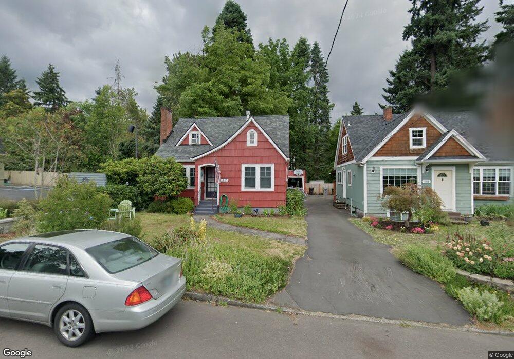
1567 Holly St Unit D West Linn, OR 97068
Bolton NeighborhoodEstimated Value: $489,613 - $693,000
3
Beds
1
Bath
2,064
Sq Ft
$264/Sq Ft
Est. Value
About This Home
This home is located at 1567 Holly St Unit D, West Linn, OR 97068 and is currently estimated at $544,403, approximately $263 per square foot. 1567 Holly St Unit D is a home located in Clackamas County with nearby schools including Bolton Primary School, West Linn High School, and Clackamas Academy of Industrial Sciences (CAIS).
Ownership History
Date
Name
Owned For
Owner Type
Purchase Details
Closed on
Jun 14, 1999
Sold by
Wells Stuart James
Bought by
Leebrick Diane D and Leebrick Christopher M
Current Estimated Value
Home Financials for this Owner
Home Financials are based on the most recent Mortgage that was taken out on this home.
Original Mortgage
$146,520
Outstanding Balance
$37,764
Interest Rate
7.01%
Mortgage Type
FHA
Estimated Equity
$506,639
Create a Home Valuation Report for This Property
The Home Valuation Report is an in-depth analysis detailing your home's value as well as a comparison with similar homes in the area
Home Values in the Area
Average Home Value in this Area
Purchase History
| Date | Buyer | Sale Price | Title Company |
|---|---|---|---|
| Leebrick Diane D | $147,500 | Ticor Title Insurance |
Source: Public Records
Mortgage History
| Date | Status | Borrower | Loan Amount |
|---|---|---|---|
| Open | Leebrick Diane D | $146,520 |
Source: Public Records
Tax History Compared to Growth
Tax History
| Year | Tax Paid | Tax Assessment Tax Assessment Total Assessment is a certain percentage of the fair market value that is determined by local assessors to be the total taxable value of land and additions on the property. | Land | Improvement |
|---|---|---|---|---|
| 2025 | $3,575 | $185,529 | -- | -- |
| 2024 | $3,442 | $180,126 | -- | -- |
| 2023 | $3,442 | $174,880 | $0 | $0 |
| 2022 | $3,248 | $169,787 | $0 | $0 |
| 2021 | $3,084 | $164,842 | $0 | $0 |
| 2020 | $3,105 | $160,041 | $0 | $0 |
| 2019 | $2,961 | $155,380 | $0 | $0 |
| 2018 | $2,828 | $150,854 | $0 | $0 |
| 2017 | $2,719 | $146,460 | $0 | $0 |
| 2016 | $2,648 | $142,194 | $0 | $0 |
| 2015 | $2,573 | $138,052 | $0 | $0 |
| 2014 | $2,477 | $134,031 | $0 | $0 |
Source: Public Records
Map
Nearby Homes
- 5390 Grove St
- 5089 Territorial Dr
- 5687 River St
- 909 Center St
- 5910 W A St
- 824 Center St
- 4711 Alder St
- 4645 Pine St
- 709 10th St
- 401 4th St
- 411 4th St
- 1870 Hemlock St
- 22691 Oregon City Loop
- 22881 Oregon City Loop
- 812 Jefferson St
- 312 High St
- 1954 Buck St
- 911 9th St
- 911 John Quincy Adams St
- 5128 Firwood Dr
- 1567 Holly St Unit 1
- 1563 Holly St
- 22150 Willamette Dr
- 1555 Holly St Unit D
- 1595 Holly St
- 1547 Holly St
- 1570 Holly St
- 1560 Holly St
- 1584 Holly St Unit 2
- 1584 Holly St Unit 1
- 1584 Holly St
- 1531 Holly St
- 1542 Holly St
- 1550 Garden St
- 1536 Holly St
- 1519 Holly St
- 1544 Garden St
- 1524 Holly St
- 5493 Amy St
- 1513 Holly St