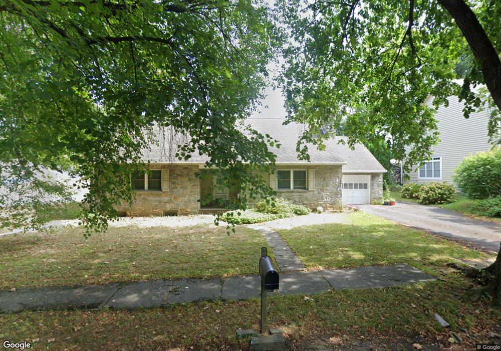
1567 Linden Ave Lancaster, PA 17601
Eden NeighborhoodEstimated Value: $247,000 - $377,576
2
Beds
2
Baths
1,344
Sq Ft
$244/Sq Ft
Est. Value
About This Home
This home is located at 1567 Linden Ave, Lancaster, PA 17601 and is currently estimated at $328,144, approximately $244 per square foot. 1567 Linden Ave is a home located in Lancaster County with nearby schools including Schaeffer Elementary School, Landis Run Intermediate School, and Manheim Township Middle School.
Ownership History
Date
Name
Owned For
Owner Type
Purchase Details
Closed on
Jul 31, 2007
Sold by
Shervanick Sherlyn
Bought by
Kneisley John W and Kneisley Michele L
Current Estimated Value
Purchase Details
Closed on
Jul 6, 2006
Sold by
Shervanick Mark
Bought by
Shervanick Sherlyn
Purchase Details
Closed on
Mar 12, 2002
Sold by
Estate Of Grace V Peil and Shervanick Sherlyn
Bought by
Shervanick Mark
Create a Home Valuation Report for This Property
The Home Valuation Report is an in-depth analysis detailing your home's value as well as a comparison with similar homes in the area
Home Values in the Area
Average Home Value in this Area
Purchase History
| Date | Buyer | Sale Price | Title Company |
|---|---|---|---|
| Kneisley John W | $120,000 | None Available | |
| Shervanick Sherlyn | -- | None Available | |
| Shervanick Mark | $81,700 | -- |
Source: Public Records
Tax History Compared to Growth
Tax History
| Year | Tax Paid | Tax Assessment Tax Assessment Total Assessment is a certain percentage of the fair market value that is determined by local assessors to be the total taxable value of land and additions on the property. | Land | Improvement |
|---|---|---|---|---|
| 2025 | $4,888 | $225,900 | $81,400 | $144,500 |
| 2024 | $4,888 | $225,900 | $81,400 | $144,500 |
| 2023 | $4,680 | $225,900 | $81,400 | $144,500 |
| 2022 | $4,680 | $225,900 | $81,400 | $144,500 |
| 2021 | $4,576 | $225,900 | $81,400 | $144,500 |
| 2020 | $4,576 | $225,900 | $81,400 | $144,500 |
| 2019 | $4,531 | $225,900 | $81,400 | $144,500 |
| 2018 | $3,414 | $225,900 | $81,400 | $144,500 |
| 2017 | $3,975 | $156,200 | $45,100 | $111,100 |
| 2016 | $3,975 | $156,200 | $45,100 | $111,100 |
| 2015 | $999 | $156,200 | $45,100 | $111,100 |
| 2014 | $2,912 | $156,200 | $45,100 | $111,100 |
Source: Public Records
Map
Nearby Homes
- 1550 Euclid Dr
- 1914 Pickering Trail
- 1922 Pickering Trail
- 1915 Pickering Trail
- 1923 Pickering Trail
- 1919 Pickering Trail
- 1150 Groff Ln
- 1935 New Holland Pike
- 1100 Bluegrass Rd Unit NOTTINGHAM
- 1100 Bluegrass Rd Unit HAWTHORNE
- 1100 Bluegrass Rd Unit DEVONSHIRE
- 1100 Bluegrass Rd Unit AUGUSTA
- 1100 Bluegrass Rd Unit SAVANNAH
- 1100 Bluegrass Rd Unit COVINGTON
- 1100 Bluegrass Rd Unit ARCADIA
- 200 Hershey Ln Unit CRESTWOOD
- 200 Hershey Ln Unit CEDARBROOK
- 1231 Hershey Ln
- Cedarbrook Plan at Somerford at Stoner Farm - Carriage Homes
- Crestwood Plan at Somerford at Stoner Farm - Carriage Homes