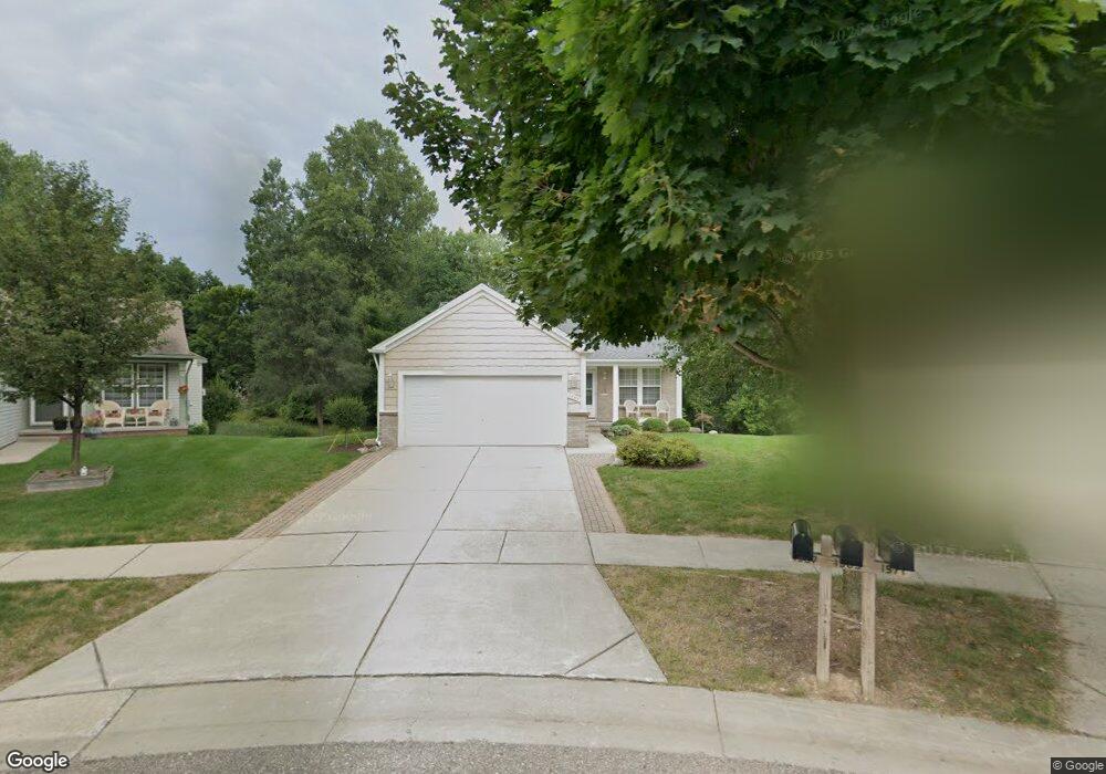
1567 Marshbank Ct Pontiac, MI 48340
Estimated Value: $268,000 - $303,000
3
Beds
2
Baths
1,303
Sq Ft
$215/Sq Ft
Est. Value
About This Home
This home is located at 1567 Marshbank Ct, Pontiac, MI 48340 and is currently estimated at $279,946, approximately $214 per square foot. 1567 Marshbank Ct is a home located in Oakland County with nearby schools including Alcott School, Pontiac Middle School, and Pontiac High School.
Ownership History
Date
Name
Owned For
Owner Type
Purchase Details
Closed on
Aug 16, 2015
Sold by
Descamps Kathryn A
Bought by
Descamps Kathryn A
Current Estimated Value
Purchase Details
Closed on
Jul 8, 1999
Sold by
Pulte Land Dev Corp
Bought by
Descamps Gary L
Create a Home Valuation Report for This Property
The Home Valuation Report is an in-depth analysis detailing your home's value as well as a comparison with similar homes in the area
Home Values in the Area
Average Home Value in this Area
Purchase History
| Date | Buyer | Sale Price | Title Company |
|---|---|---|---|
| Descamps Kathryn A | -- | Attorney | |
| Descamps Gary L | $40,000 | -- |
Source: Public Records
Tax History Compared to Growth
Tax History
| Year | Tax Paid | Tax Assessment Tax Assessment Total Assessment is a certain percentage of the fair market value that is determined by local assessors to be the total taxable value of land and additions on the property. | Land | Improvement |
|---|---|---|---|---|
| 2024 | $1,731 | $114,540 | $0 | $0 |
| 2023 | $1,650 | $101,520 | $0 | $0 |
| 2022 | $1,665 | $94,420 | $0 | $0 |
| 2021 | $1,615 | $85,350 | $0 | $0 |
| 2020 | $1,499 | $80,610 | $0 | $0 |
| 2019 | $1,584 | $71,540 | $0 | $0 |
| 2018 | $1,537 | $65,310 | $0 | $0 |
| 2017 | $1,454 | $62,140 | $0 | $0 |
| 2016 | $1,475 | $57,190 | $0 | $0 |
| 2015 | -- | $45,590 | $0 | $0 |
| 2014 | -- | $38,630 | $0 | $0 |
| 2011 | -- | $45,730 | $0 | $0 |
Source: Public Records
Map
Nearby Homes
- 2854 Beacham Dr
- 2927 Huntington Park Dr
- 2831 Silverstone Ln
- 940 Lake Angelus Shores Rd
- 405 W Walton Blvd
- 2550 W Walton Blvd
- 2361 Montroyal Ave
- 310 W Princeton Ave
- 2830 Dixie Hwy
- 228 W Walton Blvd
- 3411 Wormer Dr
- 161 W Brooklyn Ave
- 1123 Cherrylawn Dr
- 108 W Brooklyn Ave
- 104 W Brooklyn Ave
- 1153 Stanley Ave
- 64 W Colgate Ave
- 3039 Mccormick Dr
- 240 W Fairmount Ave
- 1017 Cherrylawn Dr
- 1565 Marshbank Ct
- 1569 Marshbank Ct
- 1563 Marshbank Ct
- 1571 Marshbank Ct
- 1561 Marshbank Ct
- 1573 Marshbank Ct
- 1559 Marshbank Dr
- 1575 Marshbank Dr
- 1555 Marshbank Dr
- 1560 Marshbank Dr
- 1577 Marshbank Dr
- 1572 Marshbank Dr
- 1566 Marshbank Dr
- 1558 Marshbank Dr
- 1551 Marshbank Dr
- 1579 Marshbank Dr
- 2878 Beacham Dr Unit Bldg-Unit
- 2878 Beacham Dr
- 1563 Meadow Ridge Dr
- 2866 Beacham Dr