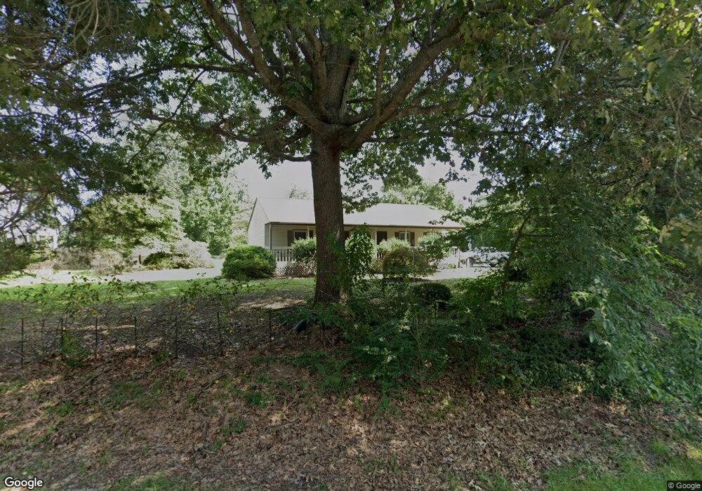
1567 Pine Tree Dr Gloucester Point, VA 23062
Estimated Value: $298,000 - $319,267
3
Beds
2
Baths
1,356
Sq Ft
$227/Sq Ft
Est. Value
About This Home
This home is located at 1567 Pine Tree Dr, Gloucester Point, VA 23062 and is currently estimated at $308,067, approximately $227 per square foot. 1567 Pine Tree Dr is a home located in Gloucester County with nearby schools including Achilles Elementary School, Page Middle School, and Gloucester High School.
Ownership History
Date
Name
Owned For
Owner Type
Purchase Details
Closed on
Nov 22, 2019
Sold by
Croteau Cynthia Jane Torr and Torr Jonathan Lee
Bought by
Wilson Caitlin B and Wilson Dustin A
Current Estimated Value
Home Financials for this Owner
Home Financials are based on the most recent Mortgage that was taken out on this home.
Original Mortgage
$140,409
Outstanding Balance
$123,920
Interest Rate
3.87%
Mortgage Type
FHA
Estimated Equity
$184,147
Purchase Details
Closed on
Nov 12, 2008
Sold by
Torr Phyllis F
Bought by
Torr Phyllis F and Phyllis F Torr Revocable Living Trust
Create a Home Valuation Report for This Property
The Home Valuation Report is an in-depth analysis detailing your home's value as well as a comparison with similar homes in the area
Home Values in the Area
Average Home Value in this Area
Purchase History
| Date | Buyer | Sale Price | Title Company |
|---|---|---|---|
| Wilson Caitlin B | $143,000 | Attorney | |
| Torr Phyllis F | -- | -- |
Source: Public Records
Mortgage History
| Date | Status | Borrower | Loan Amount |
|---|---|---|---|
| Open | Wilson Caitlin B | $140,409 |
Source: Public Records
Tax History
| Year | Tax Paid | Tax Assessment Tax Assessment Total Assessment is a certain percentage of the fair market value that is determined by local assessors to be the total taxable value of land and additions on the property. | Land | Improvement |
|---|---|---|---|---|
| 2025 | $1,570 | $247,660 | $60,800 | $186,860 |
| 2024 | $1,570 | $247,660 | $60,800 | $186,860 |
| 2023 | $1,493 | $247,660 | $60,800 | $186,860 |
| 2022 | $1,534 | $205,900 | $66,000 | $139,900 |
| 2021 | $1,472 | $205,900 | $66,000 | $139,900 |
| 2020 | $1,472 | $205,900 | $66,000 | $139,900 |
| 2019 | $1,361 | $190,360 | $68,400 | $121,960 |
| 2017 | $1,361 | $190,360 | $68,400 | $121,960 |
| 2016 | $1,354 | $189,400 | $68,400 | $121,000 |
| 2015 | $1,326 | $199,600 | $53,000 | $146,600 |
| 2014 | $1,337 | $199,600 | $53,000 | $146,600 |
Source: Public Records
Map
Nearby Homes
- 8157 O Carra Dr
- 1399 Mercer Rd
- 7547 Villa Ct
- 7699 the Points Place Unit 1002
- 7746 Farmwood Rd
- 2038 Kathleen Place
- 7763 Jordan Rd
- 7823 Sunset Dr Unit 6F
- 7873 Sunset Dr Unit 3E
- 8003 Sunset Dr Unit 1E
- 8007 Sunset Dr Unit 1C
- 2022 Swiss Ln
- 7900 George Washington Memorial Hwy
- Par A Hayes Rd
- 230 Nelson St
- 7159 Stokes Dr
- 2135 Nicole Dr
- .51ac George Washington Memorial Hwy
- 000 George Washington Memorial Hwy
- 17 George Washington Memorial Hwy
- 1579 Pine Tree Dr
- 7402 Camp Okee Dr
- 7423 Camp Okee Dr
- 1568 Pine Tree Dr
- 1589 Pine Tree Dr
- 7378 Camp Okee Dr
- 1574 Pine Tree Dr
- 7437 Camp Okee Dr
- 1584 Pine Tree Dr
- 1593 Pine Tree Dr
- 7372 Camp Okee Dr
- 7445 Camp Okee Dr
- 7416 Camp Okee Dr
- 7426 Camp Okee Dr
- 1569 Coleman Dr
- 7432 Canoe Ln
- 1594 Pine Tree Dr
- 7434 Camp Okee Dr
- 7426 Canoe Ln
- 1609 Pine Tree Dr
Your Personal Tour Guide
Ask me questions while you tour the home.