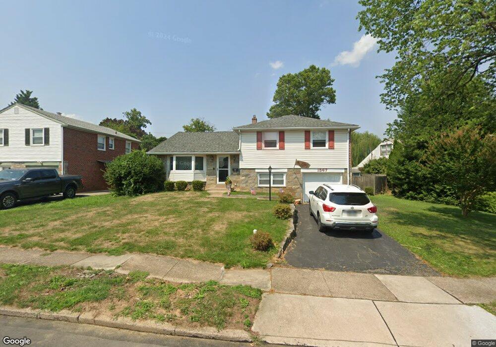
1567 Raymond Cir Swarthmore, PA 19081
Estimated Value: $494,000 - $557,000
3
Beds
3
Baths
2,259
Sq Ft
$229/Sq Ft
Est. Value
About This Home
This home is located at 1567 Raymond Cir, Swarthmore, PA 19081 and is currently estimated at $517,311, approximately $229 per square foot. 1567 Raymond Cir is a home located in Delaware County with nearby schools including Grace Park Elementary School, Ridley Middle School, and Ridley High School.
Ownership History
Date
Name
Owned For
Owner Type
Purchase Details
Closed on
Jul 31, 2003
Sold by
Meiers Robert M and Meiers Dorothy B
Bought by
Kusner Michael J and Kusner Marybeth
Current Estimated Value
Home Financials for this Owner
Home Financials are based on the most recent Mortgage that was taken out on this home.
Original Mortgage
$155,900
Outstanding Balance
$66,950
Interest Rate
5.28%
Mortgage Type
Purchase Money Mortgage
Estimated Equity
$450,361
Create a Home Valuation Report for This Property
The Home Valuation Report is an in-depth analysis detailing your home's value as well as a comparison with similar homes in the area
Home Values in the Area
Average Home Value in this Area
Purchase History
| Date | Buyer | Sale Price | Title Company |
|---|---|---|---|
| Kusner Michael J | $194,900 | -- |
Source: Public Records
Mortgage History
| Date | Status | Borrower | Loan Amount |
|---|---|---|---|
| Open | Kusner Michael J | $155,900 | |
| Closed | Kusner Michael J | $29,235 |
Source: Public Records
Tax History Compared to Growth
Tax History
| Year | Tax Paid | Tax Assessment Tax Assessment Total Assessment is a certain percentage of the fair market value that is determined by local assessors to be the total taxable value of land and additions on the property. | Land | Improvement |
|---|---|---|---|---|
| 2025 | $8,787 | $253,080 | $83,020 | $170,060 |
| 2024 | $8,787 | $253,080 | $83,020 | $170,060 |
| 2023 | $8,405 | $253,080 | $83,020 | $170,060 |
| 2022 | $8,136 | $253,080 | $83,020 | $170,060 |
| 2021 | $12,594 | $253,080 | $83,020 | $170,060 |
| 2020 | $7,888 | $139,640 | $42,360 | $97,280 |
| 2019 | $7,744 | $139,640 | $42,360 | $97,280 |
| 2018 | $7,648 | $139,640 | $0 | $0 |
| 2017 | $7,648 | $139,640 | $0 | $0 |
| 2016 | $766 | $139,640 | $0 | $0 |
| 2015 | $782 | $139,640 | $0 | $0 |
| 2014 | $766 | $139,640 | $0 | $0 |
Source: Public Records
Map
Nearby Homes
- 1614 Blackrock Rd
- 629 University Place
- 802 Fairview Rd
- 700 Avondale Rd Unit 3J
- 700 Avondale Rd Unit 7C
- 801 Yale Ave Unit 508
- 801 Yale Ave Unit 308
- 801 Yale Ave Unit 711
- 801 Yale Ave Unit 701
- 801 Yale Ave Unit 827
- 801 Yale Ave Unit 1119
- 801 Yale Ave Unit 107
- 801 Yale Ave Unit 1109
- 630 Yale Ave
- 800 Avondale Rd Unit 7N
- 800 Avondale Rd Unit 7P
- 800 Avondale Rd Unit 7B
- 1115 7th Ave
- 801 UNIT 701 Yale Ave
- 608 Milmont Ave
- 1571 Raymond Cir
- 1563 Raymond Cir
- 1308 Kendall Rd
- 1312 Kendall Rd
- 1575 Raymond Cir
- 1116 Raymond Rd
- 1566 Raymond Cir
- 1304 Kendall Rd
- 1570 Raymond Cir
- 1556 Raymond Cir
- 1574 Raymond Cir
- 1113 Raymond Rd
- 1558 Raymond Cir
- 1112 Raymond Rd
- 1133 Fairview Rd
- 1563 Parklane Rd
- 1561 Parklane Rd
- 1400 Raymond Cir
- 1300 Kendall Rd
- 1567 Parklane Rd