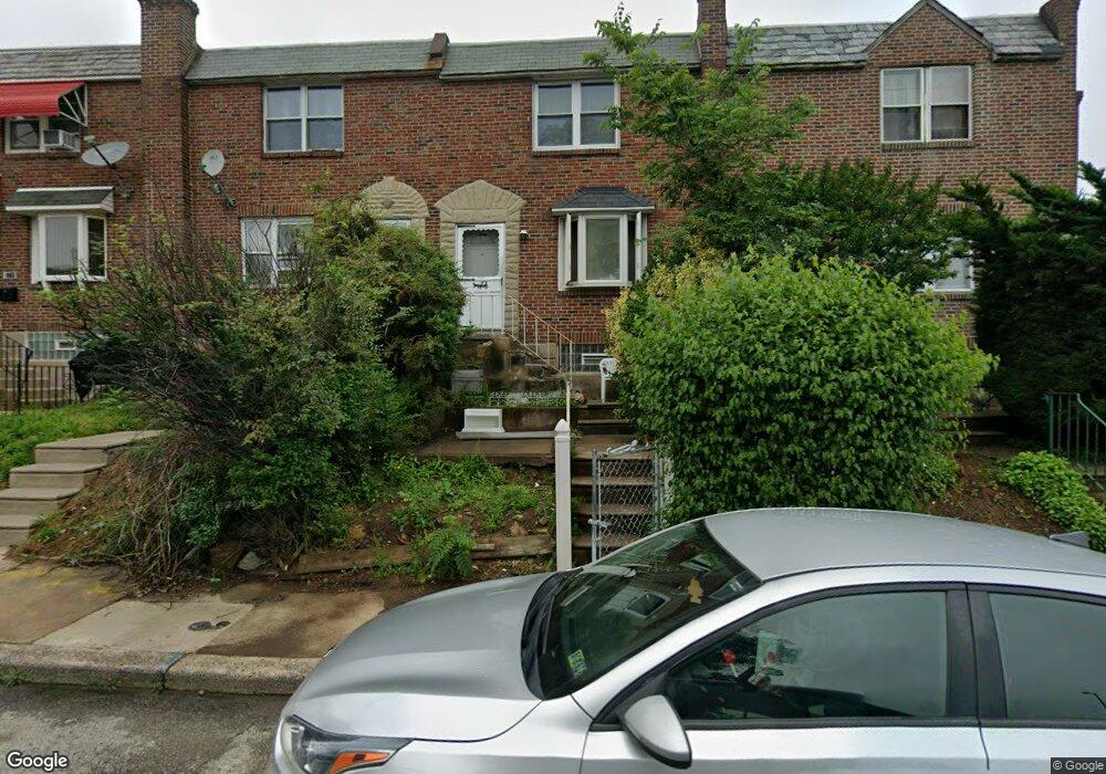
1567 Stevens St Philadelphia, PA 19149
Oxford Circle NeighborhoodEstimated Value: $198,398 - $215,000
3
Beds
1
Bath
1,126
Sq Ft
$183/Sq Ft
Est. Value
About This Home
This home is located at 1567 Stevens St, Philadelphia, PA 19149 and is currently estimated at $206,600, approximately $183 per square foot. 1567 Stevens St is a home located in Philadelphia County with nearby schools including Gilbert Spruance School, Northeast High School, and The Philadelphia Charter School for the Arts & Sciences.
Ownership History
Date
Name
Owned For
Owner Type
Purchase Details
Closed on
Jun 25, 2025
Sold by
Sheriff Of The County Of Philadelphia
Bought by
Freddie Mac Seasoned Credit Risk Transfer Tru and Federal Home Loan Mortgage Corporation
Current Estimated Value
Purchase Details
Closed on
Jul 15, 1999
Sold by
Spadaccini Daniel and Spadaccini Karen
Bought by
Cottom Theresa D
Create a Home Valuation Report for This Property
The Home Valuation Report is an in-depth analysis detailing your home's value as well as a comparison with similar homes in the area
Home Values in the Area
Average Home Value in this Area
Purchase History
| Date | Buyer | Sale Price | Title Company |
|---|---|---|---|
| Freddie Mac Seasoned Credit Risk Transfer Tru | $48,000 | None Listed On Document | |
| Cottom Theresa D | $56,900 | -- |
Source: Public Records
Tax History Compared to Growth
Tax History
| Year | Tax Paid | Tax Assessment Tax Assessment Total Assessment is a certain percentage of the fair market value that is determined by local assessors to be the total taxable value of land and additions on the property. | Land | Improvement |
|---|---|---|---|---|
| 2026 | $2,077 | $185,700 | $37,140 | $148,560 |
| 2025 | $2,077 | $185,700 | $37,140 | $148,560 |
| 2024 | $2,077 | $185,700 | $37,140 | $148,560 |
| 2023 | $2,077 | $148,400 | $29,680 | $118,720 |
| 2022 | $854 | $103,400 | $29,680 | $73,720 |
| 2021 | $1,484 | $0 | $0 | $0 |
| 2020 | $1,484 | $0 | $0 | $0 |
| 2019 | $1,424 | $0 | $0 | $0 |
| 2018 | $1,502 | $0 | $0 | $0 |
| 2017 | $1,502 | $0 | $0 | $0 |
| 2016 | $1,082 | $0 | $0 | $0 |
| 2015 | $1,036 | $0 | $0 | $0 |
| 2014 | -- | $107,300 | $15,282 | $92,018 |
| 2012 | -- | $14,208 | $1,362 | $12,846 |
Source: Public Records
Map
Nearby Homes
- 1551 Lardner St
- 1548 Lardner St
- 2001R Mckinley St
- 1531 Stevens St
- 1507 Benner St
- 6005 Horrocks St
- 1453 Mckinley St
- 1439 Higbee St
- 1440 Robbins Ave
- 1438 Higbee St
- 1417 Stevens St
- 2003 Devereaux Ave
- 7040 E Roosevelt Blvd
- 7536 E Roosevelt Blvd
- 6840 E Roosevelt Blvd
- 7600 E Roosevelt Blvd Unit 206
- 7600 E Roosevelt Blvd Unit 212
- 7600 E Roosevelt Blvd Unit 909
- 7600 E Roosevelt Blvd Unit 705
- 7600 E Roosevelt Blvd Unit 701
- 1565 Stevens St
- 1569 Stevens St
- 1563 Stevens St
- 1561 Stevens St
- 1568 Devereaux Ave
- 1559 Stevens St
- 1566 Devereaux Ave
- 1570 Devereaux Ave
- 1564 Devereaux Ave
- 1572 Devereaux Ave
- 1562 Devereaux Ave
- 1557 Stevens St
- 1574 Devereaux Ave
- 1560 Devereaux Ave
- 1560 Stevens St
- 1555 Stevens St
- 1576 Devereaux Ave
- 1558 Stevens St
- 1558 Devereaux Ave
- 1553 Stevens St