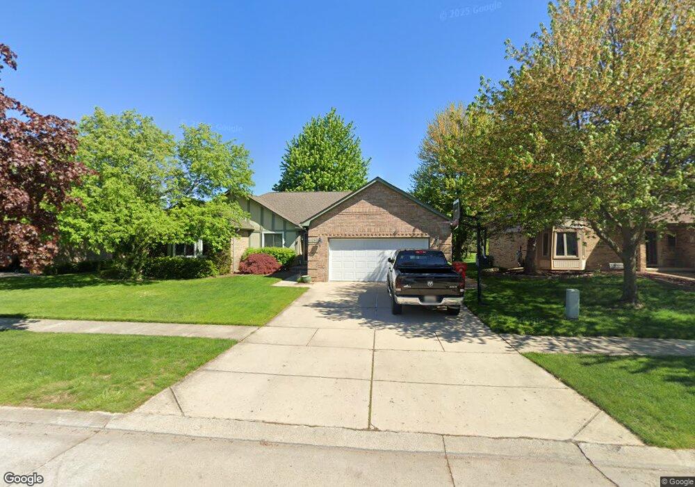
15671 Mountainside Dr Macomb, MI 48042
Estimated Value: $408,000 - $475,000
Studio
2
Baths
2,066
Sq Ft
$209/Sq Ft
Est. Value
About This Home
This home is located at 15671 Mountainside Dr, Macomb, MI 48042 and is currently estimated at $430,789, approximately $208 per square foot. 15671 Mountainside Dr is a home located in Macomb County with nearby schools including Beck Centennial Elementary School, Shelby Junior High School, and Eisenhower High School.
Ownership History
Date
Name
Owned For
Owner Type
Purchase Details
Closed on
Jan 13, 2012
Sold by
Wetzel Michael A and Wetzel Lori W
Bought by
Wetzel Michael A and Wetzel Lori K
Current Estimated Value
Purchase Details
Closed on
Jul 30, 2010
Sold by
Wetzel Michael A and Wetzel Lori K
Bought by
Wetzel Michael A and Wetzel Lori K
Purchase Details
Closed on
Sep 5, 2007
Sold by
Burbary Kenneth and Burbary Kathleen
Bought by
Wetzel Michael A and Wetzel Lori K
Purchase Details
Closed on
Jul 17, 2003
Sold by
Spanopoulos Christ and Spanopoulos Karen
Bought by
Burbary Kenneth and Burbary Kathleen
Purchase Details
Closed on
Jun 25, 1999
Sold by
Fifer Jeffrey Willis
Bought by
Spanopoulos Christ
Create a Home Valuation Report for This Property
The Home Valuation Report is an in-depth analysis detailing your home's value as well as a comparison with similar homes in the area
Home Values in the Area
Average Home Value in this Area
Purchase History
| Date | Buyer | Sale Price | Title Company |
|---|---|---|---|
| Wetzel Michael A | -- | None Available | |
| Wetzel Michael A | -- | None Available | |
| Wetzel Michael A | $241,000 | Metropolitan Title Company | |
| Burbary Kenneth | $257,000 | Metropolitan Title Company | |
| Spanopoulos Christ | $215,000 | -- |
Source: Public Records
Tax History
| Year | Tax Paid | Tax Assessment Tax Assessment Total Assessment is a certain percentage of the fair market value that is determined by local assessors to be the total taxable value of land and additions on the property. | Land | Improvement |
|---|---|---|---|---|
| 2025 | $2,331 | $202,400 | $0 | $0 |
| 2024 | $23 | $195,000 | $0 | $0 |
| 2023 | $2,149 | $169,400 | $0 | $0 |
| 2022 | $3,103 | $152,800 | $0 | $0 |
| 2021 | $3,023 | $147,100 | $0 | $0 |
| 2020 | $1,978 | $142,400 | $0 | $0 |
| 2019 | $2,772 | $133,700 | $0 | $0 |
| 2018 | $2,742 | $126,300 | $0 | $0 |
| 2017 | $2,695 | $118,670 | $32,500 | $86,170 |
| 2016 | $2,536 | $118,630 | $0 | $0 |
| 2015 | $2,504 | $112,310 | $0 | $0 |
| 2014 | $2,504 | $101,550 | $21,500 | $80,050 |
| 2011 | $743 | $96,880 | $18,500 | $78,380 |
Source: Public Records
Map
Nearby Homes
- 15019 Kelly Ct
- 52163 Heatherstone Ave
- 52244 Stoneridge Unit 121
- 52522 Charing Way
- 53118 Celtic Dr
- 16767 Cobblestone West Blvd
- 16885 Way
- 50441 Aldwych St
- 16921 Coral Ln
- 15833 Kingsway Dr
- 52210 Gabriella Ln Unit 39
- 14345 24 Mile Rd
- 50414 Greycoat Ln
- 16448 Trailway Dr
- 16489 Bishopsgate Dr
- 17437 Westgrove Dr
- 52801 Royal Park Ave
- 50094 Greycoat Ln
- 13874 Grandeur Ave
- 52921 Royal Park Ave
- 15643 Mountainside Dr
- 15699 Mountainside Dr
- 52380 Ten Point Dr
- 52358 Ten Point Dr
- 15615 Mountainside Dr
- 52396 Ten Point Dr
- 52015 Antler Dr
- 52063 Antler Dr
- 52324 Ten Point Dr
- 15676 Mountainside Dr
- 15704 Mountainside Dr
- 15648 Mountainside Dr
- 15587 Mountainside Dr
- 52414 Ten Point Dr
- 52276 Ten Point Dr
- 15732 Mountainside Dr
- 15620 Mountainside Dr
- 52436 Ten Point Dr
- 15559 Mountainside Dr
- 15760 Mountainside Dr
Your Personal Tour Guide
Ask me questions while you tour the home.