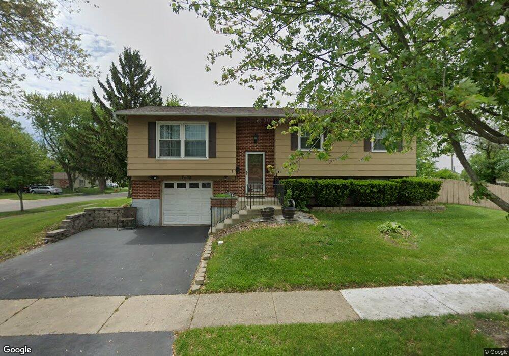
1568 Laurie Ln Hanover Park, IL 60133
Estimated Value: $286,000 - $361,000
3
Beds
2
Baths
1,135
Sq Ft
$296/Sq Ft
Est. Value
About This Home
This home is located at 1568 Laurie Ln, Hanover Park, IL 60133 and is currently estimated at $335,483, approximately $295 per square foot. 1568 Laurie Ln is a home located in Cook County with nearby schools including Albert Einstein Elementary School, Jane Addams Junior High School, and Hoffman Estates High School.
Ownership History
Date
Name
Owned For
Owner Type
Purchase Details
Closed on
Jun 7, 2014
Sold by
Dinuzzo Dominic and Dinuzzo Rosalie M
Bought by
Dinuzzo Rosalie M and Dinuzzo Vincent J
Current Estimated Value
Purchase Details
Closed on
Aug 7, 1998
Sold by
Dinuzzo Dominic and Dinuzzo Rosalie M
Bought by
Dinuzzo Dominic and Dinuzzo Rosalie M
Create a Home Valuation Report for This Property
The Home Valuation Report is an in-depth analysis detailing your home's value as well as a comparison with similar homes in the area
Home Values in the Area
Average Home Value in this Area
Purchase History
| Date | Buyer | Sale Price | Title Company |
|---|---|---|---|
| Dinuzzo Rosalie M | -- | None Available | |
| Dinuzzo Dominic | -- | -- |
Source: Public Records
Tax History Compared to Growth
Tax History
| Year | Tax Paid | Tax Assessment Tax Assessment Total Assessment is a certain percentage of the fair market value that is determined by local assessors to be the total taxable value of land and additions on the property. | Land | Improvement |
|---|---|---|---|---|
| 2024 | $6,386 | $26,001 | $6,845 | $19,156 |
| 2023 | $6,135 | $26,001 | $6,845 | $19,156 |
| 2022 | $6,135 | $26,001 | $6,845 | $19,156 |
| 2021 | $2,502 | $21,109 | $4,475 | $16,634 |
| 2020 | $2,299 | $21,109 | $4,475 | $16,634 |
| 2019 | $2,287 | $23,718 | $4,475 | $19,243 |
| 2018 | $2,584 | $19,795 | $3,948 | $15,847 |
| 2017 | $2,499 | $19,795 | $3,948 | $15,847 |
| 2016 | $3,186 | $19,795 | $3,948 | $15,847 |
| 2015 | $3,625 | $16,717 | $3,422 | $13,295 |
| 2014 | $3,486 | $16,717 | $3,422 | $13,295 |
| 2013 | $3,462 | $16,717 | $3,422 | $13,295 |
Source: Public Records
Map
Nearby Homes
- 8138 N Carrolton Ct
- 200 Columbia Ct Unit 5
- 1316 Kingsbury Dr Unit 1
- 224 Glenridge Ln
- 1323 Kingsbury Dr Unit 2
- 7873 Asbury Cir S
- 1307 Kingsbury Dr Unit A
- 7526 Bristol Ln Unit 502
- 7843 Kensington Ln
- 2404 Baldwin Ct
- 7523 Bristol Ln Unit A
- 2902 Belle Ln
- 195 Island Ct
- 515 Southwood Cir
- 1283 Bristol Ln
- 2868 Belle Ln Unit 143B28
- 136 Caryville Ln
- 2814 Belle Ln Unit 128A28
- 202 Parkwood Dr
- 630 S Walnut Ln
- 8120 Catawba Ln
- 8110 Catawba Ln
- 1579 Laurie Ln
- 1556 Laurie Ln
- 8094 Catawba Ln
- 8119 Catawba Ln
- 8148 Catawba Ln
- 1555 Laurie Ln Unit 11
- 1544 Laurie Ln
- 8109 Catawba Ln
- 8080 Catawba Ln
- 8160 Catawba Ln
- 8147 Catawba Ln
- 8093 Catawba Ln
- 8118 Olivia Ln
- 8122 Olivia Ln
- 1523 Laurie Ln
- 8066 Catawba Ln
- 8108 Olivia Ln
- 8079 Catawba Ln