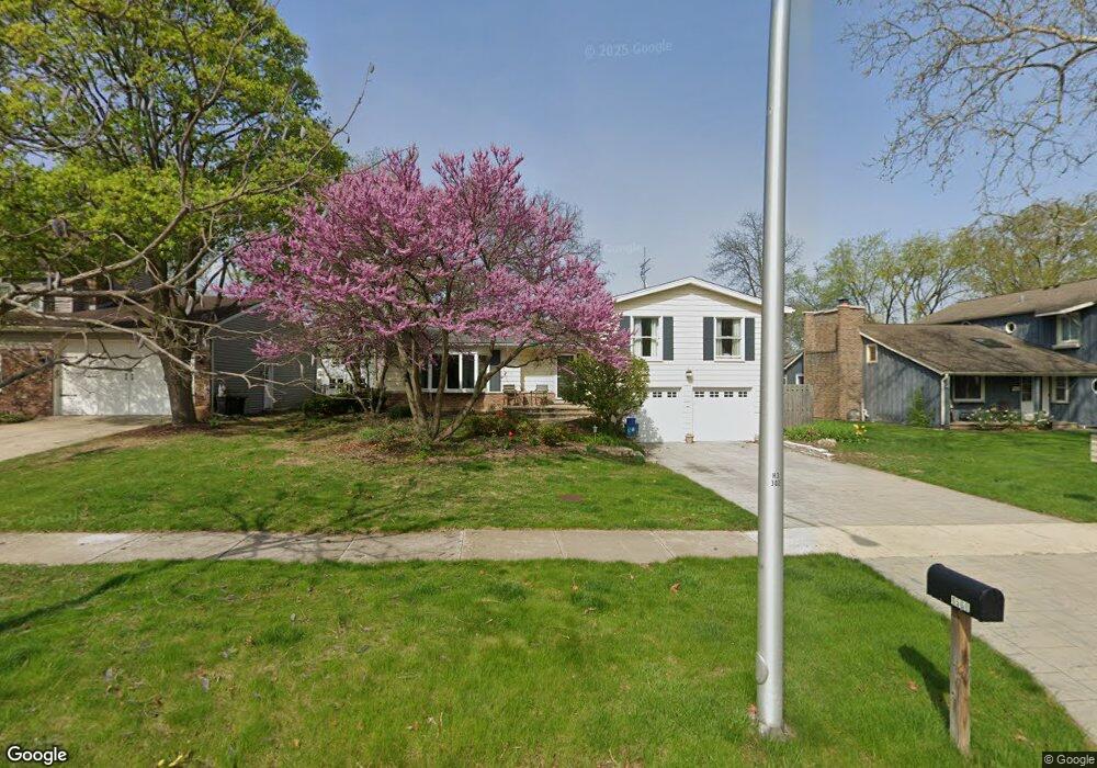
1568 Surrey Dr Wheaton, IL 60189
West Wheaton NeighborhoodEstimated Value: $490,292 - $653,000
4
Beds
3
Baths
1,724
Sq Ft
$348/Sq Ft
Est. Value
About This Home
This home is located at 1568 Surrey Dr, Wheaton, IL 60189 and is currently estimated at $600,073, approximately $348 per square foot. 1568 Surrey Dr is a home located in DuPage County with nearby schools including Madison Elementary School, Edison Middle School, and Wheaton Warrenville South High School.
Ownership History
Date
Name
Owned For
Owner Type
Purchase Details
Closed on
Apr 30, 1998
Sold by
Nubie Joseph J and Mcgee Raelene S
Bought by
Slater John M and Slater Stacy R
Current Estimated Value
Home Financials for this Owner
Home Financials are based on the most recent Mortgage that was taken out on this home.
Original Mortgage
$167,250
Interest Rate
7.32%
Create a Home Valuation Report for This Property
The Home Valuation Report is an in-depth analysis detailing your home's value as well as a comparison with similar homes in the area
Home Values in the Area
Average Home Value in this Area
Purchase History
| Date | Buyer | Sale Price | Title Company |
|---|---|---|---|
| Slater John M | $223,000 | First American Title |
Source: Public Records
Mortgage History
| Date | Status | Borrower | Loan Amount |
|---|---|---|---|
| Previous Owner | Slater John M | $167,250 |
Source: Public Records
Tax History
| Year | Tax Paid | Tax Assessment Tax Assessment Total Assessment is a certain percentage of the fair market value that is determined by local assessors to be the total taxable value of land and additions on the property. | Land | Improvement |
|---|---|---|---|---|
| 2024 | $9,643 | $157,615 | $36,579 | $121,036 |
| 2023 | $9,264 | $145,080 | $33,670 | $111,410 |
| 2022 | $8,761 | $132,510 | $31,820 | $100,690 |
| 2021 | $8,731 | $129,360 | $31,060 | $98,300 |
| 2020 | $8,703 | $128,150 | $30,770 | $97,380 |
| 2019 | $8,503 | $124,770 | $29,960 | $94,810 |
| 2018 | $8,313 | $120,770 | $28,540 | $92,230 |
| 2017 | $8,188 | $116,320 | $27,490 | $88,830 |
| 2016 | $8,077 | $111,670 | $26,390 | $85,280 |
| 2015 | $8,013 | $106,540 | $25,180 | $81,360 |
| 2014 | $7,440 | $97,760 | $22,480 | $75,280 |
| 2013 | $7,249 | $98,060 | $22,550 | $75,510 |
Source: Public Records
Map
Nearby Homes
- 1601 W Wiesbrook Rd
- 1605 Burning Trail
- 1519 Foothill Dr
- 1620 Hemstock Ave
- 2099 Creekside Dr Unit 1-4
- 1612 Stonebridge Trail
- 2043 Spring Green Dr
- Lot 1 Foothill Dr
- 1420 Stonebridge Trail Unit 1-3
- 1974 Wexford Cir Unit 123
- 1217 Sunset Rd
- 1424 Stonebridge Cir Unit L4
- 1442 Stonebridge Cir Unit I8
- 1462 Stonebridge Cir Unit F10
- 1110 S Gables Blvd
- 1533 S County Farm Rd Unit 1-4
- 1028 Lodalia Ct
- 1907 Gresham Cir Unit D
- 1S728 Shaffner Rd
- 1S710 Shaffner Rd
- 1562 Surrey Dr
- 1576 Surrey Dr
- 1569 Burning Trail
- 1561 Burning Trail
- 1556 Surrey Dr
- 1580 Surrey Dr
- 1581 Burning Trail
- 1569 Surrey Dr
- 1555 Burning Trail
- 1563 Surrey Dr
- 1581 Surrey Dr
- 1557 Surrey Dr
- 1548 Surrey Dr
- 1587 Burning Trail
- 1584 Surrey Dr
- 1549 Burning Trail
- 1553 Surrey Dr
- 1593 Burning Trail
- 1586 Surrey Dr
- 1570 Burning Trail
Your Personal Tour Guide
Ask me questions while you tour the home.