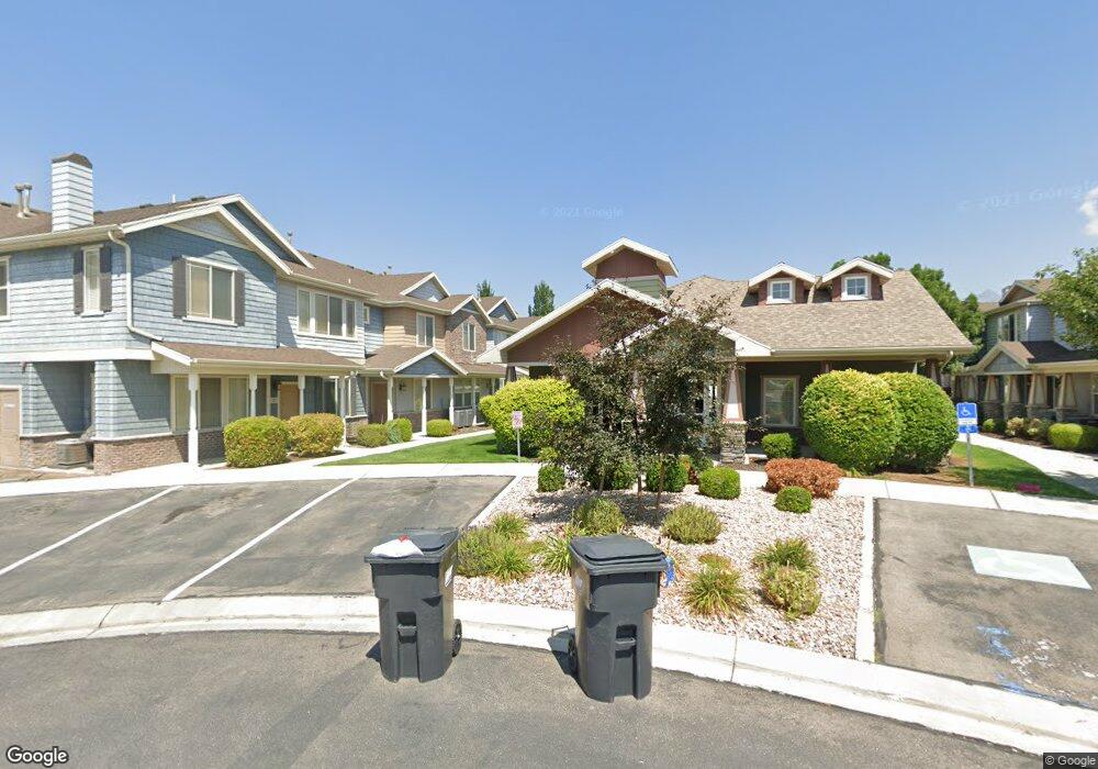
1568 W 10 S Pleasant Grove, UT 84062
Estimated Value: $380,000 - $446,000
2
Beds
3
Baths
1,479
Sq Ft
$270/Sq Ft
Est. Value
About This Home
This home is located at 1568 W 10 S, Pleasant Grove, UT 84062 and is currently estimated at $399,321, approximately $269 per square foot. 1568 W 10 S is a home located in Utah County with nearby schools including Mount Mahogany School, Pleasant Grove Junior High School, and Pleasant Grove High School.
Ownership History
Date
Name
Owned For
Owner Type
Purchase Details
Closed on
Jul 18, 2024
Sold by
Romney Scott T and Romney Veronica I
Bought by
Cox Angela Sheree
Current Estimated Value
Home Financials for this Owner
Home Financials are based on the most recent Mortgage that was taken out on this home.
Original Mortgage
$315,000
Outstanding Balance
$308,506
Interest Rate
4%
Mortgage Type
New Conventional
Estimated Equity
$90,815
Purchase Details
Closed on
Dec 9, 2021
Sold by
1568 A Series Of Romney Properties Llc
Bought by
Romney Scott T and Romney Veronica I
Purchase Details
Closed on
Jan 5, 2017
Sold by
Romney Properties Llc
Bought by
1568 Series Of Romney Properties Llc
Purchase Details
Closed on
Jun 9, 2014
Sold by
Romney Scott T and Romney Veronica I
Bought by
Romney Properties Llc
Purchase Details
Closed on
May 23, 2012
Sold by
Ewing Trenton J and Wilkinson Kimberly
Bought by
Romney Scott T
Home Financials for this Owner
Home Financials are based on the most recent Mortgage that was taken out on this home.
Original Mortgage
$111,900
Interest Rate
3.85%
Mortgage Type
New Conventional
Purchase Details
Closed on
May 22, 2012
Sold by
Romney Scott T
Bought by
Romney Scott T and Romney Veronica I
Home Financials for this Owner
Home Financials are based on the most recent Mortgage that was taken out on this home.
Original Mortgage
$111,900
Interest Rate
3.85%
Mortgage Type
New Conventional
Purchase Details
Closed on
Sep 25, 2007
Sold by
General Construction & Development Inc
Bought by
Ewing Trenton J and Wilkinson Kimberly
Home Financials for this Owner
Home Financials are based on the most recent Mortgage that was taken out on this home.
Original Mortgage
$228,101
Interest Rate
6.61%
Mortgage Type
Purchase Money Mortgage
Create a Home Valuation Report for This Property
The Home Valuation Report is an in-depth analysis detailing your home's value as well as a comparison with similar homes in the area
Home Values in the Area
Average Home Value in this Area
Purchase History
| Date | Buyer | Sale Price | Title Company |
|---|---|---|---|
| Cox Angela Sheree | -- | None Listed On Document | |
| Romney Scott T | -- | Rei Title | |
| 1568 Series Of Romney Properties Llc | -- | Accommodation | |
| Romney Properties Llc | -- | Accommodation | |
| Romney Scott T | -- | Bonneville Superior Title | |
| Romney Scott T | -- | Gateway Title Insurance Agen | |
| Ewing Trenton J | -- | Empire Land Title Company |
Source: Public Records
Mortgage History
| Date | Status | Borrower | Loan Amount |
|---|---|---|---|
| Open | Cox Angela Sheree | $315,000 | |
| Previous Owner | Romney Scott T | $111,900 | |
| Previous Owner | Ewing Trenton J | $228,101 |
Source: Public Records
Tax History Compared to Growth
Tax History
| Year | Tax Paid | Tax Assessment Tax Assessment Total Assessment is a certain percentage of the fair market value that is determined by local assessors to be the total taxable value of land and additions on the property. | Land | Improvement |
|---|---|---|---|---|
| 2025 | $1,406 | $363,000 | $40,300 | $322,700 |
| 2024 | $1,406 | $360,900 | $0 | $0 |
| 2023 | $3,028 | $369,900 | $0 | $0 |
| 2022 | $3,038 | $369,300 | $36,900 | $332,400 |
| 2021 | $2,668 | $271,600 | $32,600 | $239,000 |
| 2020 | $2,497 | $249,200 | $29,900 | $219,300 |
| 2019 | $2,196 | $226,600 | $26,400 | $200,200 |
| 2018 | $2,039 | $199,000 | $23,900 | $175,100 |
| 2017 | $1,905 | $180,000 | $0 | $0 |
| 2016 | $1,025 | $93,500 | $0 | $0 |
| 2015 | $1,083 | $93,500 | $0 | $0 |
| 2014 | $913 | $78,100 | $0 | $0 |
Source: Public Records
Map
Nearby Homes
- 1559 W 50 N
- 1584 W 110 N
- 1512 W 50 N
- 1542 W 110 N
- 1593 W 220 N
- 1429 W 110 N
- 1406 W 50 N
- 1541 W 250 N
- 1525 W 300 N
- 1775 W 120 S Unit 54
- 1795 W 120 S Unit 52
- 128 S 1700 W Unit 12
- The Hastings Plan at Tayside Farm - Townhome
- The Henley A Plan at Tayside Farm - Single Family Home
- The Denton Plan at Tayside Farm - Townhome
- The Henley B Plan at Tayside Farm - Single Family Home
- 293 N 1630 W
- 150 N 1300 W
- 1267 W 20 S
- 29 S 2000 W
- 1592 W 10 S
- 1588 W 10 S Unit 5
- 1574 W 10 S Unit 3
- 1592 W 10 S Unit M6
- 1582 W 10 S
- 1582 W 10 S
- 1582 W 10 S Unit 4M
- 1562 W 10 S
- 1562 W 10 S
- 1562 W 10 S Unit M1
- 17 S 1580 W Unit L6
- 17 S 1580 W Unit 6
- 27 S 1580 W
- 1598 W 10 S
- 1606 W 10 S
- 1606 W 10 S Unit 2N
- 1606 W 10 S Unit N2
- 1565 W 50 N
- 1581 W 50 N
- 1612 W 10 S