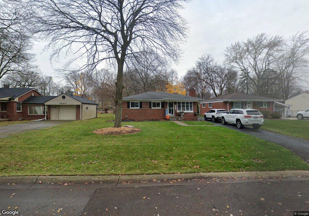
15689 Doris St Unit Bldg-Unit Livonia, MI 48154
Estimated Value: $254,000 - $285,000
--
Bed
1
Bath
1,075
Sq Ft
$254/Sq Ft
Est. Value
About This Home
This home is located at 15689 Doris St Unit Bldg-Unit, Livonia, MI 48154 and is currently estimated at $273,200, approximately $254 per square foot. 15689 Doris St Unit Bldg-Unit is a home located in Wayne County with nearby schools including Riley Upper Elementary School, Buchanan Elementary School, and Holmes Middle School.
Ownership History
Date
Name
Owned For
Owner Type
Purchase Details
Closed on
Jan 29, 2018
Sold by
Burbidge William C and Burbidge Susan M
Bought by
Gilbert Aaron Michael
Current Estimated Value
Home Financials for this Owner
Home Financials are based on the most recent Mortgage that was taken out on this home.
Original Mortgage
$140,650
Outstanding Balance
$118,968
Interest Rate
3.94%
Mortgage Type
New Conventional
Estimated Equity
$154,232
Purchase Details
Closed on
Oct 26, 2001
Sold by
Wright John D
Bought by
Burbidge Susan M
Purchase Details
Closed on
Jul 12, 1995
Sold by
Davis Sheldon H
Bought by
John D Wright
Create a Home Valuation Report for This Property
The Home Valuation Report is an in-depth analysis detailing your home's value as well as a comparison with similar homes in the area
Home Values in the Area
Average Home Value in this Area
Purchase History
| Date | Buyer | Sale Price | Title Company |
|---|---|---|---|
| Gilbert Aaron Michael | $145,000 | None Available | |
| Burbidge Susan M | $162,000 | -- | |
| John D Wright | $98,500 | -- |
Source: Public Records
Mortgage History
| Date | Status | Borrower | Loan Amount |
|---|---|---|---|
| Open | Gilbert Aaron Michael | $140,650 |
Source: Public Records
Tax History Compared to Growth
Tax History
| Year | Tax Paid | Tax Assessment Tax Assessment Total Assessment is a certain percentage of the fair market value that is determined by local assessors to be the total taxable value of land and additions on the property. | Land | Improvement |
|---|---|---|---|---|
| 2025 | $1,821 | $122,200 | $0 | $0 |
| 2024 | $1,821 | $111,600 | $0 | $0 |
| 2023 | $1,737 | $95,200 | $0 | $0 |
| 2022 | $3,050 | $84,500 | $0 | $0 |
| 2021 | $2,963 | $80,400 | $0 | $0 |
| 2019 | $2,843 | $70,000 | $0 | $0 |
| 2018 | $986 | $66,400 | $0 | $0 |
| 2017 | $629 | $64,700 | $0 | $0 |
| 2016 | $1,834 | $63,000 | $0 | $0 |
| 2015 | $4,441 | $55,570 | $0 | $0 |
| 2012 | -- | $43,040 | $9,530 | $33,510 |
Source: Public Records
Map
Nearby Homes
- 30900 Wentworth St
- 31005 Roycroft St
- 15345 Bainbridge St
- 30115 Munger Dr
- 31069 Munger Dr
- 14962 Beatrice St
- 29945 6 Mile Rd
- 29106 Broadmoor St
- 29831 Oakley St
- 28692 Bayberry Park Dr
- 15040 Berwick St
- 29631 Lyndon St
- 29464 Bobrich St Unit 49
- 31221 Lyndon St
- 14592 Melrose St
- 14563 Melrose St
- 31366 Mayville St
- 14270 Sunset St
- 14292 Hubbell St
- 14327 Arden St
- 15689 Doris St
- 15701 Doris St
- 15671 Doris St
- 15709 Doris St
- 15719 Doris St
- 15653 Doris St
- 15875 Henry Ruff St
- 15696 Doris St
- 15684 Doris St
- 15631 Doris St
- 15716 Doris St
- 15670 Doris St
- 15735 Doris St
- 15877 Henry Ruff St
- 30414 Rayburn St
- 30409 Wentworth St
- 15728 Doris St
- 15660 Doris St
- 15749 Doris St
- 15650 Doris St