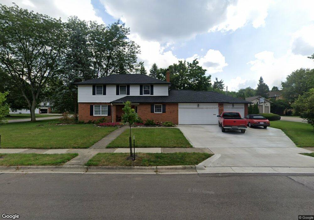
1569 Langston Dr Columbus, OH 43220
Estimated Value: $662,853 - $755,000
4
Beds
3
Baths
2,158
Sq Ft
$323/Sq Ft
Est. Value
About This Home
This home is located at 1569 Langston Dr, Columbus, OH 43220 and is currently estimated at $697,213, approximately $323 per square foot. 1569 Langston Dr is a home located in Franklin County with nearby schools including Greensview Elementary School, Hastings Middle School, and Upper Arlington High School.
Ownership History
Date
Name
Owned For
Owner Type
Purchase Details
Closed on
Mar 25, 1998
Sold by
Wright Timothy R
Bought by
Wright Timothy R and Lombardi Barbara Lisa
Current Estimated Value
Purchase Details
Closed on
Oct 26, 1993
Purchase Details
Closed on
Jan 6, 1988
Create a Home Valuation Report for This Property
The Home Valuation Report is an in-depth analysis detailing your home's value as well as a comparison with similar homes in the area
Home Values in the Area
Average Home Value in this Area
Purchase History
| Date | Buyer | Sale Price | Title Company |
|---|---|---|---|
| Wright Timothy R | -- | -- | |
| -- | -- | -- | |
| -- | $150,000 | -- |
Source: Public Records
Tax History
| Year | Tax Paid | Tax Assessment Tax Assessment Total Assessment is a certain percentage of the fair market value that is determined by local assessors to be the total taxable value of land and additions on the property. | Land | Improvement |
|---|---|---|---|---|
| 2025 | $12,018 | $207,590 | $91,000 | $116,590 |
| 2024 | $12,018 | $207,590 | $91,000 | $116,590 |
| 2023 | $11,869 | $207,585 | $91,000 | $116,585 |
| 2022 | $9,823 | $140,570 | $58,980 | $81,590 |
| 2021 | $8,695 | $140,570 | $58,980 | $81,590 |
| 2020 | $8,618 | $140,570 | $58,980 | $81,590 |
| 2019 | $8,313 | $119,880 | $58,980 | $60,900 |
| 2018 | $8,123 | $119,880 | $58,980 | $60,900 |
| 2017 | $8,249 | $119,880 | $58,980 | $60,900 |
| 2016 | $7,986 | $120,790 | $46,060 | $74,730 |
| 2015 | $7,980 | $120,790 | $46,060 | $74,730 |
| 2014 | $7,989 | $120,790 | $46,060 | $74,730 |
| 2013 | $3,814 | $109,795 | $41,860 | $67,935 |
Source: Public Records
Map
Nearby Homes
- 1512 Lafayette Dr Unit B
- 4120 Lyon Dr
- 1568 Lafayette Dr
- 1474 Lafayette Dr Unit B
- 1594 Lafayette Dr Unit 1594
- 4500 Reed Rd
- 1363 Castleton Rd N
- 4263 Gavin Ln
- 4027 Patricia Dr
- 1444 Havencrest Ct
- 1225 Windham Rd
- 4641 Orwell Dr Unit 4641
- 1955 Rosebery Dr
- 4651 Orwell Dr Unit 4651
- 4818 Larwell Dr
- 4360 Woodhall Rd
- 2123 Nayland Rd
- 4818 Winterset Dr Unit 820
- 2200 Nayland Rd
- 2080 Mackenzie Dr Unit 12
- 4265 Reedbury Ln
- 1571 Langston Dr
- 4278 Lyon Dr
- 4280 Reedbury Ln
- 4255 Reedbury Ln
- 1570 Langston Dr
- 4310 Lyon Dr
- 4266 Lyon Dr
- 4260 Reedbury Ln
- 1527 Langston Dr
- 4245 Reedbury Ln
- 1526 Bridgeton Dr
- 4254 Lyon Dr
- 4295 Lyon Dr
- 4305 Lyon Dr
- 4283 Lyon Dr
- 1515 Langston Dr
- 4315 Lyon Dr
- 4235 Reedbury Ln
- 4271 Lyon Dr
Your Personal Tour Guide
Ask me questions while you tour the home.