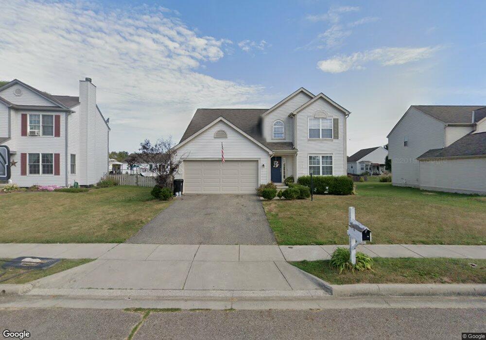
1569 Mallard Cir W Newark, OH 43055
Estimated Value: $353,000 - $384,000
4
Beds
3
Baths
2,388
Sq Ft
$153/Sq Ft
Est. Value
About This Home
This home is located at 1569 Mallard Cir W, Newark, OH 43055 and is currently estimated at $365,762, approximately $153 per square foot. 1569 Mallard Cir W is a home located in Licking County with nearby schools including Legend Elementary School, Liberty Middle School, and Newark High School.
Ownership History
Date
Name
Owned For
Owner Type
Purchase Details
Closed on
Mar 11, 2011
Sold by
Yonker Lynda L and Yonker Lynda
Bought by
Yonker Thomas W and Yanker Thomas
Current Estimated Value
Purchase Details
Closed on
Dec 28, 2007
Sold by
Hud
Bought by
Yonker Thomas W and Yonker Lyndia L
Purchase Details
Closed on
Jan 26, 2007
Sold by
Johnson James E and Andrews Sarah A
Bought by
Hud
Purchase Details
Closed on
Jul 28, 2003
Sold by
Johnson James E
Bought by
Andrews Sarah A
Purchase Details
Closed on
May 2, 2002
Sold by
M/I Schottenstein Homes
Bought by
Andrews-Johnson James E Johnson
Home Financials for this Owner
Home Financials are based on the most recent Mortgage that was taken out on this home.
Original Mortgage
$194,554
Interest Rate
7.18%
Mortgage Type
FHA
Purchase Details
Closed on
Nov 1, 2001
Sold by
Kraner William C
Bought by
M/I Schottenstein Homes Inc
Create a Home Valuation Report for This Property
The Home Valuation Report is an in-depth analysis detailing your home's value as well as a comparison with similar homes in the area
Home Values in the Area
Average Home Value in this Area
Purchase History
| Date | Buyer | Sale Price | Title Company |
|---|---|---|---|
| Yonker Thomas W | -- | Attorney | |
| Yonker Thomas W | $142,000 | Lakeside Title & Escrow Agen | |
| Hud | $137,000 | None Available | |
| Andrews Sarah A | -- | -- | |
| Andrews-Johnson James E Johnson | $196,910 | -- | |
| M/I Schottenstein Homes Inc | $55,000 | -- |
Source: Public Records
Mortgage History
| Date | Status | Borrower | Loan Amount |
|---|---|---|---|
| Previous Owner | Andrews-Johnson James E Johnson | $194,554 |
Source: Public Records
Tax History Compared to Growth
Tax History
| Year | Tax Paid | Tax Assessment Tax Assessment Total Assessment is a certain percentage of the fair market value that is determined by local assessors to be the total taxable value of land and additions on the property. | Land | Improvement |
|---|---|---|---|---|
| 2024 | $3,744 | $102,100 | $21,250 | $80,850 |
| 2023 | $5,439 | $102,100 | $21,250 | $80,850 |
| 2022 | $3,047 | $74,170 | $14,040 | $60,130 |
| 2021 | $3,197 | $74,170 | $14,040 | $60,130 |
| 2020 | $3,270 | $74,170 | $14,040 | $60,130 |
| 2019 | $3,085 | $67,380 | $11,690 | $55,690 |
| 2018 | $3,087 | $0 | $0 | $0 |
| 2017 | $3,901 | $0 | $0 | $0 |
| 2016 | $2,371 | $0 | $0 | $0 |
| 2015 | $1,211 | $0 | $0 | $0 |
| 2014 | $1,188 | $0 | $0 | $0 |
| 2013 | $1,188 | $0 | $0 | $0 |
Source: Public Records
Map
Nearby Homes
- 1631 W Turkey Run Dr
- 1649 W Turkey Run Dr
- 437 Hunters Ct
- 1831 Churchill Downs Rd
- 1345 Sherwood Downs Rd W
- 1954 Iselin St
- 1948 Jamesburg St
- 1821 Mount Vernon Rd
- 1993 Iselin St
- 1981 Iselin St
- 1949 Iselin St
- 1957 Iselin St
- 1973 Iselin St
- 1977 Iselin St
- 1989 Iselin St
- 1968 High Bridge St
- 1952 Jamesburg St
- 1684 Churchill Downs Rd
- 1738 Scioto Way
- 2012 Edison St
- 1563 Mallard Cir W
- 1560 Mallard Cir E
- 359 W Hunters Dr
- 353 W Hunters Dr
- 367 W Hunters Dr
- 1544 Mallard Cir W
- 1543 Mallard Cir E
- 1554 Mallard Cir E
- 345 W Hunters Dr
- 1557 Mallard Cir W
- 349 W Hunters Dr
- 373 W Hunters Dr
- 1551 Mallard Cir W
- 1548 Mallard Cir E
- 1537 Mallard Cir E
- 379 W Hunters Dr
- 1545 Mallard Cir W
- 1587 W Hunter Dr
- 1542 Mallard Cir E
- 1587 S Hunters Dr