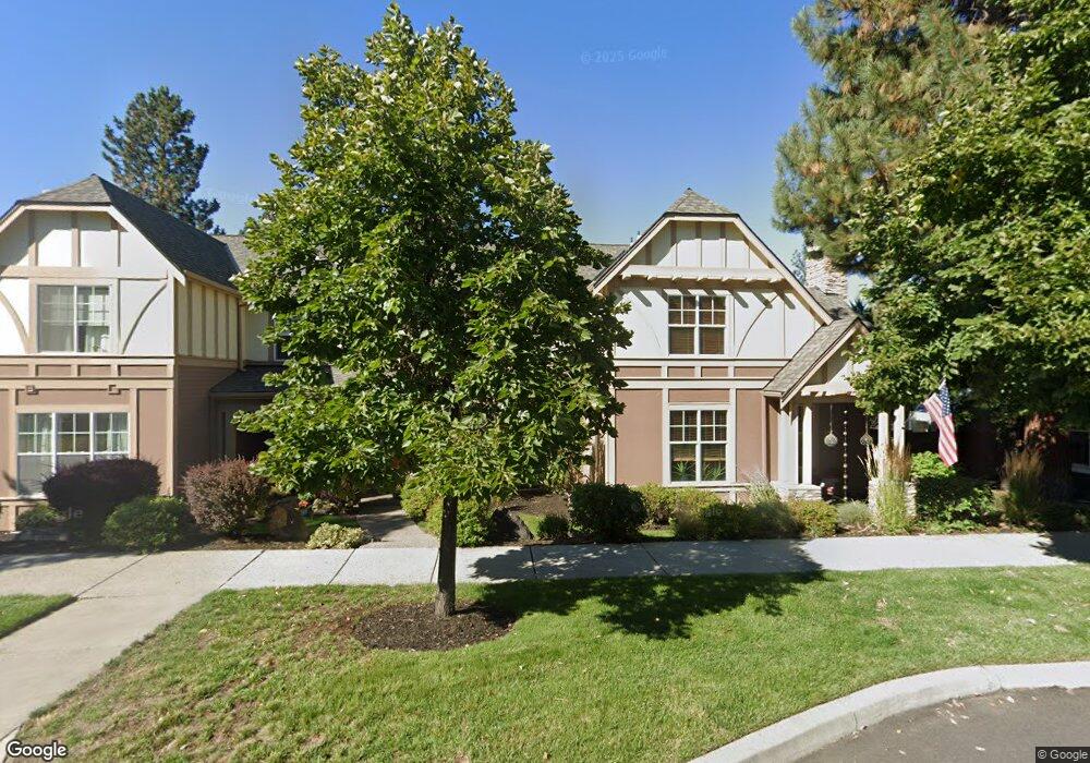
1569 NW Lewis St Bend, OR 97701
Summit West NeighborhoodEstimated Value: $801,509 - $869,000
3
Beds
3
Baths
1,791
Sq Ft
$467/Sq Ft
Est. Value
About This Home
This home is located at 1569 NW Lewis St, Bend, OR 97701 and is currently estimated at $836,127, approximately $466 per square foot. 1569 NW Lewis St is a home located in Deschutes County with nearby schools including High Lakes Elementary School, Pacific Crest Middle School, and Summit High School.
Ownership History
Date
Name
Owned For
Owner Type
Purchase Details
Closed on
Mar 24, 2006
Sold by
Dunning Kathryn
Bought by
Dunning Kathryn M
Current Estimated Value
Home Financials for this Owner
Home Financials are based on the most recent Mortgage that was taken out on this home.
Original Mortgage
$125,000
Outstanding Balance
$70,578
Interest Rate
6.25%
Mortgage Type
Credit Line Revolving
Estimated Equity
$765,549
Purchase Details
Closed on
Dec 29, 2004
Sold by
Vernon C Palmer Inc
Bought by
Dunning Kathryn
Home Financials for this Owner
Home Financials are based on the most recent Mortgage that was taken out on this home.
Original Mortgage
$226,080
Outstanding Balance
$112,521
Interest Rate
5.74%
Mortgage Type
Purchase Money Mortgage
Estimated Equity
$723,606
Create a Home Valuation Report for This Property
The Home Valuation Report is an in-depth analysis detailing your home's value as well as a comparison with similar homes in the area
Home Values in the Area
Average Home Value in this Area
Purchase History
| Date | Buyer | Sale Price | Title Company |
|---|---|---|---|
| Dunning Kathryn M | -- | Amerititle | |
| Dunning Kathryn | $286,800 | Amerititle |
Source: Public Records
Mortgage History
| Date | Status | Borrower | Loan Amount |
|---|---|---|---|
| Open | Dunning Kathryn M | $125,000 | |
| Open | Dunning Kathryn | $226,080 |
Source: Public Records
Tax History Compared to Growth
Tax History
| Year | Tax Paid | Tax Assessment Tax Assessment Total Assessment is a certain percentage of the fair market value that is determined by local assessors to be the total taxable value of land and additions on the property. | Land | Improvement |
|---|---|---|---|---|
| 2025 | $4,954 | $293,230 | -- | -- |
| 2024 | $4,767 | $284,690 | -- | -- |
| 2023 | $4,419 | $276,400 | $0 | $0 |
| 2022 | $4,123 | $260,540 | $0 | $0 |
| 2021 | $4,129 | $252,960 | $0 | $0 |
| 2020 | $3,917 | $252,960 | $0 | $0 |
| 2019 | $3,808 | $245,600 | $0 | $0 |
| 2018 | $3,701 | $238,450 | $0 | $0 |
| 2017 | $3,658 | $231,510 | $0 | $0 |
| 2016 | $3,492 | $224,770 | $0 | $0 |
| 2015 | $3,397 | $218,230 | $0 | $0 |
| 2014 | $3,299 | $211,880 | $0 | $0 |
Source: Public Records
Map
Nearby Homes
- 1650 NW Lewis St Unit 4
- 2580 NW Shields Dr
- 2612 NW Lemhi Pass Dr
- 1676 NW William Clark St
- 2589 NW Lemhi Pass Dr
- 1399 NW Fort Clatsop St Unit 1&2
- 2429 NW Dorion Way
- 2234 NW Reserve Camp Ct
- 2927 NW Celilo Ln
- 62947 Levins Ln
- 2511 NW Crossing Dr
- 1251 NW Stanhope Way Unit 250
- 2745 NW Ordway Ave Unit 209
- 2745 NW Ordway Ave Unit 207
- 2745 NW Ordway Ave Unit 300
- 2745 NW Ordway Ave Unit 212
- 2745 NW Ordway Ave Unit 104
- 2954 NW Wild Meadow Dr
- 3035 NW Celilo Ln
- The Carrington Plan at Collier
- 1585 NW Lewis St
- 1603 NW Lewis St
- 1537 NW Lewis St
- 1619 NW Lewis St
- 1521 NW Lewis St
- 1508 NW John Fremont St
- 1482 NW John Fremont St
- 1635 NW Lewis St
- 1554 NW John Fremont St
- 1505 NW Lewis St
- 2590 NW Pompy Place
- 1470 NW John Fremont St
- 1602 NW Lewis St
- 1651 NW Lewis St
- 1489 NW Lewis St
- 2567 NW Shields Dr
- 1618 NW John Fremont St
- 1458 NW John Fremont St
- 1667 NW Lewis St Unit 219
- 1667 NW Lewis St