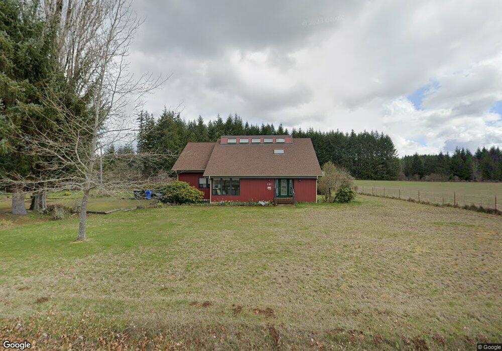
157 Brown Rd E Chehalis, WA 98532
Estimated Value: $618,473 - $954,000
3
Beds
3
Baths
3,445
Sq Ft
$221/Sq Ft
Est. Value
About This Home
This home is located at 157 Brown Rd E, Chehalis, WA 98532 and is currently estimated at $761,118, approximately $220 per square foot. 157 Brown Rd E is a home located in Lewis County with nearby schools including James W. Lintott Elementary School, R E Bennett Elementary School, and Orin C. Smith Elementary School.
Ownership History
Date
Name
Owned For
Owner Type
Purchase Details
Closed on
Oct 14, 2020
Sold by
Foister Martin Steven
Bought by
Foister Maralee Rosford and Foister Martin S
Current Estimated Value
Home Financials for this Owner
Home Financials are based on the most recent Mortgage that was taken out on this home.
Original Mortgage
$40,000
Interest Rate
2.9%
Mortgage Type
Stand Alone Second
Create a Home Valuation Report for This Property
The Home Valuation Report is an in-depth analysis detailing your home's value as well as a comparison with similar homes in the area
Purchase History
| Date | Buyer | Sale Price | Title Company |
|---|---|---|---|
| Foister Maralee Rosford | -- | Lewis County Title |
Source: Public Records
Mortgage History
| Date | Status | Borrower | Loan Amount |
|---|---|---|---|
| Closed | Foister Maralee Rosford | $40,000 |
Source: Public Records
Tax History
| Year | Tax Paid | Tax Assessment Tax Assessment Total Assessment is a certain percentage of the fair market value that is determined by local assessors to be the total taxable value of land and additions on the property. | Land | Improvement |
|---|---|---|---|---|
| 2024 | $5,158 | $595,900 | $93,800 | $502,100 |
| 2023 | $6,027 | $705,800 | $40,300 | $665,500 |
| 2022 | $6,099 | $618,500 | $32,100 | $586,400 |
| 2021 | $5,447 | $618,500 | $32,100 | $586,400 |
| 2020 | $4,937 | $502,800 | $30,700 | $472,100 |
| 2019 | $3,921 | $423,400 | $30,700 | $392,700 |
| 2018 | $3,726 | $360,800 | $25,600 | $335,200 |
| 2017 | $3,285 | $319,000 | $25,600 | $293,400 |
Source: Public Records
Map
Nearby Homes
- 597 Brown Rd E
- 200 Lot A Fineview
- 123 Upland Vista Dr
- 942 Shorey Rd
- 1003 Old Hwy
- 0 Newaukum Valley Rd
- 143 Berry Rd
- 607 Brown
- 123 Cherry Ln
- 1865 SW Fair Ave
- 1615 SW Snively Ave
- 1492 SW Kelly Ave
- 0 SW Hillburger Rd
- 2046 SW Salsbury Ave
- 602 SW 19th St
- 833 SW 20th St
- 514 Berry Rd
- 765 SW Chehalis Ave
- 823 SW 21st St
- 2119 SW Olympic Dr
- 147 Brown Rd E
- 179 Brown Rd E
- 146 Brown Rd E
- 110 Urquhart Rd
- 196 Brown Rd E
- 126 Urquhart Rd
- 118 Urquhart Rd
- 0 E Brown Rd Unit 763338
- 0 E Brown Rd Unit 696616
- 0 E Brown Rd Unit 22060341
- 0 E Brown Rd Unit 1795016
- 782 Highway 603
- 744 Highway 603
- 124 Brown Rd E
- 786 Highway 603
- 767 Highway 603
- 751 Highway 603 Unit A
- 751 Highway 603 Unit C
- 751 Highway 603 Unit B
Your Personal Tour Guide
Ask me questions while you tour the home.