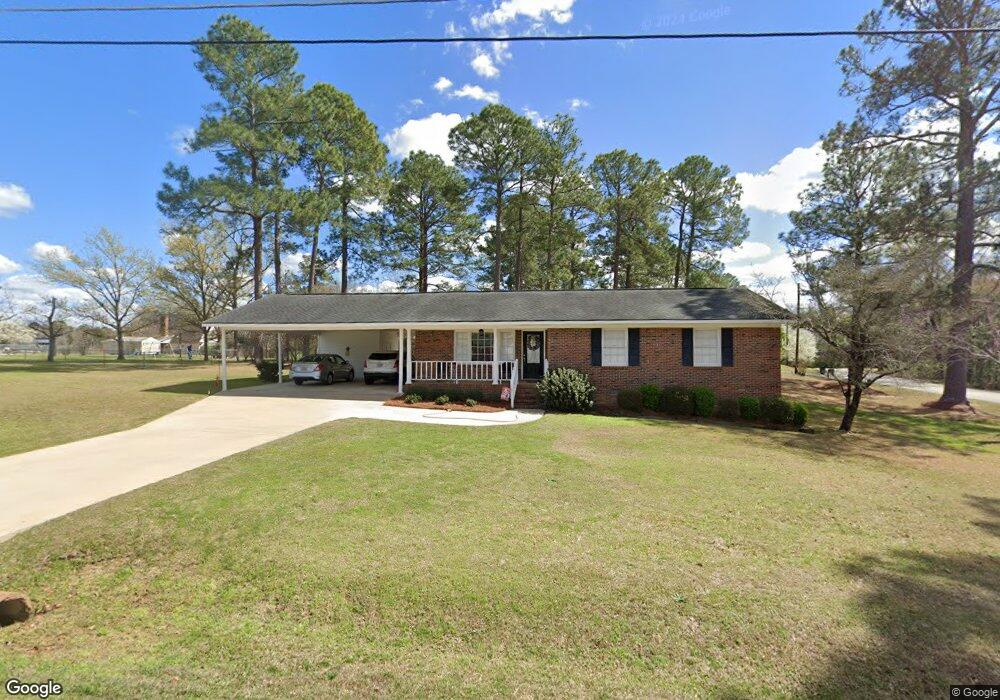
157 Browning Dr Cochran, GA 31014
Estimated Value: $183,000 - $233,000
3
Beds
2
Baths
1,612
Sq Ft
$127/Sq Ft
Est. Value
About This Home
This home is located at 157 Browning Dr, Cochran, GA 31014 and is currently estimated at $204,557, approximately $126 per square foot. 157 Browning Dr is a home located in Bleckley County with nearby schools including Bleckley County Primary School, Bleckley County Elementary School, and Bleckley Middle School.
Ownership History
Date
Name
Owned For
Owner Type
Purchase Details
Closed on
Sep 12, 2024
Sold by
Little Beverly B
Bought by
Dillard Amanda L and Little Howard Jason
Current Estimated Value
Purchase Details
Closed on
Jul 25, 2003
Sold by
Little Beverly B
Bought by
Moore Beverly B
Purchase Details
Closed on
Jun 9, 1993
Bought by
Little Beverly B
Purchase Details
Closed on
May 15, 1987
Bought by
Little Beverly B
Create a Home Valuation Report for This Property
The Home Valuation Report is an in-depth analysis detailing your home's value as well as a comparison with similar homes in the area
Home Values in the Area
Average Home Value in this Area
Purchase History
| Date | Buyer | Sale Price | Title Company |
|---|---|---|---|
| Dillard Amanda L | -- | -- | |
| Moore Beverly B | -- | -- | |
| Little Beverly B | -- | -- | |
| Little Beverly B | -- | -- |
Source: Public Records
Tax History Compared to Growth
Tax History
| Year | Tax Paid | Tax Assessment Tax Assessment Total Assessment is a certain percentage of the fair market value that is determined by local assessors to be the total taxable value of land and additions on the property. | Land | Improvement |
|---|---|---|---|---|
| 2024 | $2,725 | $72,320 | $5,520 | $66,800 |
| 2023 | $2,602 | $63,680 | $5,520 | $58,160 |
| 2022 | $1,554 | $57,120 | $5,520 | $51,600 |
| 2021 | $1,283 | $45,160 | $5,520 | $39,640 |
| 2020 | $1,288 | $45,160 | $5,520 | $39,640 |
| 2019 | $1,032 | $36,175 | $4,000 | $32,175 |
| 2018 | $1,463 | $36,175 | $4,000 | $32,175 |
| 2017 | $1,044 | $36,175 | $4,000 | $32,175 |
| 2016 | $1,055 | $36,175 | $4,000 | $32,175 |
| 2015 | -- | $36,175 | $4,000 | $32,175 |
| 2014 | -- | $36,175 | $4,000 | $32,175 |
| 2013 | -- | $36,175 | $4,000 | $32,175 |
Source: Public Records
Map
Nearby Homes
- 119 Moll Dr
- 406 Mac Thompson Rd
- RV Park Mac Thompson Rd
- Land Mac Thompson Rd
- 150 Wood Oak Cir
- 0 Willow Creek Run
- 0 Wood Oak Cir Unit 233873
- 0 Wood Oak Cir Unit 9278951
- 124 Pine Hill Dr
- 0 Mac Thompson Rd Unit 255994
- 0 Mac Thompson Rd Unit 16072590
- 134 Easy St
- 116 Pecan St
- 118 Pecan St
- 112 Pecan St
- 238 Wood Oak Cir
- 140 Racetrack Dr
- 116 W Lewis St
- 105 Hillcrest Dr
- 288 Frank Cook Rd
- 167 Morris Dr
- MORRIS Morris Ave
- 151 Browning Dr
- 164 Albert Grimsley Dr
- 174 Morris Dr
- 158 Albert Grimsley Dr
- 163 Morris Dr
- 150 Browning Dr
- 147 Carol Dr
- 152 Albert Grimsley Dr
- 159 Morris Dr
- 141 Browning Dr
- 164 Morris Dr
- 144 Browning Dr
- 133 Moll Dr
- 153 Morris Ave
- 157 Cathy Dr
- 158 Morris Dr
- 153 Morris Dr
- 144 Albert Grimsley Dr