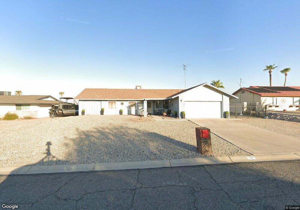
157 Cottonwood Dr Lake Havasu City, AZ 86403
Estimated Value: $308,134 - $466,000
--
Bed
1
Bath
1,512
Sq Ft
$246/Sq Ft
Est. Value
About This Home
This home is located at 157 Cottonwood Dr, Lake Havasu City, AZ 86403 and is currently estimated at $371,284, approximately $245 per square foot. 157 Cottonwood Dr is a home located in Mohave County with nearby schools including Starline Elementary School, Thunderbolt Middle School, and Lake Havasu High School.
Ownership History
Date
Name
Owned For
Owner Type
Purchase Details
Closed on
May 19, 2006
Sold by
Ziegler Samuel Charles and Ziegler Sam
Bought by
Butler Ii Stanley
Current Estimated Value
Home Financials for this Owner
Home Financials are based on the most recent Mortgage that was taken out on this home.
Original Mortgage
$211,500
Interest Rate
7%
Mortgage Type
Purchase Money Mortgage
Purchase Details
Closed on
Oct 26, 2002
Sold by
Sampson Raye Ann
Bought by
Butler Ii Stanley and Ziegler Samuel Charles
Home Financials for this Owner
Home Financials are based on the most recent Mortgage that was taken out on this home.
Original Mortgage
$112,575
Interest Rate
6.12%
Purchase Details
Closed on
Aug 13, 2001
Sold by
Cleland Neill D and Cleland Gladys M
Bought by
Sampson Raye Ann
Home Financials for this Owner
Home Financials are based on the most recent Mortgage that was taken out on this home.
Original Mortgage
$82,800
Interest Rate
7.05%
Mortgage Type
New Conventional
Create a Home Valuation Report for This Property
The Home Valuation Report is an in-depth analysis detailing your home's value as well as a comparison with similar homes in the area
Home Values in the Area
Average Home Value in this Area
Purchase History
| Date | Buyer | Sale Price | Title Company |
|---|---|---|---|
| Butler Ii Stanley | -- | Capital Title Agency Inc | |
| Butler Ii Stanley | $118,500 | Capital Title Agency Inc | |
| Sampson Raye Ann | $92,000 | Capital Title Agency Inc |
Source: Public Records
Mortgage History
| Date | Status | Borrower | Loan Amount |
|---|---|---|---|
| Previous Owner | Butler Ii Stanley | $211,500 | |
| Previous Owner | Butler Ii Stanley | $112,575 | |
| Previous Owner | Sampson Raye Ann | $82,800 |
Source: Public Records
Tax History Compared to Growth
Tax History
| Year | Tax Paid | Tax Assessment Tax Assessment Total Assessment is a certain percentage of the fair market value that is determined by local assessors to be the total taxable value of land and additions on the property. | Land | Improvement |
|---|---|---|---|---|
| 2026 | $493 | -- | -- | -- |
| 2025 | $1,000 | $20,797 | $0 | $0 |
| 2024 | $1,000 | $33,970 | $0 | $0 |
| 2023 | $1,000 | $22,537 | $0 | $0 |
| 2022 | $957 | $20,553 | $0 | $0 |
| 2021 | $1,113 | $17,046 | $0 | $0 |
| 2019 | $1,060 | $13,940 | $0 | $0 |
| 2018 | $1,026 | $13,742 | $0 | $0 |
| 2017 | $1,017 | $12,622 | $0 | $0 |
| 2016 | $927 | $10,662 | $0 | $0 |
| 2015 | $890 | $10,039 | $0 | $0 |
Source: Public Records
Map
Nearby Homes
- 190 Aspen Dr
- 160 Aspen Dr
- 1962 Cliffrose Dr
- 1958 Montana Vista Unit D
- 1939 Pine Ln
- 72 Mariposa Dr Unit D
- 371 Cottonwood Dr
- 2042 Swanson Ave Unit A
- 2042 Swanson Ave Unit H
- 220 White Oak Dr
- 1884 Montana Vista Unit 63B
- 1852 Montana Vista Unit B
- 1840 Montana Vista Unit D
- 1838 Montana Vista Unit C
- 1827 Combat Dr
- 1793 Montana Vista Unit C
- 1824 Montana Vista Unit D
- 2080 Swanson Ave Unit F
- 2080 Swanson Ave Unit C
- 2080 Swanson Ave Unit D
- 165 Cottonwood Dr
- 149 Cottonwood Dr
- 150 Cottonwood Dr
- 141 Cottonwood Dr
- 140 Cottonwood Dr
- 160 Cottonwood Dr
- 132 Mariposa Dr
- 124 Mariposa Dr
- 140 Mariposa Dr
- 130 Cottonwood Dr
- 170 Cottonwood Dr
- 151 Aspen Dr
- 181 Cottonwood Dr
- 148 Mariposa Dr
- 133 Cottonwood Dr
- 116 Mariposa Dr
- 141 Aspen Dr
- 161 Aspen Dr
- 131 Aspen Dr
- 180 Cottonwood Dr