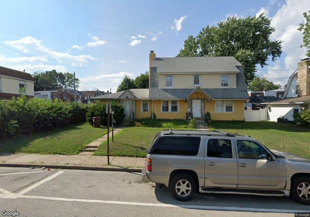
157 E Plumstead Ave Lansdowne, PA 19050
Estimated Value: $250,572
5
Beds
3
Baths
2,409
Sq Ft
$104/Sq Ft
Est. Value
About This Home
This home is located at 157 E Plumstead Ave, Lansdowne, PA 19050 and is currently estimated at $250,572, approximately $104 per square foot. 157 E Plumstead Ave is a home located in Delaware County with nearby schools including East Lansdowne Elementary School, Penn Wood Middle School, and Penn Wood High School - Cypress Street Campus.
Ownership History
Date
Name
Owned For
Owner Type
Purchase Details
Closed on
Mar 22, 2005
Sold by
Dubin Robert
Bought by
Saad Mohamed A and Attawia Omaier
Current Estimated Value
Purchase Details
Closed on
Jun 13, 1994
Sold by
Barron Joshua H and Barron Verna S
Bought by
Dubin Robert
Home Financials for this Owner
Home Financials are based on the most recent Mortgage that was taken out on this home.
Original Mortgage
$105,000
Interest Rate
8.55%
Mortgage Type
Seller Take Back
Create a Home Valuation Report for This Property
The Home Valuation Report is an in-depth analysis detailing your home's value as well as a comparison with similar homes in the area
Home Values in the Area
Average Home Value in this Area
Purchase History
| Date | Buyer | Sale Price | Title Company |
|---|---|---|---|
| Saad Mohamed A | $150,000 | None Available | |
| Dubin Robert | $110,000 | -- |
Source: Public Records
Mortgage History
| Date | Status | Borrower | Loan Amount |
|---|---|---|---|
| Previous Owner | Dubin Robert | $105,000 |
Source: Public Records
Tax History
| Year | Tax Paid | Tax Assessment Tax Assessment Total Assessment is a certain percentage of the fair market value that is determined by local assessors to be the total taxable value of land and additions on the property. | Land | Improvement |
|---|---|---|---|---|
| 2025 | $8,669 | $210,560 | $49,460 | $161,100 |
| 2024 | $8,669 | $210,560 | $49,460 | $161,100 |
| 2023 | $8,265 | $210,560 | $49,460 | $161,100 |
| 2022 | $8,103 | $210,560 | $49,460 | $161,100 |
| 2021 | $12,168 | $210,560 | $49,460 | $161,100 |
| 2020 | $7,575 | $115,510 | $35,730 | $79,780 |
| 2019 | $7,448 | $115,510 | $35,730 | $79,780 |
| 2018 | $7,320 | $115,510 | $0 | $0 |
| 2017 | $7,159 | $115,510 | $0 | $0 |
| 2016 | $634 | $115,510 | $0 | $0 |
| 2015 | $647 | $115,510 | $0 | $0 |
| 2014 | $647 | $115,510 | $0 | $0 |
Source: Public Records
Map
Nearby Homes
- 291 N Wycombe Ave
- 291 Jackson Ave
- 247 Coverly Rd
- 243 Coverly Rd
- 212 N Maple Ave
- 210 Wabash Ave
- 360 Huntley Rd
- 7303 Sherbrook Blvd
- 91 Lamport Rd
- 7265 Calvin Rd
- 178 N Union Ave
- 7273 Guilford Rd
- 7261 Calvin Rd
- 319 Avon Rd
- 217 E Greenwood Ave
- 7283 Bradford Rd
- 305 Margate Rd
- 311 Margate Rd
- 0 Hirst Ave
- 327 Congress Ave
- 287 Braddock Ave
- 159 E Plumstead Ave
- 141 E Plumstead Ave
- 289 Braddock Ave
- 139 E Plumstead Ave
- 299 Wabash Ave
- 308 Barker Ave
- 291 Braddock Ave
- 297 Wabash Ave
- 310 Barker Ave
- 295 Wabash Ave
- 135 E Plumstead Ave
- 284 Braddock Ave
- 161 E Plumstead Ave
- 293 Wabash Ave
- 300 Wabash Ave
- 286 Braddock Ave
- 312 Barker Ave
- 293 Braddock Ave
- 165 E Plumstead Ave
Your Personal Tour Guide
Ask me questions while you tour the home.