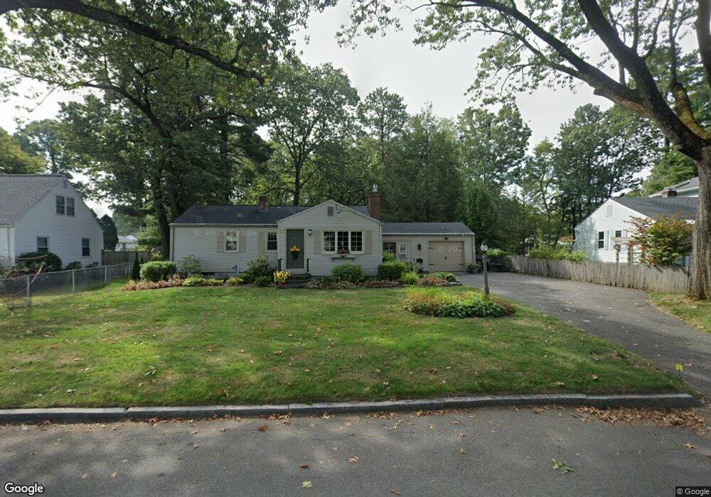
157 Mccarthy Ave Chicopee, MA 01020
Fairview NeighborhoodEstimated Value: $338,000 - $369,000
3
Beds
1
Bath
1,430
Sq Ft
$245/Sq Ft
Est. Value
About This Home
This home is located at 157 Mccarthy Ave, Chicopee, MA 01020 and is currently estimated at $350,955, approximately $245 per square foot. 157 Mccarthy Ave is a home located in Hampden County with nearby schools including Bowie Elementary School, Fairview Middle School, and Chicopee Comprehensive High School.
Ownership History
Date
Name
Owned For
Owner Type
Purchase Details
Closed on
Mar 2, 2022
Sold by
Tremblay Constance A
Bought by
Tremblay Marc R
Current Estimated Value
Purchase Details
Closed on
May 4, 2021
Sold by
Tremblay Marc R and Tremblay Bryan J
Bought by
Tremblay Constance A
Purchase Details
Closed on
May 10, 2016
Sold by
Tremblay Constance A and Tremblay Richard T
Bought by
Tremblay Marc R and Tremblay Bryan J
Purchase Details
Closed on
Oct 7, 1974
Bought by
Tremblay Richard T and Tremblay Constance
Create a Home Valuation Report for This Property
The Home Valuation Report is an in-depth analysis detailing your home's value as well as a comparison with similar homes in the area
Home Values in the Area
Average Home Value in this Area
Purchase History
| Date | Buyer | Sale Price | Title Company |
|---|---|---|---|
| Tremblay Marc R | -- | None Available | |
| Tremblay Constance A | -- | None Available | |
| Tremblay Marc R | -- | -- | |
| Tremblay Richard T | -- | -- |
Source: Public Records
Mortgage History
| Date | Status | Borrower | Loan Amount |
|---|---|---|---|
| Previous Owner | Tremblay Richard T | $23,000 | |
| Previous Owner | Tremblay Richard T | $20,210 |
Source: Public Records
Tax History
| Year | Tax Paid | Tax Assessment Tax Assessment Total Assessment is a certain percentage of the fair market value that is determined by local assessors to be the total taxable value of land and additions on the property. | Land | Improvement |
|---|---|---|---|---|
| 2025 | $4,600 | $303,400 | $117,300 | $186,100 |
| 2024 | $4,365 | $295,700 | $115,100 | $180,600 |
| 2023 | $4,051 | $267,400 | $104,700 | $162,700 |
| 2022 | $3,938 | $231,800 | $91,000 | $140,800 |
| 2021 | $3,735 | $212,100 | $82,700 | $129,400 |
| 2020 | $3,595 | $205,900 | $85,000 | $120,900 |
| 2019 | $3,545 | $197,400 | $85,000 | $112,400 |
| 2018 | $3,461 | $189,000 | $80,900 | $108,100 |
| 2017 | $3,220 | $186,000 | $74,100 | $111,900 |
| 2016 | $3,247 | $192,000 | $74,100 | $117,900 |
| 2015 | $3,273 | $186,600 | $74,100 | $112,500 |
| 2014 | $1,436 | $186,600 | $74,100 | $112,500 |
Source: Public Records
Map
Nearby Homes
- 81 Mccarthy Ave
- 240 Mccarthy Ave
- 61 Saint Jacques Ave
- 1709 Memorial Dr
- 20 Richmond Way
- 523 James St
- 143 Royal St
- 90 Anson St
- 104 Johnson Rd Unit 1103
- 104 Johnson Rd Unit 707
- 18 Devlin Dr
- 15 Hudson Ave
- 144 Horseshoe Dr
- 156 Horseshoe Dr
- 128 Ann St
- 54 Mitchell Dr
- 54 Yorktown Ct
- 58 Robinridge Rd
- 117 Andersen Rd
- 1181 James St
- 149 Mccarthy Ave
- 165 Mccarthy Ave
- 154 Mccarthy Ave
- 141 Mccarthy Ave
- 164 Mccarthy Ave
- 175 Mccarthy Ave
- 25 Green St
- 19 Green St
- 14 Shaban Dr
- 140 Mccarthy Ave
- 174 Mccarthy Ave
- 131 Mccarthy Ave
- 26 Shaban Dr
- 132 Mccarthy Ave
- 33 Green St
- 241 College St
- 40 Shaban Dr
- 39 Green St
- 128 Mccarthy Ave
- 235 College St
Your Personal Tour Guide
Ask me questions while you tour the home.