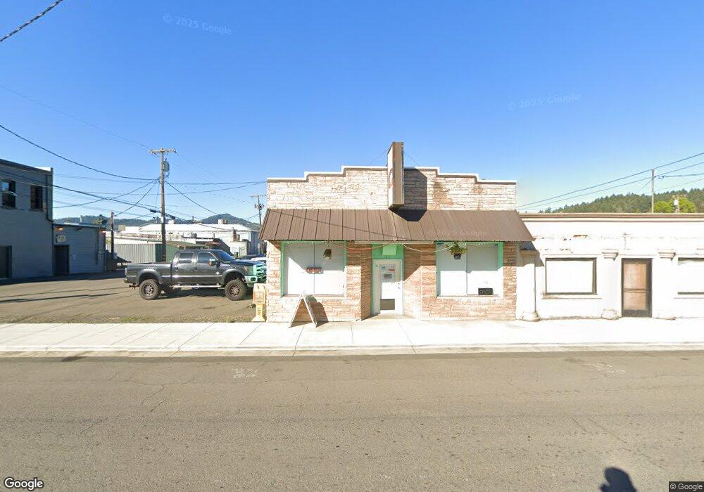
157 N State St Unit 2 Sutherlin, OR 97479
Estimated Value: $190,271
--
Bed
--
Bath
2,380
Sq Ft
$80/Sq Ft
Est. Value
About This Home
This home is located at 157 N State St Unit 2, Sutherlin, OR 97479 and is currently estimated at $190,271, approximately $79 per square foot. 157 N State St Unit 2 is a home located in Douglas County with nearby schools including East Sutherlin Primary School, West Sutherlin Intermediate School, and Sutherlin Middle School.
Ownership History
Date
Name
Owned For
Owner Type
Purchase Details
Closed on
Jul 30, 2020
Sold by
Greer Patricia J and Greer Derald D
Bought by
Lopez Luis A Rodriguez
Current Estimated Value
Home Financials for this Owner
Home Financials are based on the most recent Mortgage that was taken out on this home.
Original Mortgage
$112,000
Outstanding Balance
$79,527
Interest Rate
3%
Mortgage Type
Commercial
Estimated Equity
$110,744
Purchase Details
Closed on
Aug 28, 2015
Sold by
Greer Patricia J
Bought by
Greer Derald D and Avery Joanna B
Purchase Details
Closed on
Mar 17, 2011
Sold by
Reed Mezdulene and Reed Cheri
Bought by
Greer Earl S and Greer Patricia J
Create a Home Valuation Report for This Property
The Home Valuation Report is an in-depth analysis detailing your home's value as well as a comparison with similar homes in the area
Home Values in the Area
Average Home Value in this Area
Purchase History
| Date | Buyer | Sale Price | Title Company |
|---|---|---|---|
| Lopez Luis A Rodriguez | $140,000 | First American Title | |
| Greer Derald D | -- | None Available | |
| Greer Earl S | -- | Accommodation |
Source: Public Records
Mortgage History
| Date | Status | Borrower | Loan Amount |
|---|---|---|---|
| Open | Lopez Luis A Rodriguez | $112,000 |
Source: Public Records
Tax History Compared to Growth
Tax History
| Year | Tax Paid | Tax Assessment Tax Assessment Total Assessment is a certain percentage of the fair market value that is determined by local assessors to be the total taxable value of land and additions on the property. | Land | Improvement |
|---|---|---|---|---|
| 2024 | $1,906 | $152,873 | -- | -- |
| 2023 | $1,852 | $148,421 | $0 | $0 |
| 2022 | $1,798 | $144,099 | $0 | $0 |
| 2021 | $1,747 | $139,902 | $0 | $0 |
| 2020 | $1,687 | $135,828 | $0 | $0 |
| 2019 | $1,687 | $135,828 | $0 | $0 |
Source: Public Records
Map
Nearby Homes
- 0 N Fourth St Unit 24557651
- 232 Heavenly Ct
- 328 S State St
- 409 S State St
- 530 Tanglewood St
- 427 S State St
- 444 S State St
- 550 S State St
- 550 S State St Unit 139
- 550 S State St Unit 115
- 776 E Fourth Ave
- 226 Miller St
- 220 Miller St
- 788 Schoon Mountain Rd
- 845 Forest Heights St
- 119 Terrace Ln
- 279 Grant St
- 662 Brooks Loop
- 1000 E Central Ave Unit 2
- 1000 E Central Ave Unit 21
- 157 N State St
- 109 N State St
- 115 N State St
- 103 W Central Ave
- 101 W Central Ave Unit 1
- 101 W Central Ave
- 105 W Central Ave
- 222 N State St
- 222 N State St Unit 1
- 224 N State St
- 107 E Central Ave Unit 2
- 167 W First Ave Unit 28
- 119 W Central Ave
- 121 W Central Ave Unit 2
- 121 W Central Ave
- 117 Central
- 175 W First Ave
- 152 N Calapooia St
- 144 N Calapooia St
- 102 E Central Ave