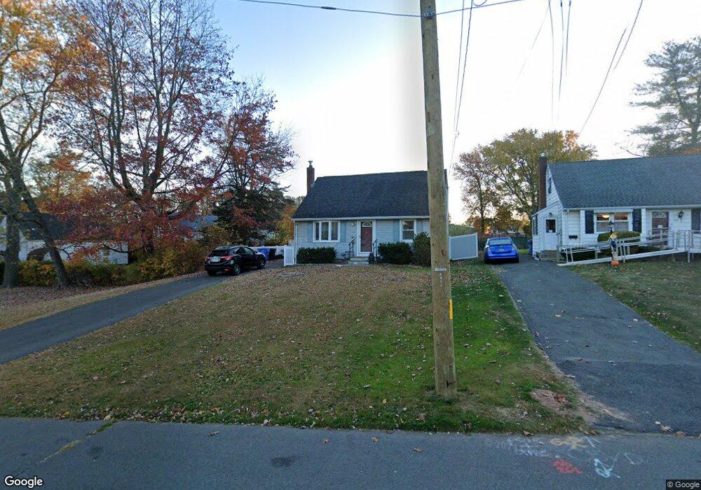
157 Nancy Rd New Britain, CT 06053
Estimated Value: $298,201 - $325,000
3
Beds
2
Baths
1,296
Sq Ft
$242/Sq Ft
Est. Value
About This Home
This home is located at 157 Nancy Rd, New Britain, CT 06053 and is currently estimated at $313,800, approximately $242 per square foot. 157 Nancy Rd is a home located in Hartford County with nearby schools including Gaffney School, Pulaski Middle School, and St. Francis of Assisi Middle School.
Ownership History
Date
Name
Owned For
Owner Type
Purchase Details
Closed on
Jan 25, 2024
Sold by
Yott Nancy
Bought by
Nancy Yott Lt and Yott
Current Estimated Value
Purchase Details
Closed on
Aug 18, 1994
Sold by
Demaria Robert J and Demaria Marilyn M
Bought by
Hoar Shawn H and Hoar Debra L
Home Financials for this Owner
Home Financials are based on the most recent Mortgage that was taken out on this home.
Original Mortgage
$54,000
Interest Rate
7%
Mortgage Type
Purchase Money Mortgage
Create a Home Valuation Report for This Property
The Home Valuation Report is an in-depth analysis detailing your home's value as well as a comparison with similar homes in the area
Home Values in the Area
Average Home Value in this Area
Purchase History
| Date | Buyer | Sale Price | Title Company |
|---|---|---|---|
| Nancy Yott Lt | -- | None Available | |
| Hoar Shawn H | $60,000 | -- |
Source: Public Records
Mortgage History
| Date | Status | Borrower | Loan Amount |
|---|---|---|---|
| Previous Owner | Hoar Shawn H | $17,449 | |
| Previous Owner | Hoar Shawn H | $54,000 |
Source: Public Records
Tax History
| Year | Tax Paid | Tax Assessment Tax Assessment Total Assessment is a certain percentage of the fair market value that is determined by local assessors to be the total taxable value of land and additions on the property. | Land | Improvement |
|---|---|---|---|---|
| 2025 | $5,751 | $146,790 | $52,710 | $94,080 |
| 2024 | $5,811 | $146,790 | $52,710 | $94,080 |
| 2023 | $5,619 | $146,790 | $52,710 | $94,080 |
| 2022 | $4,806 | $97,090 | $22,190 | $74,900 |
| 2021 | $4,806 | $97,090 | $22,190 | $74,900 |
| 2020 | $4,903 | $97,090 | $22,190 | $74,900 |
| 2019 | $4,854 | $96,110 | $22,190 | $73,920 |
| 2018 | $4,854 | $96,110 | $22,190 | $73,920 |
| 2017 | $4,528 | $89,670 | $22,190 | $67,480 |
| 2016 | $4,528 | $89,670 | $22,190 | $67,480 |
| 2015 | $4,394 | $89,670 | $22,190 | $67,480 |
| 2014 | $4,394 | $89,670 | $22,190 | $67,480 |
Source: Public Records
Map
Nearby Homes
- 153 Horseplain Rd
- 234 Pierremount Ave
- 2453 Corbin Ave
- 230 Hillhurst Ave
- 240 Hillhurst Ave
- 24 Pentlow Ave
- 678 Farmington Ave
- 527 Burritt St
- 432 Mcclintock St
- 54 Fairlane Dr
- 1114 Fienemann Rd
- 8128 Colt Hwy
- 25 Clinton St
- 55 Allen St
- 376 Broad St
- 37 Richard St
- 50 Curtin Ave
- 7 Ledyard Rd
- 154 Allen St
- 45 Tunxis St
Your Personal Tour Guide
Ask me questions while you tour the home.