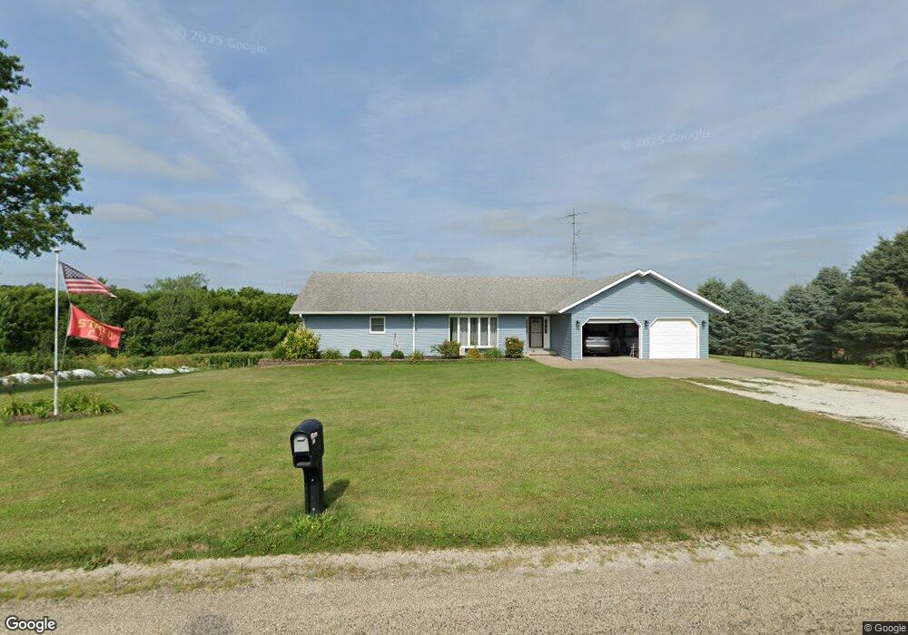
157 Rr 1 Stronghurst, IL 61480
Estimated Value: $164,000 - $234,000
2
Beds
--
Bath
1,526
Sq Ft
$132/Sq Ft
Est. Value
About This Home
This home is located at 157 Rr 1, Stronghurst, IL 61480 and is currently estimated at $201,683, approximately $132 per square foot. 157 Rr 1 is a home located in Henderson County with nearby schools including West Central Elementary School and West Central High School.
Create a Home Valuation Report for This Property
The Home Valuation Report is an in-depth analysis detailing your home's value as well as a comparison with similar homes in the area
Home Values in the Area
Average Home Value in this Area
Tax History Compared to Growth
Tax History
| Year | Tax Paid | Tax Assessment Tax Assessment Total Assessment is a certain percentage of the fair market value that is determined by local assessors to be the total taxable value of land and additions on the property. | Land | Improvement |
|---|---|---|---|---|
| 2024 | $3,928 | $66,165 | $6,195 | $59,970 |
| 2023 | $3,761 | $61,935 | $5,799 | $56,136 |
| 2022 | $3,443 | $56,616 | $6,211 | $50,405 |
| 2021 | $3,383 | $53,573 | $5,877 | $47,696 |
| 2020 | $3,415 | $52,251 | $5,732 | $46,519 |
| 2019 | $3,542 | $51,733 | $5,675 | $46,058 |
| 2018 | $2,967 | $45,940 | $6,388 | $39,552 |
| 2017 | $2,956 | $45,940 | $6,388 | $39,552 |
| 2016 | $2,831 | $42,675 | $5,934 | $36,741 |
| 2015 | -- | $41,703 | $5,799 | $35,904 |
| 2014 | -- | $39,841 | $2,879 | $36,962 |
| 2010 | -- | $43,561 | $2,904 | $40,657 |
Source: Public Records
Map
Nearby Homes
- 420 S Commercial St
- 202 E Maple St
- 305 N Cooper St
- 702 W Maple St
- 1229 Township Road 1800e
- 1060 Centennial Ave
- 1000 Ellison Creek Rd
- 166 State Highway 94
- 208 W Washington St
- 209 E Main St
- 419 Crane Hill Rd
- 0 Carman Rd
- 305 E Division St
- 114 Oak St
- 110 Oak St
- 792 Water St N
- 1063 Second St
- 181 Aviston St
- 344 S Benton St
- 831 E Atchison St