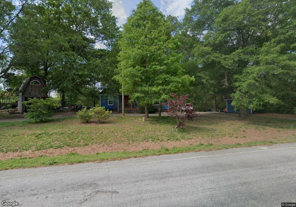
157 Salem Rd Royston, GA 30662
Estimated Value: $126,000 - $288,000
2
Beds
1
Bath
1,050
Sq Ft
$193/Sq Ft
Est. Value
About This Home
This home is located at 157 Salem Rd, Royston, GA 30662 and is currently estimated at $202,417, approximately $192 per square foot. 157 Salem Rd is a home located in Franklin County with nearby schools including Franklin County High School.
Ownership History
Date
Name
Owned For
Owner Type
Purchase Details
Closed on
Aug 23, 2005
Sold by
Fleeman William Adam
Bought by
Ledbetter Brian
Current Estimated Value
Home Financials for this Owner
Home Financials are based on the most recent Mortgage that was taken out on this home.
Original Mortgage
$66,400
Outstanding Balance
$40,717
Interest Rate
8.38%
Mortgage Type
New Conventional
Estimated Equity
$161,700
Purchase Details
Closed on
Mar 22, 2005
Sold by
Tolbert Scott R
Bought by
Fleeman William Adam
Purchase Details
Closed on
Dec 13, 2002
Sold by
Britt Stacey
Bought by
Britt Stacey and Tolbert Scott
Purchase Details
Closed on
Aug 28, 1995
Bought by
Phillips Myrtle B
Create a Home Valuation Report for This Property
The Home Valuation Report is an in-depth analysis detailing your home's value as well as a comparison with similar homes in the area
Home Values in the Area
Average Home Value in this Area
Purchase History
| Date | Buyer | Sale Price | Title Company |
|---|---|---|---|
| Ledbetter Brian | $83,000 | -- | |
| Fleeman William Adam | $25,000 | -- | |
| Britt Stacey | -- | -- | |
| Britt Stacey | $18,000 | -- | |
| Phillips Polly | -- | -- | |
| Phillips Myrtle B | -- | -- |
Source: Public Records
Mortgage History
| Date | Status | Borrower | Loan Amount |
|---|---|---|---|
| Open | Ledbetter Brian | $66,400 |
Source: Public Records
Tax History Compared to Growth
Tax History
| Year | Tax Paid | Tax Assessment Tax Assessment Total Assessment is a certain percentage of the fair market value that is determined by local assessors to be the total taxable value of land and additions on the property. | Land | Improvement |
|---|---|---|---|---|
| 2024 | $834 | $37,020 | $2,734 | $34,286 |
| 2023 | $817 | $33,655 | $2,486 | $31,169 |
| 2022 | $730 | $30,283 | $1,926 | $28,357 |
| 2021 | $699 | $27,398 | $1,926 | $25,472 |
| 2020 | $706 | $27,398 | $1,926 | $25,472 |
| 2019 | $682 | $27,398 | $1,926 | $25,472 |
| 2018 | $611 | $24,738 | $2,494 | $22,244 |
| 2017 | $625 | $24,368 | $2,494 | $21,874 |
| 2016 | $578 | $21,819 | $2,494 | $19,325 |
| 2015 | -- | $21,818 | $2,494 | $19,325 |
| 2014 | -- | $21,818 | $2,494 | $19,325 |
| 2013 | -- | $22,038 | $2,493 | $19,544 |
Source: Public Records
Map
Nearby Homes
- 955 Collins Dudley Rd
- 0 Dickson Dr Unit 416392
- 0 Dickson Dr Unit 7594620
- 0 Dickson Dr Unit 23800701
- 0 Dickson Dr Unit 10539867
- 66 Topaz Ln
- 1745 Hannah Creek Church Rd
- 0 Dove Hill Rd Unit 25439972
- 0 Dove Hill Rd Unit 10637645
- 0 S Tanglewood Dr Unit 1027287
- 0 S Tanglewood Dr Unit 10538269
- 1350 Baker Rd
- 329 Riverbend Dr
- 1112 Reno Rd
- 222 Reno Rd
- 157 Riverbend Cir
- 1344 Jim Grizzle Rd
- 706 Sam Bruce Rd
- 450 Stagecoach Way
- 266 Water Oak Rd