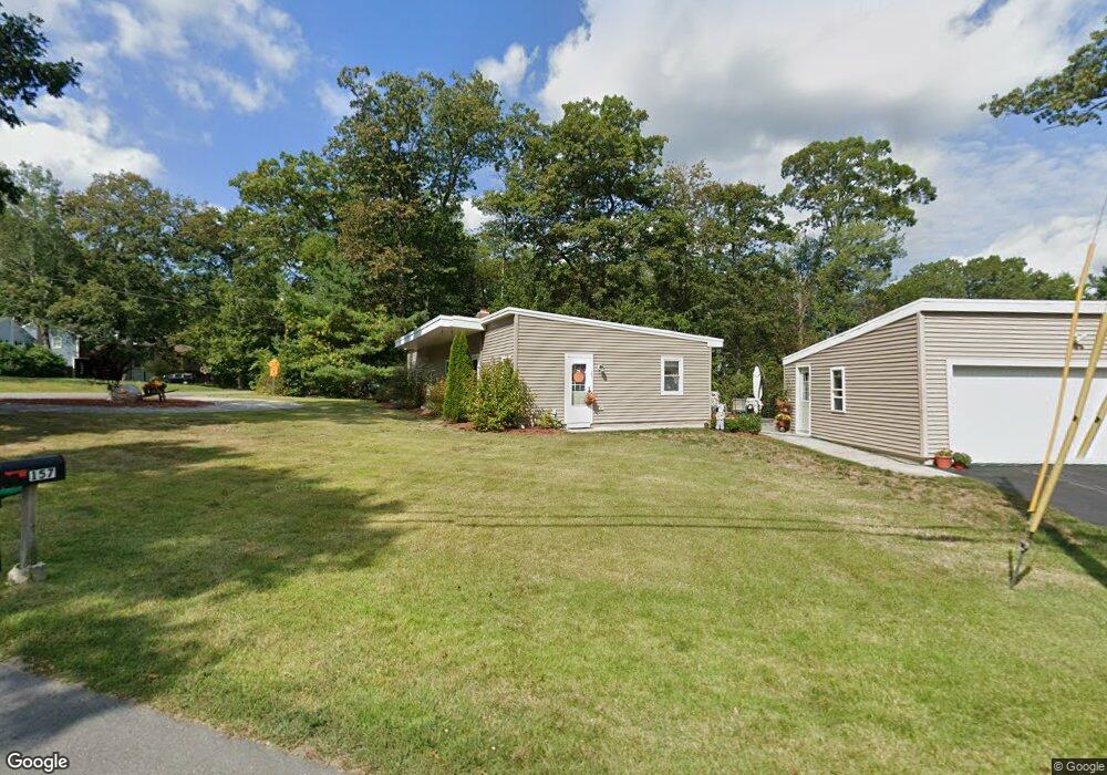
157 Townsend Harbor Rd Lunenburg, MA 01462
Estimated Value: $484,000 - $622,000
3
Beds
2
Baths
1,600
Sq Ft
$325/Sq Ft
Est. Value
About This Home
This home is located at 157 Townsend Harbor Rd, Lunenburg, MA 01462 and is currently estimated at $520,359, approximately $325 per square foot. 157 Townsend Harbor Rd is a home located in Worcester County with nearby schools including Lunenburg Primary School and Lunenburg High School.
Ownership History
Date
Name
Owned For
Owner Type
Purchase Details
Closed on
Aug 26, 2019
Sold by
Mdb Management Group Llc
Bought by
Steimel Ft
Current Estimated Value
Purchase Details
Closed on
Apr 6, 2018
Sold by
Jp Morgan Chase Bank N
Bought by
Mdb Management Group L
Purchase Details
Closed on
Nov 17, 2017
Sold by
Bailey Kenneth K
Bought by
Jp Morgan Chase Bank N
Purchase Details
Closed on
Dec 12, 1994
Sold by
Usa Va
Bought by
Bailey Kenneth
Home Financials for this Owner
Home Financials are based on the most recent Mortgage that was taken out on this home.
Original Mortgage
$84,700
Interest Rate
9%
Mortgage Type
Purchase Money Mortgage
Create a Home Valuation Report for This Property
The Home Valuation Report is an in-depth analysis detailing your home's value as well as a comparison with similar homes in the area
Home Values in the Area
Average Home Value in this Area
Purchase History
| Date | Buyer | Sale Price | Title Company |
|---|---|---|---|
| Steimel Ft | $330,400 | -- | |
| Mdb Management Group L | $87,500 | -- | |
| Jp Morgan Chase Bank N | $93,480 | -- | |
| Bailey Kenneth | $85,900 | -- |
Source: Public Records
Mortgage History
| Date | Status | Borrower | Loan Amount |
|---|---|---|---|
| Previous Owner | Bailey Kenneth | $172,975 | |
| Previous Owner | Bailey Kenneth | $141,660 | |
| Previous Owner | Bailey Kenneth | $143,380 | |
| Previous Owner | Bailey Kenneth | $84,700 |
Source: Public Records
Tax History
| Year | Tax Paid | Tax Assessment Tax Assessment Total Assessment is a certain percentage of the fair market value that is determined by local assessors to be the total taxable value of land and additions on the property. | Land | Improvement |
|---|---|---|---|---|
| 2025 | $5,194 | $361,700 | $110,700 | $251,000 |
| 2024 | $4,839 | $343,200 | $104,400 | $238,800 |
| 2023 | $4,749 | $324,800 | $93,800 | $231,000 |
| 2022 | $4,368 | $254,100 | $78,200 | $175,900 |
| 2020 | $4,097 | $226,100 | $78,500 | $147,600 |
| 2019 | $3,714 | $198,800 | $72,400 | $126,400 |
| 2018 | $3,375 | $171,300 | $75,500 | $95,800 |
| 2017 | $3,101 | $155,200 | $64,200 | $91,000 |
| 2016 | $3,043 | $155,200 | $64,800 | $90,400 |
| 2015 | $2,733 | $149,200 | $61,800 | $87,400 |
Source: Public Records
Map
Nearby Homes
- 91 Valley Rd
- 167 S Row Rd
- 36 Gilchrest St
- 35 Leominster Rd
- 146 Elmwood Rd
- 367 Mulpus Rd
- 63 Holman St
- 319 Highland St
- 12 Cortland Cir Unit 12
- 711 Massachusetts Ave Unit 2
- 2 Gabes Place
- 80 W Townsend Rd
- 110 Burrage St
- 00 Tyler Rd
- 756 Northfield Rd
- 222 W Townsend Rd
- 309 Reservoir Rd
- Lot 10 Christian Cir
- 507/533R W Townsend Rd
- 365 Hollis Rd
- 8 Hemlock Dr
- 160 Townsend Harbor Rd
- 167 Townsend Harbor Rd
- 165 Townsend Harbor Rd
- 5 Hemlock Dr
- 169 Townsend Harbor Rd
- 168 Townsend Harbor Rd
- 16 Hemlock Dr
- 12 Hemlock Dr
- 15 Hemlock Dr
- 15 Woodland Dr
- 172 Townsend Harbor Rd
- 23 Hemlock Dr
- 32 Hemlock Dr
- 12 Woodland Dr
- 176 Townsend Harbor Rd
- 129 Townsend Harbor Rd
- 27 Woodland Dr
- 199 Woodland Dr
- 18 Woodland Dr
Your Personal Tour Guide
Ask me questions while you tour the home.