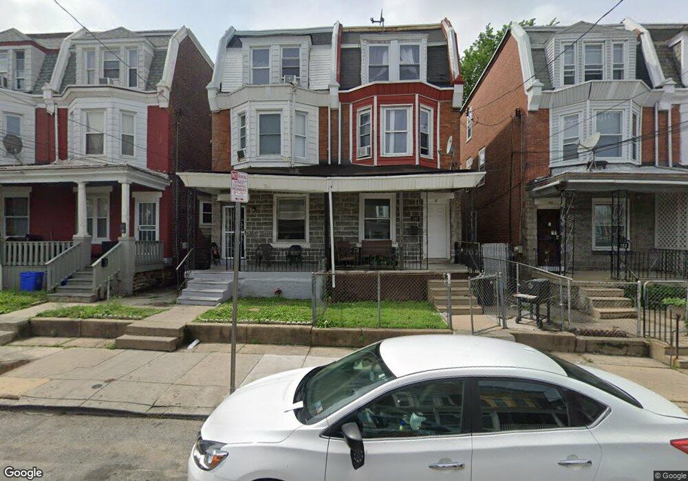
157 W Hansberry St Philadelphia, PA 19144
Germantown NeighborhoodEstimated Value: $217,000 - $290,000
5
Beds
1
Bath
1,992
Sq Ft
$127/Sq Ft
Est. Value
About This Home
This home is located at 157 W Hansberry St, Philadelphia, PA 19144 and is currently estimated at $253,569, approximately $127 per square foot. 157 W Hansberry St is a home located in Philadelphia County with nearby schools including John B. Kelly School, Roosevelt Theodore Middle School, and Martin Luther King High School.
Ownership History
Date
Name
Owned For
Owner Type
Purchase Details
Closed on
Jul 13, 2015
Sold by
Tycoon Investments Llc
Bought by
Dekel Properties Llc
Current Estimated Value
Purchase Details
Closed on
Mar 26, 2014
Sold by
Cooper Barbara V and Harper Ronald J
Bought by
Tycoon Investments Llc
Purchase Details
Closed on
Jul 29, 1996
Sold by
Cooper Barbara V
Bought by
Harper Ronald J and Cooper Barbara V
Purchase Details
Closed on
Feb 3, 1989
Bought by
Cooper Barbara
Create a Home Valuation Report for This Property
The Home Valuation Report is an in-depth analysis detailing your home's value as well as a comparison with similar homes in the area
Home Values in the Area
Average Home Value in this Area
Purchase History
| Date | Buyer | Sale Price | Title Company |
|---|---|---|---|
| Dekel Properties Llc | $23,163 | None Available | |
| Tycoon Investments Llc | $14,100 | None Available | |
| Harper Ronald J | -- | -- | |
| Cooper Barbara | -- | -- |
Source: Public Records
Tax History Compared to Growth
Tax History
| Year | Tax Paid | Tax Assessment Tax Assessment Total Assessment is a certain percentage of the fair market value that is determined by local assessors to be the total taxable value of land and additions on the property. | Land | Improvement |
|---|---|---|---|---|
| 2025 | $2,595 | $224,300 | $44,860 | $179,440 |
| 2024 | $2,595 | $224,300 | $44,860 | $179,440 |
| 2023 | $2,595 | $185,400 | $37,080 | $148,320 |
| 2022 | $1,688 | $185,400 | $37,080 | $148,320 |
| 2021 | $1,688 | $0 | $0 | $0 |
| 2020 | $1,688 | $0 | $0 | $0 |
| 2019 | $1,762 | $0 | $0 | $0 |
| 2018 | $0 | $0 | $0 | $0 |
| 2017 | $1,053 | $0 | $0 | $0 |
| 2016 | $1,037 | $0 | $0 | $0 |
| 2015 | $1,008 | $0 | $0 | $0 |
| 2014 | -- | $75,200 | $10,858 | $64,342 |
| 2012 | -- | $11,456 | $1,909 | $9,547 |
Source: Public Records
Map
Nearby Homes
- 131 W Hansberry St
- 5217 Marion St
- 128 W Queen Ln
- 137 W Manheim St
- 125 W Penn St
- 178 W Manheim St
- 5312 Greene St
- 5037 Keyser St
- 5125 Newhall St
- 5138 Newhall St
- 5322 Wayne Ave
- 5331 Wayne Ave
- 44 W Queen Ln
- 5128 Newhall St
- 230 W Penn St
- 232 W Penn St
- 260 W Queen Ln
- 5012 Greene St
- 5347 Newhall St
- 107 W Seymour St
- 155 W Hansberry St
- 159 W Hansberry St
- 153 W Hansberry St
- 161 W Hansberry St
- 151 W Hansberry St
- 163 W Hansberry St
- 5214 Knox St
- 165 W Hansberry St
- 149 W Hansberry St
- 5216 Knox St
- 167 W Hansberry St
- 5218 Knox St
- 169 WAYNE AVE W Hansberry St
- 5220 Knox St
- 169 W Hansberry St
- 5222 Knox St
- 171 W Hansberry St
- 5224 Knox St
- 156 W Hansberry St
- 158 W Hansberry St