Estimated Value: $137,000 - $179,000
3
Beds
1
Bath
1,048
Sq Ft
$148/Sq Ft
Est. Value
About This Home
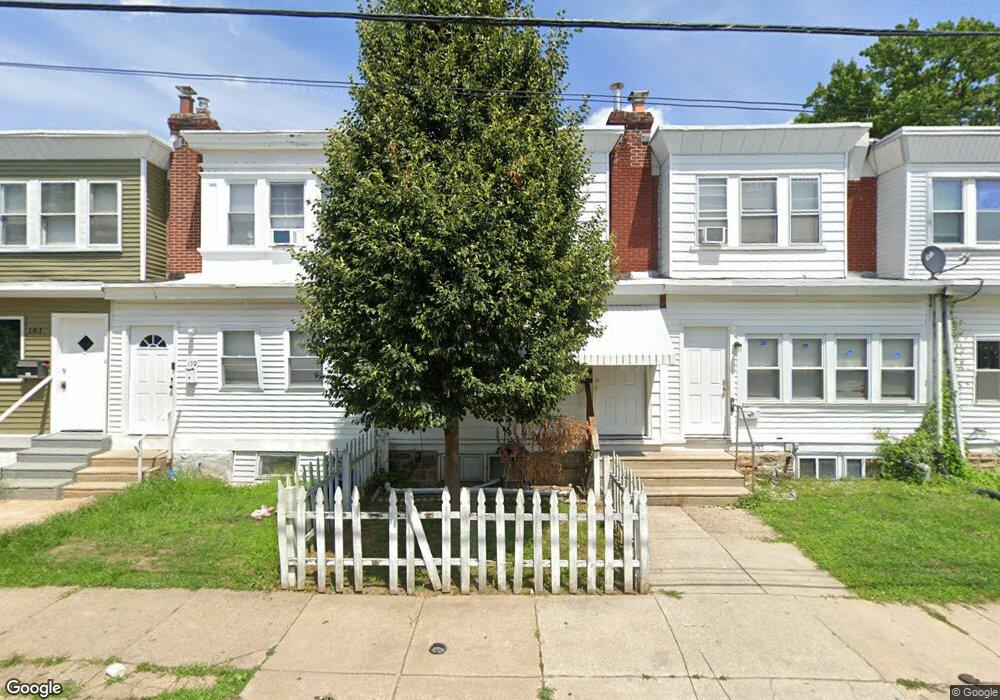
This home is located at 157 Wayne Ave, Darby, PA 19023 and is currently estimated at $155,159, approximately $148 per square foot. 157 Wayne Ave is a home located in Delaware County with nearby schools including Harris School, Academy Park High School, and Liberty Baptist Academy.
Ownership History
Date
Name
Owned For
Owner Type
Purchase Details
Closed on
Mar 3, 1999
Sold by
Sovereign Bank
Bought by
Elliott Mark J and Carbonetti Michael
Current Estimated Value
Purchase Details
Closed on
Sep 21, 1998
Sold by
Shown Kenneth M and Shown Dennis Dana
Bought by
Main Line Bank and Main Line Fsb
Purchase Details
Closed on
Feb 28, 1995
Sold by
Goldy Brian E and Goldy Bruce D
Bought by
Shown Kenneth M and Shown Dennis Dana
Home Financials for this Owner
Home Financials are based on the most recent Mortgage that was taken out on this home.
Original Mortgage
$38,000
Interest Rate
9.09%
Mortgage Type
Purchase Money Mortgage
Create a Home Valuation Report for This Property
The Home Valuation Report is an in-depth analysis detailing your home's value as well as a comparison with similar homes in the area
Home Values in the Area
Average Home Value in this Area
Purchase History
| Date | Buyer | Sale Price | Title Company |
|---|---|---|---|
| Elliott Mark J | $20,500 | Commonwealth Land Title Ins | |
| Main Line Bank | -- | -- | |
| Shown Kenneth M | $40,000 | -- |
Source: Public Records
Mortgage History
| Date | Status | Borrower | Loan Amount |
|---|---|---|---|
| Previous Owner | Shown Kenneth M | $38,000 |
Source: Public Records
Tax History
| Year | Tax Paid | Tax Assessment Tax Assessment Total Assessment is a certain percentage of the fair market value that is determined by local assessors to be the total taxable value of land and additions on the property. | Land | Improvement |
|---|---|---|---|---|
| 2025 | $2,312 | $52,000 | $19,950 | $32,050 |
| 2024 | $2,355 | $52,000 | $19,950 | $32,050 |
| 2023 | $2,292 | $52,000 | $19,950 | $32,050 |
| 2022 | $2,205 | $52,000 | $19,950 | $32,050 |
| 2021 | $3,037 | $52,000 | $19,950 | $32,050 |
| 2020 | $2,330 | $36,660 | $16,430 | $20,230 |
| 2019 | $2,246 | $36,660 | $16,430 | $20,230 |
| 2018 | $2,196 | $36,660 | $0 | $0 |
| 2017 | $3,016 | $51,290 | $0 | $0 |
| 2016 | $281 | $51,290 | $0 | $0 |
| 2015 | $287 | $51,290 | $0 | $0 |
| 2014 | $287 | $51,290 | $0 | $0 |
Source: Public Records
Map
Nearby Homes
- 149 Wayne Ave
- 217 Blunston Ave
- 223 Lafayette Ave
- 1011 Andrews Ave
- 81 Florence Ave
- 307 Clifton Ave
- 123 High St
- 112 Burton Ln E
- 71 Burnside Ave
- 531 Pershing Ave
- 235 Felton Ave
- 217 Sharon Ave
- 513 Macdade Blvd
- 317 N Llanwellyn Ave
- 1311 Spring St
- 213 Lincoln Ave
- 712 Bartram Ave
- 200 Barker Ave
- 105 Jackson Ave
- 314 Felton Ave
- 155 Wayne Ave
- 153 Wayne Ave
- 159 Wayne Ave
- 151 Wayne Ave
- 163 Wayne Ave
- 147 Wayne Ave
- 165 Wayne Ave
- 145 Wayne Ave
- 167 Wayne Ave
- 143 Wayne Ave
- 152 Wayne Ave
- 156 Wayne Ave
- 154 Wayne Ave
- 116 Upland Terrace
- 118 Upland Terrace
- 158 Wayne Ave
- 150 Wayne Ave
- 114 Upland Terrace
- 141 Wayne Ave
- 141 Wayne Ave Unit 782
Your Personal Tour Guide
Ask me questions while you tour the home.