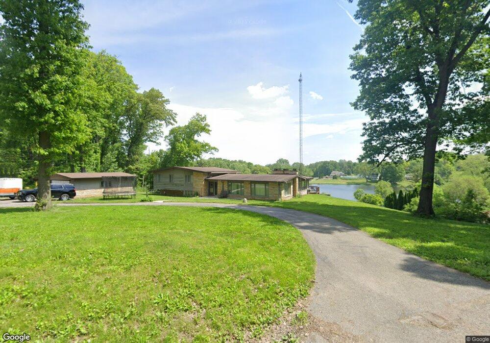
157 Woodside Ln Valparaiso, IN 46385
Estimated Value: $453,000 - $517,000
4
Beds
3
Baths
3,344
Sq Ft
$146/Sq Ft
Est. Value
About This Home
This home is located at 157 Woodside Ln, Valparaiso, IN 46385 and is currently estimated at $488,014, approximately $145 per square foot. 157 Woodside Ln is a home located in Porter County with nearby schools including Ben Franklin Middle School and Valparaiso High School.
Ownership History
Date
Name
Owned For
Owner Type
Purchase Details
Closed on
Jan 26, 2010
Sold by
Earhart Brad and Earhart Laura
Bought by
Whitcomb Aaron D
Current Estimated Value
Purchase Details
Closed on
Aug 12, 2005
Sold by
Earhart Brad
Bought by
Earhart Brad and Earhart Laura
Home Financials for this Owner
Home Financials are based on the most recent Mortgage that was taken out on this home.
Original Mortgage
$200,000
Interest Rate
5%
Mortgage Type
Fannie Mae Freddie Mac
Create a Home Valuation Report for This Property
The Home Valuation Report is an in-depth analysis detailing your home's value as well as a comparison with similar homes in the area
Home Values in the Area
Average Home Value in this Area
Purchase History
| Date | Buyer | Sale Price | Title Company |
|---|---|---|---|
| Whitcomb Aaron D | -- | Community Title Company | |
| Earhart Brad | -- | Meridian Title Corp | |
| Earhart Brad | -- | Meridian Title Corp |
Source: Public Records
Mortgage History
| Date | Status | Borrower | Loan Amount |
|---|---|---|---|
| Previous Owner | Earhart Brad | $200,000 |
Source: Public Records
Tax History Compared to Growth
Tax History
| Year | Tax Paid | Tax Assessment Tax Assessment Total Assessment is a certain percentage of the fair market value that is determined by local assessors to be the total taxable value of land and additions on the property. | Land | Improvement |
|---|---|---|---|---|
| 2024 | $3,790 | $425,500 | $86,900 | $338,600 |
| 2023 | $3,776 | $406,100 | $81,300 | $324,800 |
| 2022 | $3,636 | $371,000 | $81,300 | $289,700 |
| 2021 | $3,815 | $337,500 | $81,300 | $256,200 |
| 2020 | $3,729 | $327,800 | $70,800 | $257,000 |
| 2019 | $3,473 | $298,300 | $70,800 | $227,500 |
| 2018 | $3,369 | $288,600 | $70,800 | $217,800 |
| 2017 | $3,261 | $285,200 | $70,800 | $214,400 |
| 2016 | $2,716 | $262,200 | $60,600 | $201,600 |
| 2014 | $2,088 | $245,400 | $57,500 | $187,900 |
| 2013 | -- | $230,300 | $57,500 | $172,800 |
Source: Public Records
Map
Nearby Homes
- 221 W 150 N
- 201 W US Highway 30
- 110 Wheatridge Rd
- 700 W Us Highway 30
- The Willow Plan at Woods Edge
- The Sequoia Plan at Woods Edge
- The Oakwood Plan at Woods Edge
- The Chickory Plan at Woods Edge
- The Birchwood Plan at Woods Edge
- The Alderwood Plan at Woods Edge
- 237 Krouser Dr
- 265 Westport Rd
- 274 Westport Rd
- 77 Sanctuary Dr
- 65 Sanctuary Dr
- 63 Sanctuary Dr
- 61 Sanctuary Dr
- 59 Sanctuary Dr
- 300 W Joliet Rd
- 97 Scotscraig Dr
- 155 Woodside Ln
- 189 Woodside Ln
- 208 Meadowridge Ct
- 159 Sylvan Dr
- 158 Woodside Ct
- 158 Woodside Ct
- Lot 29 Woodside Ln
- 153 Woodside Ln
- 156 Moorland Dr
- 155 Sylvan Dr
- 154 Woodside Ln
- 161 Woodside Ct
- 209 Meadowridge Ct
- 216 Meadowridge Rd
- 210 Meadowridge Ct
- 205 Woodside Ct
- 205 Woodside Ct
- 150 Woodside Ct
- 150 Woodside Ct
- 155 Moorland Dr