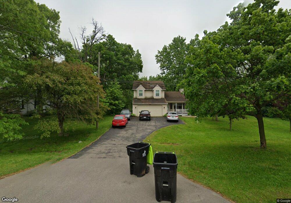
1570 Taylor Rd Auburn Hills, MI 48326
Estimated Value: $292,000 - $351,000
3
Beds
2
Baths
1,596
Sq Ft
$201/Sq Ft
Est. Value
About This Home
This home is located at 1570 Taylor Rd, Auburn Hills, MI 48326 and is currently estimated at $320,734, approximately $200 per square foot. 1570 Taylor Rd is a home located in Oakland County with nearby schools including Owen Elementary School, Pontiac Middle School, and Pontiac High School.
Ownership History
Date
Name
Owned For
Owner Type
Purchase Details
Closed on
Mar 7, 2011
Sold by
Secretary Of Housing & Urban Development
Bought by
Hazen Lloyd and Hazen Mary
Current Estimated Value
Purchase Details
Closed on
Aug 7, 2009
Sold by
Us Bank Na
Bought by
U S Department Of Housing & Urban Develo
Purchase Details
Closed on
Jun 16, 2009
Sold by
Fox Michael S and Fox Cindy M
Bought by
Us Bank Na
Purchase Details
Closed on
Aug 31, 2004
Sold by
Maron Richard C and Maron Michelle A
Bought by
Fox Michael S and Fox Cindy M
Home Financials for this Owner
Home Financials are based on the most recent Mortgage that was taken out on this home.
Original Mortgage
$205,400
Interest Rate
6.08%
Mortgage Type
FHA
Create a Home Valuation Report for This Property
The Home Valuation Report is an in-depth analysis detailing your home's value as well as a comparison with similar homes in the area
Home Values in the Area
Average Home Value in this Area
Purchase History
| Date | Buyer | Sale Price | Title Company |
|---|---|---|---|
| Hazen Lloyd | $85,010 | None Available | |
| U S Department Of Housing & Urban Develo | -- | None Available | |
| Us Bank Na | $202,791 | None Available | |
| Fox Michael S | $224,900 | Great Lakes Title Michigan |
Source: Public Records
Mortgage History
| Date | Status | Borrower | Loan Amount |
|---|---|---|---|
| Previous Owner | Fox Michael S | $205,400 |
Source: Public Records
Tax History Compared to Growth
Tax History
| Year | Tax Paid | Tax Assessment Tax Assessment Total Assessment is a certain percentage of the fair market value that is determined by local assessors to be the total taxable value of land and additions on the property. | Land | Improvement |
|---|---|---|---|---|
| 2024 | $1,380 | $128,280 | $0 | $0 |
| 2023 | $1,317 | $112,430 | $0 | $0 |
| 2022 | $6,053 | $97,170 | $0 | $0 |
| 2021 | $5,590 | $88,750 | $0 | $0 |
| 2020 | $1,236 | $92,100 | $0 | $0 |
| 2019 | $5,190 | $86,340 | $0 | $0 |
| 2018 | $3,914 | $78,200 | $0 | $0 |
| 2017 | $2,123 | $77,060 | $0 | $0 |
| 2016 | $1,994 | $76,280 | $0 | $0 |
| 2015 | -- | $74,480 | $0 | $0 |
| 2014 | -- | $69,000 | $0 | $0 |
| 2011 | -- | $67,560 | $0 | $0 |
Source: Public Records
Map
Nearby Homes
- 1286 Taylor Rd
- 1165 Vinewood St
- 1699 Giddings Rd
- 3080 Catalpa Ct
- 1038 Vinewood St
- 885 E Northfield Ave
- 1151 Fieldstone Ct
- 1172 Fieldstone Dr
- 804 Brandon Ave Unit 72
- 806 Brandon Ave Unit 71
- 819 Brandon Ave Unit 34
- 1484 Joslyn Ave
- 15 Beechwoode Ln Unit 74
- 1359 Foxrun Ln Unit 6
- 1354 Hilltop Dr
- 529 E Walton Blvd
- 1328 Ridgeway Blvd Unit 32
- 1336 Ridgeway Blvd
- 1336 Hawkcrest Ln Unit 117
- 1341 Galloway Cir Unit 100
- 1600 Taylor Rd
- 1640 Taylor Rd
- 1530 Taylor Rd
- 1654 Taylor Rd
- 1518 Taylor Rd
- 1478 Taylor Rd
- 3481 Taylor Ct
- 3469 Taylor Ct
- 1452 Taylor Rd
- 1593 Vinewood St
- 1461 Vinewood St
- 1440 Taylor Rd
- 1495 Vinewood St
- 1495 Vinewood St Unit Bldg-Unit
- 1553 Vinewood St
- 1587 Vinewood St
- 1577 Vinewood St
- 1473 Vinewood St
- 1529 Vinewood St
- 1509 Vinewood St