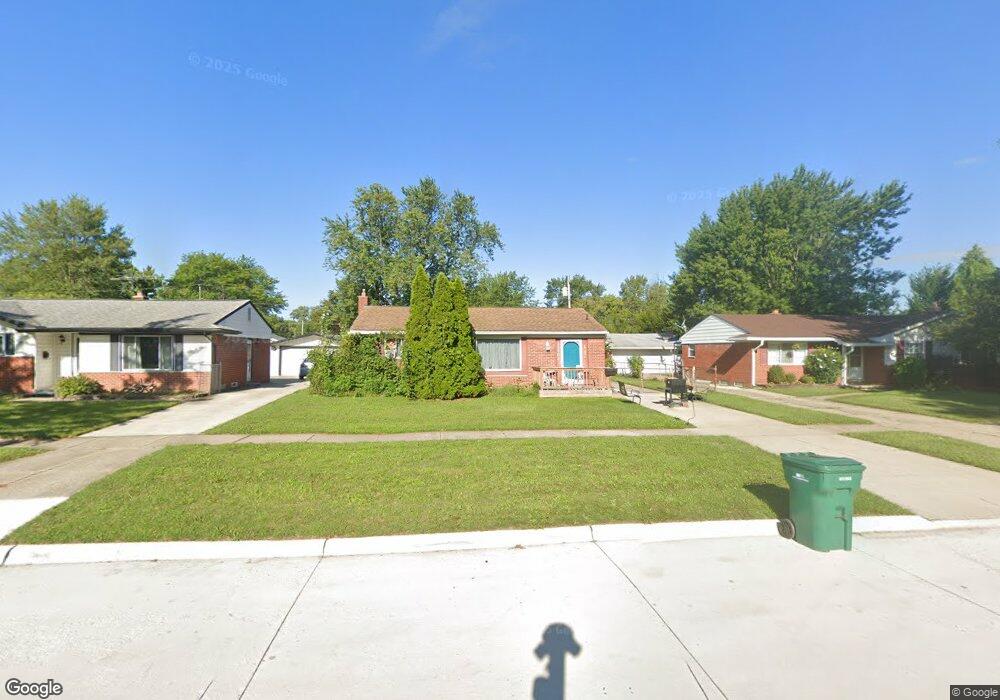
15702 Brandt St Romulus, MI 48174
Estimated Value: $159,000 - $197,000
3
Beds
1
Bath
888
Sq Ft
$201/Sq Ft
Est. Value
About This Home
This home is located at 15702 Brandt St, Romulus, MI 48174 and is currently estimated at $178,811, approximately $201 per square foot. 15702 Brandt St is a home located in Wayne County with nearby schools including Halecreek Elementary School, Romulus Middle School, and Romulus Senior High School.
Ownership History
Date
Name
Owned For
Owner Type
Purchase Details
Closed on
Nov 25, 2009
Sold by
Leigh Glennwood P and Leigh Glenwood P
Bought by
Cousins Enterprises Llc
Current Estimated Value
Purchase Details
Closed on
Nov 6, 2008
Sold by
Federal National Mortgage Association
Bought by
Leigh Glenwood P
Purchase Details
Closed on
Feb 8, 2008
Sold by
Citimortgage Inc
Bought by
Federal National Mortgage Association
Purchase Details
Closed on
Feb 6, 2008
Sold by
Corpe Earl E and Corpe Patricia A
Bought by
Citimortgage Inc
Create a Home Valuation Report for This Property
The Home Valuation Report is an in-depth analysis detailing your home's value as well as a comparison with similar homes in the area
Home Values in the Area
Average Home Value in this Area
Purchase History
| Date | Buyer | Sale Price | Title Company |
|---|---|---|---|
| Cousins Enterprises Llc | -- | None Available | |
| Leigh Glenwood P | $30,500 | Warranty Title Agency Llc | |
| Federal National Mortgage Association | -- | None Available | |
| Citimortgage Inc | $128,098 | None Available |
Source: Public Records
Tax History Compared to Growth
Tax History
| Year | Tax Paid | Tax Assessment Tax Assessment Total Assessment is a certain percentage of the fair market value that is determined by local assessors to be the total taxable value of land and additions on the property. | Land | Improvement |
|---|---|---|---|---|
| 2025 | $2,304 | $76,100 | $0 | $0 |
| 2024 | $2,304 | $69,900 | $0 | $0 |
| 2023 | $2,205 | $62,400 | $0 | $0 |
| 2022 | $2,453 | $57,500 | $0 | $0 |
| 2021 | $2,392 | $46,900 | $0 | $0 |
| 2020 | $2,342 | $46,400 | $0 | $0 |
| 2019 | $2,317 | $39,700 | $0 | $0 |
| 2018 | $1,700 | $30,500 | $0 | $0 |
| 2017 | $790 | $30,100 | $0 | $0 |
| 2016 | $2,112 | $31,700 | $0 | $0 |
| 2015 | $3,080 | $30,800 | $0 | $0 |
| 2013 | $3,000 | $32,600 | $0 | $0 |
| 2012 | $1,160 | $30,000 | $5,000 | $25,000 |
Source: Public Records
Map
Nearby Homes
- 15760 Oakbrook St
- 15771 Taft St
- 15795 Taft St
- 15415 Oakbrook St
- 30454 Dorset St
- 30455 Cherry Ave
- 30431 Cherry Ave
- 15900 Sandburg St
- 16068 Middlebelt Rd
- 16110 Farnum St
- 16971 Brandt St Unit 3
- 15701 Middlebelt Rd
- 30930 Pennsylvania Rd Unit 8
- 00000 Pennsylvania Rd
- 00 Pennsylvania Rd
- 29054 Burning Tree Ln
- 15702 Springhill St
- 37095 Eureka Rd
- 28670 Zellmer St
- 28552 Halecreek St
- 15588 Brandt St
- 15714 Brandt St
- 15574 Brook Way St
- 15726 Brandt St
- 15701 Oakbrook St
- 15711 Oakbrook St
- 15587 Oakbrook St
- 15725 Oakbrook St
- 15573 Oakbrook St Unit Bldg-Unit
- 15573 Oakbrook St
- 15560 Brandt St
- 15738 Brandt St
- 15703 Brandt St
- 15559 Oakbrook St
- 15737 Oakbrook St
- 15715 Brandt St
- 15589 Brandt St
- 15750 Brandt St
- 15548 Brandt St
- 15575 Brandt St