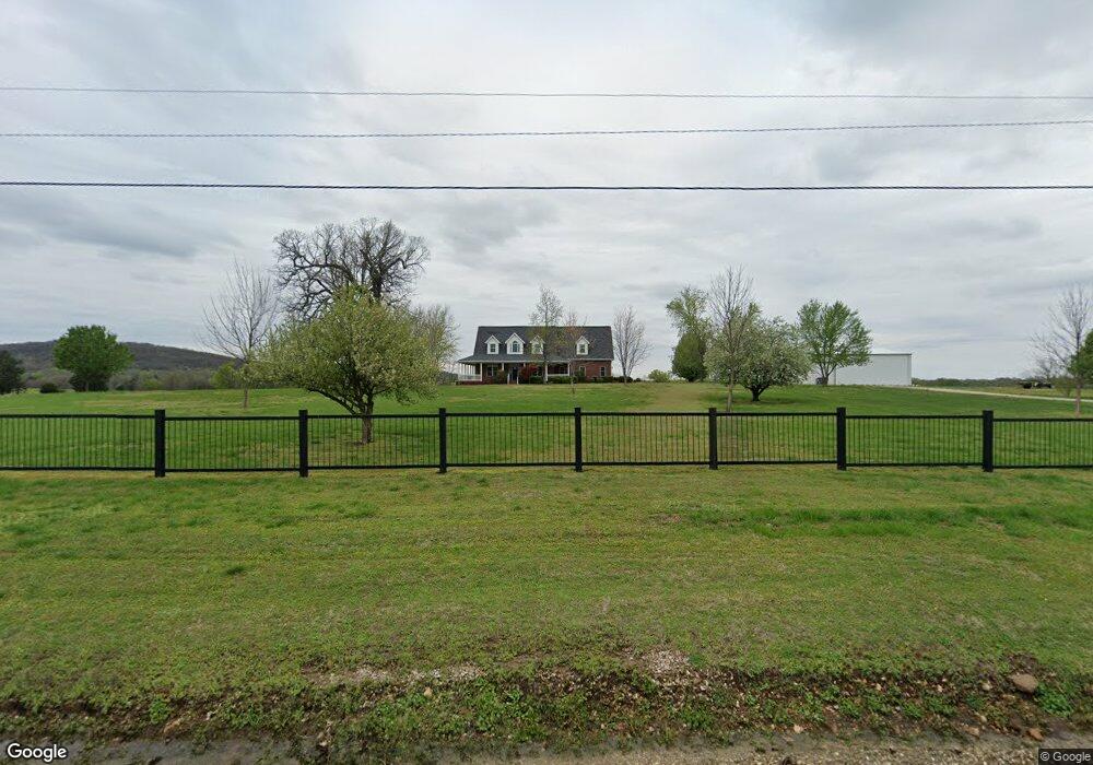
15708 Bill Campbell Rd Prairie Grove, AR 72753
Estimated Value: $465,000
--
Bed
3
Baths
2,942
Sq Ft
$158/Sq Ft
Est. Value
About This Home
This home is located at 15708 Bill Campbell Rd, Prairie Grove, AR 72753 and is currently estimated at $465,000, approximately $158 per square foot. 15708 Bill Campbell Rd is a home located in Washington County with nearby schools including Prairie Grove Elementary School, Prairie Grove Middle School, and Prairie Grove Junior High School.
Ownership History
Date
Name
Owned For
Owner Type
Purchase Details
Closed on
Mar 17, 2023
Sold by
Campbell Stephen Boyd and Campbell Steven Boyd
Bought by
Shreve Family Trust and Shreve
Current Estimated Value
Purchase Details
Closed on
Aug 14, 1996
Bought by
Moore, Marvin C Trust
Purchase Details
Closed on
Jan 1, 1985
Bought by
Moore M C
Create a Home Valuation Report for This Property
The Home Valuation Report is an in-depth analysis detailing your home's value as well as a comparison with similar homes in the area
Home Values in the Area
Average Home Value in this Area
Purchase History
| Date | Buyer | Sale Price | Title Company |
|---|---|---|---|
| Shreve Family Trust | $407,000 | Waco Title | |
| Moore, Marvin C Trust | -- | -- | |
| Moore M C | -- | -- |
Source: Public Records
Tax History Compared to Growth
Tax History
| Year | Tax Paid | Tax Assessment Tax Assessment Total Assessment is a certain percentage of the fair market value that is determined by local assessors to be the total taxable value of land and additions on the property. | Land | Improvement |
|---|---|---|---|---|
| 2024 | $45 | $950 | $950 | $0 |
| 2023 | $47 | $950 | $950 | $0 |
| 2022 | $46 | $930 | $930 | $0 |
| 2021 | $46 | $930 | $930 | $0 |
| 2020 | $46 | $930 | $930 | $0 |
| 2019 | $42 | $850 | $850 | $0 |
| 2018 | $42 | $850 | $850 | $0 |
| 2017 | $42 | $850 | $850 | $0 |
| 2016 | $42 | $850 | $850 | $0 |
| 2015 | $39 | $850 | $850 | $0 |
| 2014 | $36 | $730 | $730 | $0 |
Source: Public Records
Map
Nearby Homes
- 0 Applehill Tract 4 Rd Unit 4 1315344
- 15944 Bill Campbell Rd
- 301 Hindman Dr
- 0 S Industrial Park Rd
- 606 Hindman Dr
- 816 Custer St
- 813 Grant Ave
- 815 Custer St
- 11561 Old Apple Hill Rd
- 16453 Stonewall Rd
- 16256 W Highway 62
- 402 Maya St
- 805 Sedgwick Dr
- 422 Maya St
- 1021 Vista Ave
- 581 Crystal Dr
- DENTON Plan at Hudson Heights
- GARLAND Plan at Hudson Heights
- EUREKA Plan at Hudson Heights
- DEAN Plan at Hudson Heights
- 15730 Bill Campbell Rd
- 15606 Bill Campbell Rd
- 15649 W Highway 62
- 15633 W Highway 62
- 15633 W Highway 62
- 15671 W Highway 62
- 15768 Highway 62
- 15770 W Highway 62
- 0 Apple Hill (Co Rd 288) Rd Unit 631192
- 0 Apple Hill (Co Rd 288) Rd Unit 631201
- 0 E Applehill Rd Unit 707971
- 0 E Applehill Rd Unit 734364
- 15709 W Highway 62
- 11059 E Applehill Rd
- 1129 W Buchanan St
- 15757 W Highway 62
- 15596 Bill Campbell Rd
- 1125 W Buchanan St
- 11065 E Applehill Rd
- 15840 Bill Campbell Rd