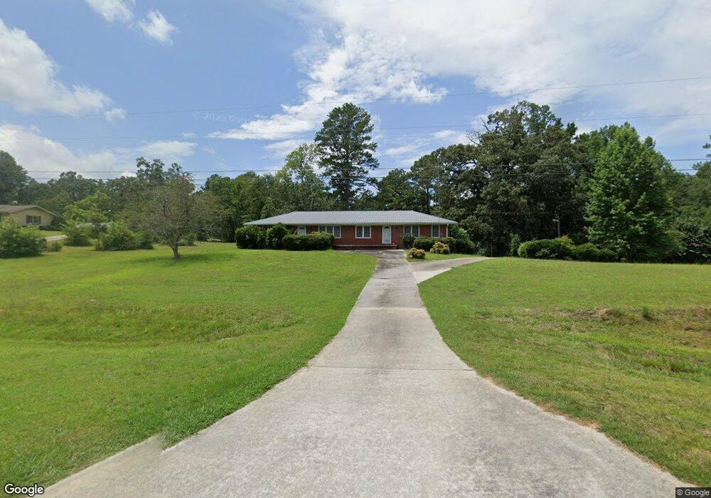
1571 Brewers Bridge Rd Elberton, GA 30635
Estimated Value: $199,000 - $298,000
--
Bed
2
Baths
1,950
Sq Ft
$134/Sq Ft
Est. Value
About This Home
This home is located at 1571 Brewers Bridge Rd, Elberton, GA 30635 and is currently estimated at $261,946, approximately $134 per square foot. 1571 Brewers Bridge Rd is a home located in Elbert County with nearby schools including Elbert County Primary School, Elbert County Elementary School, and Elbert County Middle School.
Ownership History
Date
Name
Owned For
Owner Type
Purchase Details
Closed on
Dec 6, 2011
Sold by
Wade Debra G
Bought by
Colvard Joe and Colvard Merrie
Current Estimated Value
Purchase Details
Closed on
Apr 7, 2006
Sold by
Wade Debra G
Bought by
Wade Richard R
Purchase Details
Closed on
Jun 15, 2001
Sold by
Colvard Betty Jo and Colvard Sherald J
Bought by
Wade Richard R and Wade Debra G
Purchase Details
Closed on
Jan 1, 1991
Purchase Details
Closed on
Mar 1, 1987
Create a Home Valuation Report for This Property
The Home Valuation Report is an in-depth analysis detailing your home's value as well as a comparison with similar homes in the area
Home Values in the Area
Average Home Value in this Area
Purchase History
| Date | Buyer | Sale Price | Title Company |
|---|---|---|---|
| Colvard Joe | $46,700 | -- | |
| Wade Richard R | -- | -- | |
| Wade Richard R | $103,000 | -- | |
| -- | -- | -- | |
| -- | -- | -- |
Source: Public Records
Tax History Compared to Growth
Tax History
| Year | Tax Paid | Tax Assessment Tax Assessment Total Assessment is a certain percentage of the fair market value that is determined by local assessors to be the total taxable value of land and additions on the property. | Land | Improvement |
|---|---|---|---|---|
| 2024 | $2,193 | $91,475 | $11,855 | $79,620 |
| 2023 | $2,193 | $91,475 | $11,855 | $79,620 |
| 2022 | $1,401 | $58,445 | $7,057 | $51,388 |
| 2021 | $1,403 | $58,445 | $7,057 | $51,388 |
| 2020 | $1,165 | $42,861 | $5,645 | $37,216 |
| 2019 | $1,210 | $42,861 | $5,645 | $37,216 |
| 2018 | $1,247 | $42,861 | $5,645 | $37,216 |
| 2017 | $1,241 | $39,501 | $5,645 | $33,856 |
| 2016 | $1,159 | $39,501 | $5,645 | $33,856 |
| 2015 | -- | $39,501 | $5,645 | $33,856 |
| 2014 | -- | $39,501 | $5,645 | $33,856 |
| 2013 | -- | $39,501 | $5,645 | $33,856 |
Source: Public Records
Map
Nearby Homes
- 0 Allen Logan Rd Unit 22671131
- 1315 Pine Hill Dr
- 1133 Kathwood Dr
- 1102 Williams Ln
- 1 Powerhouse Dr
- 0 Sara Jane Dr Unit 10501253
- 0 Harmony Rd Unit 18771344
- 15 Emmaus Dr
- 5 Emmaus Dr
- 2 Emmaus Dr
- 20 Emmaus Dr
- 14 Emmaus Dr
- 21 Emmaus Dr
- 19 Emmaus Dr
- 11 Emmaus Dr
- 4 Emmaus Dr
- 8 Emmaus Dr
- 16 Emmaus Dr
- 1020 Hickory Dr
- 2023 Stephens Rd
- 1425 Hartwell Hwy
- 1437 Hartwell Hwy
- 1560 Brewers Bridge Rd
- 1421 Hartwell Hwy
- 1426 Hartwell Hwy
- 1565 Brewers Bridge Rd
- 1577 Brewers Bridge Rd
- 1585 Brewers Bridge Rd
- 1535 Brewers Bridge Rd
- 1537 Brewers Bridge Rd
- 1531 Brewers Bridge Rd
- 00 Anderson Hwy
- 1483 Hartwell Hwy
- 1503 Brewers Bridge Rd
- 1387 Hartwell Hwy
- 1432 Hartwell Hwy
- 1484 Hartwell Hwy
- 1499 Brewers Bridge Rd
- 1494 Hartwell Hwy
- 1640 Anderson Hwy