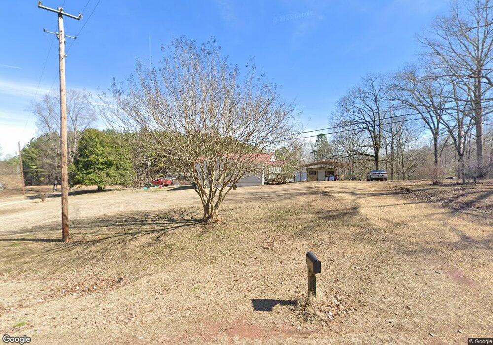
1571 Cordova Gorgas Rd Cordova, AL 35550
Estimated Value: $92,000 - $194,000
--
Bed
--
Bath
1,792
Sq Ft
$69/Sq Ft
Est. Value
About This Home
This home is located at 1571 Cordova Gorgas Rd, Cordova, AL 35550 and is currently estimated at $123,074, approximately $68 per square foot. 1571 Cordova Gorgas Rd is a home located in Walker County.
Ownership History
Date
Name
Owned For
Owner Type
Purchase Details
Closed on
Jan 25, 2021
Sold by
Chandler Linda Jacks and Chandler Donald M
Bought by
Chandler Linda Jacks and Chandler Donald M
Current Estimated Value
Purchase Details
Closed on
Jan 6, 2021
Sold by
Franklin Donna Chandler and Franklin Johnny Wayne
Bought by
Chandler Linda Jacks and Chandler Donald M
Purchase Details
Closed on
Jun 25, 2019
Sold by
Jacks Chandler Linda and Chandler Donald Morris
Bought by
Franklin Donna Chandler and Franklin Johnny Wayne
Purchase Details
Closed on
Mar 20, 2019
Sold by
Chandler Linda Jacks
Bought by
Chandler Linda Jacks and Chandler Donald Morris
Create a Home Valuation Report for This Property
The Home Valuation Report is an in-depth analysis detailing your home's value as well as a comparison with similar homes in the area
Home Values in the Area
Average Home Value in this Area
Purchase History
| Date | Buyer | Sale Price | Title Company |
|---|---|---|---|
| Chandler Linda Jacks | $50,000 | None Available | |
| Chandler Linda Jacks | $500 | None Available | |
| Franklin Donna Chandler | -- | None Available | |
| Chandler Linda Jacks | -- | None Available |
Source: Public Records
Tax History Compared to Growth
Tax History
| Year | Tax Paid | Tax Assessment Tax Assessment Total Assessment is a certain percentage of the fair market value that is determined by local assessors to be the total taxable value of land and additions on the property. | Land | Improvement |
|---|---|---|---|---|
| 2024 | $223 | $7,770 | $800 | $6,970 |
| 2023 | $198 | $7,770 | $800 | $6,970 |
| 2022 | $184 | $7,170 | $650 | $6,520 |
| 2021 | $167 | $6,530 | $650 | $5,880 |
| 2020 | $167 | $6,560 | $660 | $5,900 |
| 2019 | $141 | $7,240 | $820 | $6,420 |
| 2018 | $108 | $5,980 | $800 | $5,180 |
| 2017 | $108 | $5,980 | $800 | $5,180 |
| 2016 | $108 | $5,980 | $800 | $5,180 |
| 2015 | $108 | $5,980 | $800 | $5,180 |
| 2014 | $104 | $5,800 | $720 | $5,080 |
| 2013 | $91 | $5,300 | $720 | $4,580 |
Source: Public Records
Map
Nearby Homes
- 0 Columbus Blvd
- 444 Mound Ave
- 00 Mt View Rd
- 77 Ridge St
- 68 Buttercup Ln
- 0 Old Parrish Cordova Rd
- 2144 Old Parrish Cordova Rd
- 0 Gardners Gin Rd Unit 21399626
- 189 Vining Rd
- 0 Treece Rd
- 76 Skeeter Creek Rd
- 0 Rivers Edge Trail
- 0 Rivers Edge Trail Unit 1,2,3,5
- 1509 Old Kirkpatrick Rd
- 515 River Dr
- 646 Commerce Ave
- 0 Hidden Hollow Rd Unit 21417940
- 364 Coal Creek Rd
- 95 Jones Loop
- 0 Hatfield Trail Unit 24-1144
- 1527 Cordova Gorgas Rd
- 1604 Cordova Gorgas Rd
- 63 Autrey Reed Rd
- 1663 Cordova Gorgas Rd
- 1465 Cordova Gorgas Rd
- 1465 Cordova Gorgas Rd
- 1480 Cordova Gorgas Rd
- 1708 Cordova Gorgas Rd
- 69 Hugh Hyche Rd
- 1450 Cordova Gorgas Rd
- 1426 Cordova Gorgas Rd
- 000 Autrey Reed Rd
- 90 Hugh Hyche Rd
- 139 Hugh Hyche Rd
- 107 Autrey Reed Rd
- 1720 Cordova Gorgas Rd
- 1720 Cordova Gorgas Rd
- 1720 Cordova Gorgas Rd
- 261 Hugh Hyche Rd
- 258 Hugh Hyche Rd