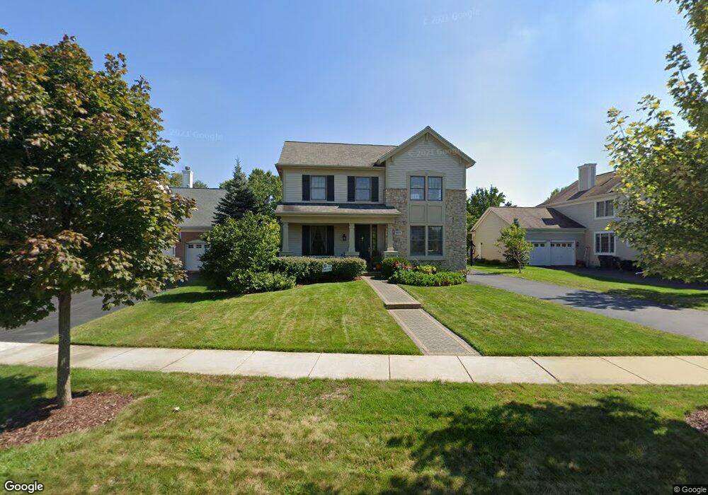
1571 Cottonwood Dr Unit 2 Glenview, IL 60026
The Glen NeighborhoodEstimated Value: $1,293,000 - $1,432,000
4
Beds
3
Baths
3,435
Sq Ft
$404/Sq Ft
Est. Value
About This Home
This home is located at 1571 Cottonwood Dr Unit 2, Glenview, IL 60026 and is currently estimated at $1,389,243, approximately $404 per square foot. 1571 Cottonwood Dr Unit 2 is a home located in Cook County with nearby schools including Westbrook Elementary School, Glen Grove Elementary School, and Attea Middle School.
Ownership History
Date
Name
Owned For
Owner Type
Purchase Details
Closed on
Oct 1, 2002
Sold by
Concord At The Glen Llc
Bought by
Herman Howard L and Herman Susan M
Current Estimated Value
Home Financials for this Owner
Home Financials are based on the most recent Mortgage that was taken out on this home.
Original Mortgage
$400,000
Outstanding Balance
$167,329
Interest Rate
6.13%
Estimated Equity
$1,221,914
Create a Home Valuation Report for This Property
The Home Valuation Report is an in-depth analysis detailing your home's value as well as a comparison with similar homes in the area
Home Values in the Area
Average Home Value in this Area
Purchase History
| Date | Buyer | Sale Price | Title Company |
|---|---|---|---|
| Herman Howard L | $706,500 | Chicago Title Insurance Co |
Source: Public Records
Mortgage History
| Date | Status | Borrower | Loan Amount |
|---|---|---|---|
| Open | Herman Howard L | $400,000 |
Source: Public Records
Tax History Compared to Growth
Tax History
| Year | Tax Paid | Tax Assessment Tax Assessment Total Assessment is a certain percentage of the fair market value that is determined by local assessors to be the total taxable value of land and additions on the property. | Land | Improvement |
|---|---|---|---|---|
| 2024 | $20,491 | $95,895 | $22,455 | $73,440 |
| 2023 | $20,774 | $95,895 | $22,455 | $73,440 |
| 2022 | $20,774 | $100,000 | $22,455 | $77,545 |
| 2021 | $20,399 | $85,288 | $10,778 | $74,510 |
| 2020 | $20,213 | $85,288 | $10,778 | $74,510 |
| 2019 | $18,834 | $93,724 | $10,778 | $82,946 |
| 2018 | $18,923 | $85,713 | $9,431 | $76,282 |
| 2017 | $18,432 | $85,713 | $9,431 | $76,282 |
| 2016 | $17,603 | $85,713 | $9,431 | $76,282 |
| 2015 | $16,596 | $72,316 | $7,634 | $64,682 |
| 2014 | $16,305 | $72,316 | $7,634 | $64,682 |
| 2013 | $15,794 | $72,316 | $7,634 | $64,682 |
Source: Public Records
Map
Nearby Homes
- 2156 Rugen Rd Unit A
- 1619 Patriot Blvd
- 1900 E Lake Ave
- 1735 Patriot Blvd
- 1341 Greenwillow Ln Unit C
- 2121 Fir St
- 2000 Chestnut Ave Unit 103
- 2701 Commons Dr Unit 210
- 1342 Pine St
- 1891 Admiral Ct Unit 79
- 1220 Depot St Unit 305
- 1220 Depot St Unit 109
- 1220 Depot St Unit 409
- 1867 Admiral Ct Unit 91
- 1088 Shermer Rd Unit DW
- 2750 Langley Cir Unit 203013
- 1557 Cottonwood Dr
- 1585 Cottonwood Dr
- 1543 Cottonwood Dr
- 1570 Bluestem Ln
- 1599 Cottonwood Dr
- 1556 Bluestem Ln
- 1584 Bluestem Ln
- 1542 Bluestem Ln
- 2254 Timothy Dr Unit 2
- 1598 Cottonwood Dr
- 1529 Cottonwood Dr
- 1598 Bluestem Ln
- 1528 Bluestem Ln
- 2255 Thistle Rd
- 3117 Cottonwood Ln N
- 3117 Cottonwood Dr N
- 2277 Thistle Rd
- 1515 Cottonwood Dr
- 2223 Thistle Rd
- 2276 Timothy Dr