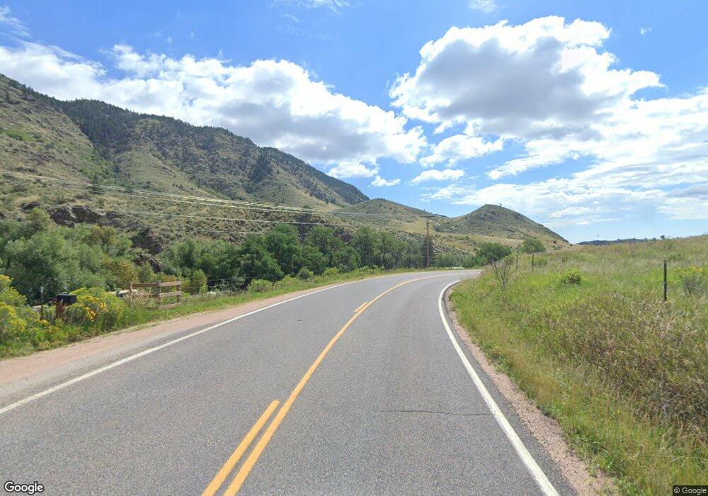
15719 Buckhorn Rd Bellvue, CO 80512
Estimated Value: $305,000 - $370,000
3
Beds
1
Bath
1,324
Sq Ft
$259/Sq Ft
Est. Value
About This Home
This home is located at 15719 Buckhorn Rd, Bellvue, CO 80512 and is currently estimated at $343,224, approximately $259 per square foot. 15719 Buckhorn Rd is a home located in Larimer County with nearby schools including Stove Prairie Elementary School, Cache La Poudre Middle School, and Poudre High School.
Ownership History
Date
Name
Owned For
Owner Type
Purchase Details
Closed on
Sep 1, 2023
Sold by
Clay Gary A
Bought by
Scot M And Joyce H Sedlacek Trust
Current Estimated Value
Purchase Details
Closed on
Jul 23, 2007
Sold by
Hopper Merwyn D and Hopper Cheryl J
Bought by
Hopper Merwyn D
Home Financials for this Owner
Home Financials are based on the most recent Mortgage that was taken out on this home.
Original Mortgage
$158,650
Interest Rate
6.69%
Mortgage Type
New Conventional
Purchase Details
Closed on
Aug 10, 2000
Sold by
Fulbright Elda Jo
Bought by
Anderson Scott A
Home Financials for this Owner
Home Financials are based on the most recent Mortgage that was taken out on this home.
Original Mortgage
$76,312
Interest Rate
8.22%
Purchase Details
Closed on
May 1, 1991
Bought by
Hopper Merwyn D and Hopper Cheryl J
Create a Home Valuation Report for This Property
The Home Valuation Report is an in-depth analysis detailing your home's value as well as a comparison with similar homes in the area
Home Values in the Area
Average Home Value in this Area
Purchase History
| Date | Buyer | Sale Price | Title Company |
|---|---|---|---|
| Scot M And Joyce H Sedlacek Trust | $349,000 | First American Title | |
| Hopper Merwyn D | -- | North American Title | |
| Anderson Scott A | $160,000 | -- | |
| Hopper Merwyn D | $102,500 | -- |
Source: Public Records
Mortgage History
| Date | Status | Borrower | Loan Amount |
|---|---|---|---|
| Previous Owner | Hopper Merwyn D | $158,650 | |
| Previous Owner | Anderson Scott A | $76,312 |
Source: Public Records
Tax History Compared to Growth
Tax History
| Year | Tax Paid | Tax Assessment Tax Assessment Total Assessment is a certain percentage of the fair market value that is determined by local assessors to be the total taxable value of land and additions on the property. | Land | Improvement |
|---|---|---|---|---|
| 2025 | $4,781 | $69,192 | $68,355 | $837 |
| 2024 | $852 | $16,536 | $16,415 | $121 |
| 2022 | $383 | $5,567 | $5,477 | $90 |
| 2021 | $394 | $5,727 | $5,634 | $93 |
| 2020 | $1,320 | $19,183 | $10,010 | $9,173 |
| 2019 | $1,465 | $21,715 | $10,010 | $11,705 |
| 2018 | $936 | $20,268 | $11,880 | $8,388 |
| 2017 | $786 | $20,268 | $11,880 | $8,388 |
| 2016 | $448 | $14,304 | $9,313 | $4,991 |
| 2015 | $444 | $14,300 | $9,310 | $4,990 |
| 2014 | $420 | $13,010 | $7,640 | $5,370 |
Source: Public Records
Map
Nearby Homes
- 192 Moondance Way
- 0 Tip Top Rd
- 439 Redtail Ridge Way
- 552 Blue Grouse Ln
- 0 Cougar Dr Unit 1048067
- 0 W County Road 44h Unit 1040235
- 9200 Old Flowers Rd
- 752 Willow Patch Ln
- 520 Isaac Ln
- 529 Quartz Rd
- 3235 Davis Ranch Rd
- 3434 Davis Ranch Rd
- 0 Tbd Old Flowers Rd
- 4119 Davis Ranch Rd
- 0 Davis Ranch Rd Unit 1048176
- 865 Redstone Dr
- 1025 Crystal Mountain Rd
- 27667 Buckhorn Rd
- 3805 Davis Ranch Rd
- 14500 Buckhorn Rd
- 58 Deer Path St
- 108 Deer Path St
- 20941 Buckhorn Rd
- 107 Deer Path St
- 0 Deer Path Unit 870723
- 0 Deer Path Unit 579989
- 0 Deer Path Unit 580384
- 0 Deer Path Unit 581061
- 0 Deer Path Unit 672373
- 0 Deer Path Unit 678161
- 20937 Buckhorn Rd
- 0 Deer Path St
- 21509 Buckhorn Rd
- 295 Deer Path St
- 21520 Buckhorn Rd
- 12 Snow Drop Ln
- 21 Snow Drop Ln
- 21 Snow Drop Ln
- 417 Wildsong Rd
- 417 Wildsong Rd
