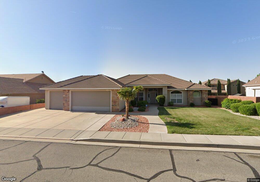
1572 E 10 S Saint George, UT 84790
Estimated Value: $564,477 - $717,000
4
Beds
3
Baths
2,296
Sq Ft
$274/Sq Ft
Est. Value
About This Home
This home is located at 1572 E 10 S, Saint George, UT 84790 and is currently estimated at $629,619, approximately $274 per square foot. 1572 E 10 S is a home located in Washington County with nearby schools including Heritage School, Dixie Middle School, and Tonaquint Intermediate School.
Ownership History
Date
Name
Owned For
Owner Type
Purchase Details
Closed on
Oct 31, 2016
Sold by
Winget Paul J and Winget Jenny A
Bought by
Winget Paul J and Winget Jennifer A
Current Estimated Value
Purchase Details
Closed on
Jan 31, 2014
Sold by
Clawson Chere
Bought by
Winget Paul J and Winget Jenny A
Purchase Details
Closed on
Mar 8, 2011
Sold by
The Bank Of New York Mellon
Bought by
Clawson Chere
Purchase Details
Closed on
Jan 14, 2011
Sold by
Pesce Gail and Ogborn Martha Jo
Bought by
The Bank Of New York Mellon and The Bank Of New York
Purchase Details
Closed on
Aug 5, 2005
Sold by
Huddleston Robert C and Huddleston Linda Gene
Bought by
Pesce3 Gail and Ogborn Martha Jo
Home Financials for this Owner
Home Financials are based on the most recent Mortgage that was taken out on this home.
Original Mortgage
$291,920
Interest Rate
4.25%
Mortgage Type
Adjustable Rate Mortgage/ARM
Create a Home Valuation Report for This Property
The Home Valuation Report is an in-depth analysis detailing your home's value as well as a comparison with similar homes in the area
Purchase History
| Date | Buyer | Sale Price | Title Company |
|---|---|---|---|
| Winget Paul J | -- | None Available | |
| Winget Paul J | -- | First American Title Co Llc | |
| Clawson Chere | -- | First American Union Heights | |
| The Bank Of New York Mellon | $339,263 | None Available | |
| Pesce3 Gail | -- | Southern Utah Title Co |
Source: Public Records
Mortgage History
| Date | Status | Borrower | Loan Amount |
|---|---|---|---|
| Previous Owner | Pesce3 Gail | $291,920 |
Source: Public Records
Tax History
| Year | Tax Paid | Tax Assessment Tax Assessment Total Assessment is a certain percentage of the fair market value that is determined by local assessors to be the total taxable value of land and additions on the property. | Land | Improvement |
|---|---|---|---|---|
| 2025 | $2,187 | $327,250 | $110,000 | $217,250 |
| 2023 | $2,095 | $313,005 | $110,000 | $203,005 |
| 2022 | $2,231 | $313,445 | $110,000 | $203,445 |
| 2021 | $1,867 | $391,200 | $110,000 | $281,200 |
| 2020 | $1,742 | $343,700 | $110,000 | $233,700 |
| 2019 | $1,777 | $342,600 | $110,000 | $232,600 |
| 2018 | $1,677 | $162,030 | $0 | $0 |
| 2017 | $1,567 | $151,470 | $0 | $0 |
| 2016 | $1,580 | $141,240 | $0 | $0 |
| 2015 | $1,630 | $139,810 | $0 | $0 |
| 2014 | $1,590 | $137,170 | $0 | $0 |
Source: Public Records
Map
Nearby Homes
- 149 N Eastridge Dr
- 1646 E 90 Cir S
- 245 Red Cliffs Dr Unit 209
- 245 Red Cliffs Dr Unit 113
- 86 S Acantilado Dr
- 1684 E 290 S
- 145 N Mall Dr Unit 57
- 145 N Mall Dr Unit 35
- 5394 S Aquamarine Ln
- 5409 S Aquamarine Ln
- 5398 S Aquamarine Ln
- 1226 W Cactus Wren Dr
- 5416 S Aquamarine Ln
- 0 Null Unit 26-269072
- 232 S Acantilado Cir
- 301 S 1200 E Unit 47
- 301 S 1200 E Unit 16
- 301 S 1200 E Unit 52
- 210 N Mall Dr Unit 115
- 210 N Mall Dr Unit 64
Your Personal Tour Guide
Ask me questions while you tour the home.