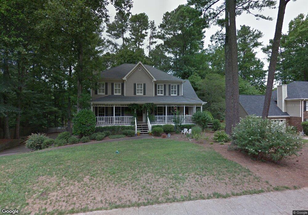
1572 Sandpoint Dr NE Unit 2 Roswell, GA 30075
East Cobb NeighborhoodEstimated Value: $661,000 - $750,000
4
Beds
3
Baths
2,676
Sq Ft
$261/Sq Ft
Est. Value
About This Home
This home is located at 1572 Sandpoint Dr NE Unit 2, Roswell, GA 30075 and is currently estimated at $698,013, approximately $260 per square foot. 1572 Sandpoint Dr NE Unit 2 is a home located in Cobb County with nearby schools including Tritt Elementary School, Hightower Trail Middle School, and Pope High School.
Ownership History
Date
Name
Owned For
Owner Type
Purchase Details
Closed on
Aug 3, 2006
Sold by
Homebuilders William and Homebuilders Forbes
Bought by
Brookshire Amy E and Fagg Paul
Current Estimated Value
Home Financials for this Owner
Home Financials are based on the most recent Mortgage that was taken out on this home.
Original Mortgage
$294,000
Outstanding Balance
$175,311
Interest Rate
6.73%
Mortgage Type
New Conventional
Estimated Equity
$522,702
Purchase Details
Closed on
Mar 14, 2006
Sold by
Forbes Susan W
Bought by
Forbes Wilson and Forbes Homebuilders L
Purchase Details
Closed on
Aug 15, 1995
Sold by
Connor Marietta D
Bought by
Velez Rafael E Vernice
Create a Home Valuation Report for This Property
The Home Valuation Report is an in-depth analysis detailing your home's value as well as a comparison with similar homes in the area
Home Values in the Area
Average Home Value in this Area
Purchase History
| Date | Buyer | Sale Price | Title Company |
|---|---|---|---|
| Brookshire Amy E | $367,500 | -- | |
| Forbes Wilson | -- | -- | |
| Forbes Susan W | $255,000 | -- | |
| Velez Rafael E Vernice | $186,400 | -- |
Source: Public Records
Mortgage History
| Date | Status | Borrower | Loan Amount |
|---|---|---|---|
| Open | Brookshire Amy E | $294,000 |
Source: Public Records
Tax History Compared to Growth
Tax History
| Year | Tax Paid | Tax Assessment Tax Assessment Total Assessment is a certain percentage of the fair market value that is determined by local assessors to be the total taxable value of land and additions on the property. | Land | Improvement |
|---|---|---|---|---|
| 2025 | $6,476 | $268,604 | $80,000 | $188,604 |
| 2024 | $6,024 | $247,496 | $64,000 | $183,496 |
| 2023 | $4,193 | $188,092 | $42,000 | $146,092 |
| 2022 | $4,771 | $188,092 | $42,000 | $146,092 |
| 2021 | $4,130 | $158,820 | $40,000 | $118,820 |
| 2020 | $4,130 | $158,820 | $40,000 | $118,820 |
| 2019 | $3,996 | $152,688 | $34,400 | $118,288 |
| 2018 | $3,996 | $152,688 | $34,400 | $118,288 |
| 2017 | $3,091 | $118,536 | $36,400 | $82,136 |
| 2016 | $3,093 | $118,536 | $36,400 | $82,136 |
| 2015 | $2,968 | $109,588 | $32,000 | $77,588 |
| 2014 | $2,993 | $109,588 | $0 | $0 |
Source: Public Records
Map
Nearby Homes
- 2661 Sandpoint Way NE
- 2482 N Forest Dr
- 2696 Long Lake Terrace NE
- 2779 Horseshoe Knoll Ln NE
- 5108 Nicolet Ct
- 2655 Boulder Creek Dr NE
- 110 Boulder Dr
- 2743 Chimney Springs Dr
- 2859 Tynewick Dr NE
- 2990 Mountain Trace NE
- 2212 Heritage Trace View
- 2281 Fox Hound Pkwy
- 4586 Hunting Hound Ln
- 3025 Creek Ct NE
- 2255 Rushmore Dr
- 2269 Chimney Springs Dr
- 1570 Sandpoint Dr NE
- 1574 Sandpoint Dr NE
- 1503 Stonebrook Place NE
- 1568 Sandpoint Dr NE
- 1563 Sandpoint Dr NE
- 0 Sandpoint Dr Unit 7189580
- 1565 Sandpoint Dr NE
- 5058 Spring Rock Terrace NE Unit 2
- 5056 Spring Rock Terrace NE
- 1500 Stonebrook Place NE
- 1576 Sandpoint Dr NE
- 1567 Sandpoint Dr NE
- 1505 Stonebrook Place NE
- 1561 Sandpoint Dr NE
- 5054 Spring Rock Terrace NE Unit 2
- 1578 Sandpoint Dr NE
- 1569 Sandpoint Dr NE Unit 2
- 1502 Stonebrook Place NE
- 1584 Sandpoint Dr NE
- 1559 Sandpoint Dr NE