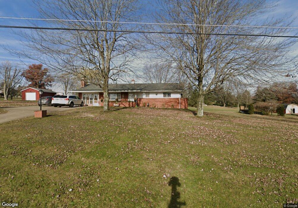
1572 State Route 1025 New Bethlehem, PA 16242
Estimated Value: $107,000 - $169,000
3
Beds
2
Baths
2,048
Sq Ft
$63/Sq Ft
Est. Value
About This Home
This home is located at 1572 State Route 1025, New Bethlehem, PA 16242 and is currently estimated at $129,771, approximately $63 per square foot. 1572 State Route 1025 is a home located in Armstrong County with nearby schools including Redbank Valley Primary School, Redbank Valley Intermediate School, and Redbank Valley High School.
Ownership History
Date
Name
Owned For
Owner Type
Purchase Details
Closed on
Nov 27, 2007
Sold by
Rebola James I and Rebola Becky Ann
Bought by
Truitt Heather L and Truitt Brian S
Current Estimated Value
Home Financials for this Owner
Home Financials are based on the most recent Mortgage that was taken out on this home.
Original Mortgage
$124,000
Outstanding Balance
$78,487
Interest Rate
6.3%
Mortgage Type
New Conventional
Estimated Equity
$51,284
Create a Home Valuation Report for This Property
The Home Valuation Report is an in-depth analysis detailing your home's value as well as a comparison with similar homes in the area
Home Values in the Area
Average Home Value in this Area
Purchase History
| Date | Buyer | Sale Price | Title Company |
|---|---|---|---|
| Truitt Heather L | $124,000 | None Available |
Source: Public Records
Mortgage History
| Date | Status | Borrower | Loan Amount |
|---|---|---|---|
| Open | Truitt Heather L | $124,000 |
Source: Public Records
Tax History Compared to Growth
Tax History
| Year | Tax Paid | Tax Assessment Tax Assessment Total Assessment is a certain percentage of the fair market value that is determined by local assessors to be the total taxable value of land and additions on the property. | Land | Improvement |
|---|---|---|---|---|
| 2025 | $2,455 | $36,140 | $19,960 | $16,180 |
| 2024 | $2,091 | $36,140 | $19,960 | $16,180 |
| 2023 | $1,570 | $36,140 | $19,960 | $16,180 |
| 2022 | $1,570 | $36,140 | $19,960 | $16,180 |
| 2021 | $1,477 | $36,140 | $19,960 | $16,180 |
| 2020 | $1,389 | $36,140 | $19,960 | $16,180 |
| 2019 | $1,353 | $36,140 | $19,960 | $16,180 |
| 2018 | $1,315 | $28,510 | $5,395 | $23,115 |
| 2017 | $1,269 | $36,140 | $19,960 | $16,180 |
| 2016 | $1,242 | $36,140 | $19,960 | $16,180 |
| 2015 | $979 | $36,140 | $19,960 | $16,180 |
| 2014 | $979 | $36,140 | $19,960 | $16,180 |
Source: Public Records
Map
Nearby Homes
- 115 Hillgale Dr
- 1578 State Route 1025
- 117 Hillgale Dr
- Lot 29 Hill Gale Dr
- 139 Hill Gale Dr
- 123 Hillgale Dr
- 104 Buckys Rd
- 1588 State Route 1025
- 131 Hillgale Dr
- 1583 State Route 1025
- 137 Hill Gale Dr
- 1596 State Route 1025
- 136 Hillgale Dr
- 1605 State Route 1025
- 138 Hillgale Dr
- 2122 Cemetery Ln
- 2101 Cemetery Ln
- 159 Pheasant Farm Rd
- 142 Hillgale Dr
- 1606 State Route 1025