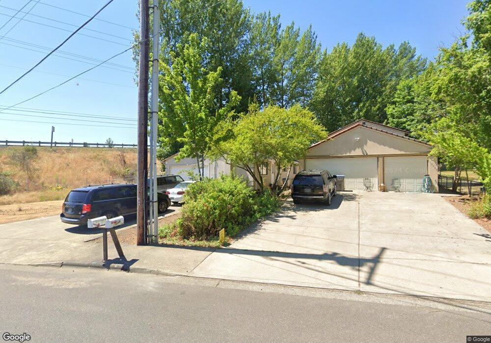
15720 NW Bronson Rd Beaverton, OR 97006
Estimated Value: $522,000 - $613,069
4
Beds
3
Baths
1,728
Sq Ft
$337/Sq Ft
Est. Value
About This Home
This home is located at 15720 NW Bronson Rd, Beaverton, OR 97006 and is currently estimated at $581,690, approximately $336 per square foot. 15720 NW Bronson Rd is a home located in Washington County with nearby schools including Oak Hills Elementary School, Sunset High School, and Agia Sophia Academy.
Ownership History
Date
Name
Owned For
Owner Type
Purchase Details
Closed on
May 24, 2004
Sold by
Lindstrand Richard and Lindstrand Kathy A
Bought by
Emmert Terry W
Current Estimated Value
Home Financials for this Owner
Home Financials are based on the most recent Mortgage that was taken out on this home.
Original Mortgage
$108,000
Outstanding Balance
$51,597
Interest Rate
5.77%
Mortgage Type
Stand Alone First
Estimated Equity
$530,093
Purchase Details
Closed on
Apr 7, 1995
Sold by
Drummond Mabel C
Bought by
Emmert Terry W
Home Financials for this Owner
Home Financials are based on the most recent Mortgage that was taken out on this home.
Original Mortgage
$15,000
Interest Rate
8.81%
Mortgage Type
Seller Take Back
Create a Home Valuation Report for This Property
The Home Valuation Report is an in-depth analysis detailing your home's value as well as a comparison with similar homes in the area
Home Values in the Area
Average Home Value in this Area
Purchase History
| Date | Buyer | Sale Price | Title Company |
|---|---|---|---|
| Emmert Terry W | $157,000 | Pacific Nw Title | |
| Emmert Terry W | $30,000 | Stewart Title Company |
Source: Public Records
Mortgage History
| Date | Status | Borrower | Loan Amount |
|---|---|---|---|
| Open | Emmert Terry W | $108,000 | |
| Previous Owner | Emmert Terry W | $15,000 |
Source: Public Records
Tax History Compared to Growth
Tax History
| Year | Tax Paid | Tax Assessment Tax Assessment Total Assessment is a certain percentage of the fair market value that is determined by local assessors to be the total taxable value of land and additions on the property. | Land | Improvement |
|---|---|---|---|---|
| 2025 | -- | -- | -- | -- |
| 2024 | $5,077 | $233,250 | -- | -- |
| 2023 | $5,077 | $240,240 | $0 | $0 |
| 2022 | $4,859 | $240,240 | $0 | $0 |
| 2021 | $4,689 | $226,460 | $0 | $0 |
| 2020 | $4,547 | $219,870 | $0 | $0 |
| 2019 | $4,403 | $213,470 | $0 | $0 |
| 2018 | $4,262 | $207,260 | $0 | $0 |
| 2017 | $4,103 | $201,230 | $0 | $0 |
| 2016 | $3,960 | $195,370 | $0 | $0 |
| 2015 | $3,813 | $189,680 | $0 | $0 |
| 2014 | $3,732 | $184,160 | $0 | $0 |
Source: Public Records
Map
Nearby Homes
- 16185 NW Ashfield Dr
- 16223 NW Ashfield Dr
- 15705 NW Barkton St
- 15867 NW Lyndel Ln
- 15125 NW Oakmont Loop
- 16590 NW Avondale Dr
- 2474 NW 168th Place
- 16056 NW Telshire Dr
- 16231 NW Ramona Dr
- 16289 NW Mission Oaks Dr
- 705 NW Silverado Dr
- 16800 NW Paddington Dr
- 2453 NW Rogue Valley Terrace
- 2525 NW Rogue Valley Terrace
- 16170 NW Donin Ct
- 16254 NW Joscelyn St
- 3053 NW Norwalk Place
- 16859 NW Joscelyn St
- 1192 NW 174th Place
- 1771 NW 143rd Ave Unit 40
- 15714 NW Bronson Rd
- 15800 NW Bronson Rd
- 15784 NW Overton Dr
- 15760 NW Overton Dr
- 15785 NW Overton Dr
- 15751 NW Overton Dr
- 15740 NW Overton Dr
- 15725 NW Overton Dr
- 15712 NW Overton Dr
- 15715 NW Overton Dr
- 15687 NW Overton Dr
- 15680 NW Overton Dr
- 15705 NW Overton Dr
- 15772 NW Sunningdale Dr
- 15665 NW Overton Dr
- 15695 NW Overton Dr
- 15738 NW Sunningdale Dr
- 15648 NW Overton Dr
- 2045 NW Bethany Blvd
- 15694 NW Sunningdale Dr