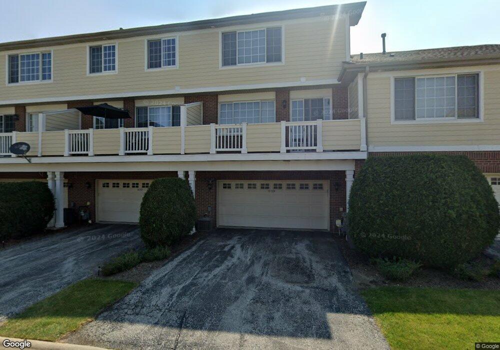
15727 Scotsglen Rd Orland Park, IL 60462
Centennial NeighborhoodEstimated Value: $349,000 - $368,062
3
Beds
3
Baths
1,817
Sq Ft
$198/Sq Ft
Est. Value
About This Home
This home is located at 15727 Scotsglen Rd, Orland Park, IL 60462 and is currently estimated at $359,766, approximately $198 per square foot. 15727 Scotsglen Rd is a home located in Cook County with nearby schools including Centennial School, Meadow Ridge School, and Century Junior High School.
Ownership History
Date
Name
Owned For
Owner Type
Purchase Details
Closed on
Oct 7, 2005
Sold by
Marquette Bank
Bought by
Navarro Richard F and Navarro Carrie L
Current Estimated Value
Home Financials for this Owner
Home Financials are based on the most recent Mortgage that was taken out on this home.
Original Mortgage
$229,788
Outstanding Balance
$125,155
Interest Rate
6.04%
Mortgage Type
Fannie Mae Freddie Mac
Estimated Equity
$234,611
Create a Home Valuation Report for This Property
The Home Valuation Report is an in-depth analysis detailing your home's value as well as a comparison with similar homes in the area
Home Values in the Area
Average Home Value in this Area
Purchase History
| Date | Buyer | Sale Price | Title Company |
|---|---|---|---|
| Navarro Richard F | $263,500 | Cti |
Source: Public Records
Mortgage History
| Date | Status | Borrower | Loan Amount |
|---|---|---|---|
| Open | Navarro Richard F | $229,788 |
Source: Public Records
Tax History Compared to Growth
Tax History
| Year | Tax Paid | Tax Assessment Tax Assessment Total Assessment is a certain percentage of the fair market value that is determined by local assessors to be the total taxable value of land and additions on the property. | Land | Improvement |
|---|---|---|---|---|
| 2024 | $6,928 | $31,000 | $1,041 | $29,959 |
| 2023 | $6,794 | $31,000 | $1,041 | $29,959 |
| 2022 | $6,794 | $26,101 | $1,527 | $24,574 |
| 2021 | $6,587 | $26,100 | $1,526 | $24,574 |
| 2020 | $6,404 | $26,100 | $1,526 | $24,574 |
| 2019 | $6,147 | $25,825 | $1,388 | $24,437 |
| 2018 | $5,977 | $25,825 | $1,388 | $24,437 |
| 2017 | $5,858 | $25,825 | $1,388 | $24,437 |
| 2016 | $5,496 | $22,194 | $1,249 | $20,945 |
| 2015 | $5,408 | $22,194 | $1,249 | $20,945 |
| 2014 | $5,343 | $22,194 | $1,249 | $20,945 |
| 2013 | $5,858 | $25,485 | $1,249 | $24,236 |
Source: Public Records
Map
Nearby Homes
- 10711 Gigi Dr
- 10701 Gabrielle Ln
- 10617 Owain Way
- 10587 W 154th Place
- 15373 Sheffield Square Pkwy
- 15212 Penrose Ct
- 15160 Penrose Ct
- 15125 Penrose Ct
- 15106 Penrose Ct
- 15245 Penrose Ct
- 10652 153rd Place
- 10855 W 153rd St
- 10300 W 159th St
- 16230 107th Ave
- 11045 Lizmore Ln
- 11049 Lizmore Ln Unit 40B
- 10330 Hilltop Dr
- 11155 Lizmore Ln Unit 35B
- 15640 113th Ave
- 16221 Kingsport Rd
- 15725 Scotsglen Rd
- 15729 Scotsglen Rd
- 15723 Scotsglen Rd
- 15731 Scotsglen Rd
- 10704 Gabrielle Ln
- 10702 Gabrielle Ln
- 10700 Gabrielle Ln Unit 1
- 10700 Gabrielle Ln
- 10717 Gigi Dr
- 10717 Gigi Dr Unit B
- 10713 Gigi Dr
- 10715 Gigi Dr
- 10715 Gigi Dr Unit 10715
- 10715 Gabrielle Ln
- 10715 Gabrielle Ln Unit 10715
- 10656 Gabrielle Ln
- 10717 Gabrielle Ln
- 10713 Gabrielle Ln
- 10705 Gigi Dr
- 10711 Gabrielle Ln