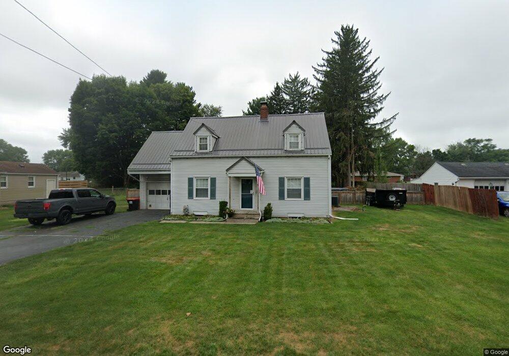
1573 N 21st St Newark, OH 43055
Estimated Value: $254,000 - $283,000
3
Beds
2
Baths
1,603
Sq Ft
$167/Sq Ft
Est. Value
About This Home
This home is located at 1573 N 21st St, Newark, OH 43055 and is currently estimated at $268,148, approximately $167 per square foot. 1573 N 21st St is a home located in Licking County with nearby schools including Legend Elementary School, Liberty Middle School, and Newark High School.
Ownership History
Date
Name
Owned For
Owner Type
Purchase Details
Closed on
Sep 25, 2007
Sold by
Swisher Jean B
Bought by
Biggerstaff Elisabeth J and Young Elisabeth J
Current Estimated Value
Home Financials for this Owner
Home Financials are based on the most recent Mortgage that was taken out on this home.
Original Mortgage
$94,587
Outstanding Balance
$60,434
Interest Rate
6.66%
Mortgage Type
FHA
Estimated Equity
$207,714
Purchase Details
Closed on
Sep 18, 2003
Sold by
Swisher Glenn E and Swisher Jean B
Bought by
Swisher Glenn E and Swisher Jean B
Create a Home Valuation Report for This Property
The Home Valuation Report is an in-depth analysis detailing your home's value as well as a comparison with similar homes in the area
Home Values in the Area
Average Home Value in this Area
Purchase History
| Date | Buyer | Sale Price | Title Company |
|---|---|---|---|
| Biggerstaff Elisabeth J | $96,000 | Kent Title | |
| Swisher Glenn E | -- | -- |
Source: Public Records
Mortgage History
| Date | Status | Borrower | Loan Amount |
|---|---|---|---|
| Open | Biggerstaff Elisabeth J | $94,587 |
Source: Public Records
Tax History Compared to Growth
Tax History
| Year | Tax Paid | Tax Assessment Tax Assessment Total Assessment is a certain percentage of the fair market value that is determined by local assessors to be the total taxable value of land and additions on the property. | Land | Improvement |
|---|---|---|---|---|
| 2024 | $2,581 | $66,750 | $20,020 | $46,730 |
| 2023 | $2,625 | $66,750 | $20,020 | $46,730 |
| 2022 | $2,298 | $52,580 | $11,310 | $41,270 |
| 2021 | $2,405 | $52,580 | $11,310 | $41,270 |
| 2020 | $2,454 | $52,580 | $11,310 | $41,270 |
| 2019 | $1,969 | $40,250 | $10,780 | $29,470 |
| 2018 | $1,960 | $0 | $0 | $0 |
| 2017 | $1,884 | $0 | $0 | $0 |
| 2016 | $1,695 | $0 | $0 | $0 |
| 2015 | $1,729 | $0 | $0 | $0 |
| 2014 | $2,199 | $0 | $0 | $0 |
| 2013 | $1,646 | $0 | $0 | $0 |
Source: Public Records
Map
Nearby Homes
- 139 Aqueduct Ave
- 106 Santa Anita Ave Unit 21A
- 336 Myrtle Ave
- 105 Pimlico Ave
- 47 Northpointe Ln Unit 47
- 1495 Kenarbre Dr
- 267 Goosepond Rd Unit A
- 1738 Scioto Way
- 261 Goosepond Rd Unit D
- 259 Goosepond Rd Unit C
- 1518 Constitution Ct
- 11 Waterworks Rd
- 1345 Sherwood Downs Rd W
- 505 Courtney Dr
- 1684 Churchill Downs Rd
- 988 Mount Vernon Rd
- 1644 Mt Vernon Rd
- 1831 Churchill Downs Rd
- 525 Meadowland Dr
- 437 Hunters Ct
- 1575 N 21st St
- 1571 N 21st St
- 112 Margaret St
- 108 Margaret St
- 1585 N 21st St
- 1569 N 21st St
- 247 Greenfield Ave
- 106 Margaret St
- 248 Greenfield Ave
- 109 Margaret St
- 111 Margaret St
- 1567 N 21st St
- 246 Greenfield Ave
- 1570 N 21st St
- 105 Margaret St
- 115 Margaret St
- 104 Margaret St
- 243 Greenfield Ave
- 1568 N 21st St
- 1590 N 21st St