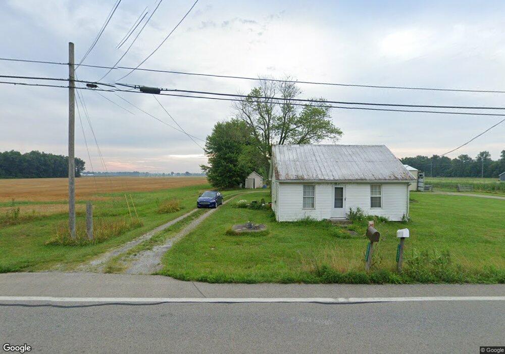
15732 Us Highway 68 Mount Orab, OH 45154
Estimated Value: $231,000 - $607,000
2
Beds
1
Bath
1,248
Sq Ft
$332/Sq Ft
Est. Value
About This Home
This home is located at 15732 Us Highway 68, Mount Orab, OH 45154 and is currently estimated at $414,233, approximately $331 per square foot. 15732 Us Highway 68 is a home located in Brown County with nearby schools including Western Brown High School.
Ownership History
Date
Name
Owned For
Owner Type
Purchase Details
Closed on
Jul 17, 2020
Sold by
Byrd Timothy L
Bought by
Klein Anthony E and Klein Kimberly A
Current Estimated Value
Home Financials for this Owner
Home Financials are based on the most recent Mortgage that was taken out on this home.
Original Mortgage
$267,750
Outstanding Balance
$237,423
Interest Rate
3.1%
Mortgage Type
Unknown
Estimated Equity
$176,810
Purchase Details
Closed on
Dec 28, 2015
Sold by
Lttm Llc
Bought by
Byrd Timothy L
Home Financials for this Owner
Home Financials are based on the most recent Mortgage that was taken out on this home.
Original Mortgage
$77,634
Interest Rate
3.96%
Mortgage Type
Commercial
Purchase Details
Closed on
Jun 15, 2012
Sold by
Davidson Roy and Davidson Eunice
Bought by
Byrd Larry C and Byrd Theresa L
Create a Home Valuation Report for This Property
The Home Valuation Report is an in-depth analysis detailing your home's value as well as a comparison with similar homes in the area
Home Values in the Area
Average Home Value in this Area
Purchase History
| Date | Buyer | Sale Price | Title Company |
|---|---|---|---|
| Klein Anthony E | $315,000 | Ivy Pointe Title Llc | |
| Byrd Timothy L | $76,000 | None Available | |
| Byrd Larry C | $96,000 | Attorney |
Source: Public Records
Mortgage History
| Date | Status | Borrower | Loan Amount |
|---|---|---|---|
| Open | Klein Anthony E | $267,750 | |
| Previous Owner | Byrd Timothy L | $77,634 |
Source: Public Records
Tax History Compared to Growth
Tax History
| Year | Tax Paid | Tax Assessment Tax Assessment Total Assessment is a certain percentage of the fair market value that is determined by local assessors to be the total taxable value of land and additions on the property. | Land | Improvement |
|---|---|---|---|---|
| 2024 | $4,181 | $145,600 | $68,260 | $77,340 |
| 2023 | $4,181 | $98,340 | $37,240 | $61,100 |
| 2022 | $3,020 | $98,340 | $37,240 | $61,100 |
| 2021 | $2,975 | $98,340 | $37,240 | $61,100 |
| 2020 | $2,670 | $85,500 | $32,380 | $53,120 |
| 2019 | $1,377 | $41,060 | $28,350 | $12,710 |
| 2018 | $1,366 | $41,060 | $28,350 | $12,710 |
| 2017 | $1,291 | $32,980 | $21,750 | $11,230 |
| 2016 | $1,290 | $32,980 | $21,750 | $11,230 |
| 2015 | $1,290 | $32,980 | $21,750 | $11,230 |
| 2014 | $1,290 | $32,980 | $21,750 | $11,230 |
| 2013 | $767 | $22,400 | $12,310 | $10,090 |
Source: Public Records
Map
Nearby Homes
- 15721 Brooks Malott Rd
- 0 Bardwell W Unit 1854344
- 15422 U S 68
- 0 Donley Rd
- 3056 Hannah Dr
- 15503 Crawford-Day Rd
- 1 Bodman Rd
- 0 Snider-Malott Rd
- 3447 Snider-Malott Rd
- 0 State Route 32 Unit 1795308
- 15316 Bodman Rd
- 14663 Day Rd
- 2756 Bardwell West Rd
- 16285 Malady Rd
- 100 Robin Ave
- 15070 Bodman Rd
- 5092 County Highway 8-C
- 204 Katelin Ln
- 3517 Bardwell Buford Rd
- 213 Katelin Ln
- 15732 Us Highway 68
- 15732 U S 68
- 15753 Us Highway 68
- 15743 Us Highway 68
- 15422 St Rt 68
- 15733 Us Highway 68
- 15817 Us Highway 68
- 15818 Hile Rd
- 15635 U S 68
- 15850 Us Highway 68
- 15863 Us Highway 68
- 3980 Greenbush Rd E
- 15589 Us Highway 68
- 15589 Us Rt 68
- 15868 Us Highway 68
- 15873 Us Highway 68
- 3952 County Highway 8-C
- 3709 Waits Rd
- 15774 Brooks Malott Rd
- 3910 Greenbush East Rd