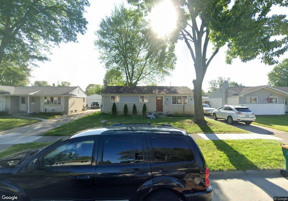
15737 Oakbrook St Romulus, MI 48174
Estimated Value: $172,000 - $188,000
3
Beds
2
Baths
960
Sq Ft
$187/Sq Ft
Est. Value
About This Home
This home is located at 15737 Oakbrook St, Romulus, MI 48174 and is currently estimated at $179,869, approximately $187 per square foot. 15737 Oakbrook St is a home located in Wayne County with nearby schools including Halecreek Elementary School, Romulus Middle School, and Romulus Senior High School.
Ownership History
Date
Name
Owned For
Owner Type
Purchase Details
Closed on
Jun 23, 2008
Sold by
Merrill Lynch Mortgage Lending Inc
Bought by
Southstar 1 Llc
Current Estimated Value
Home Financials for this Owner
Home Financials are based on the most recent Mortgage that was taken out on this home.
Original Mortgage
$40,800
Outstanding Balance
$26,060
Interest Rate
5.96%
Mortgage Type
Purchase Money Mortgage
Estimated Equity
$153,809
Purchase Details
Closed on
Feb 14, 2007
Sold by
Naidu Kula
Bought by
Merrill Lynch Mortgage Lending Inc
Purchase Details
Closed on
Jun 23, 2006
Sold by
Flagg Charles S and Flagg Lori A
Bought by
Naidu Kula
Purchase Details
Closed on
Mar 10, 1995
Sold by
Donald Walker
Bought by
Flagg Charles S and Flagg Lori A
Home Financials for this Owner
Home Financials are based on the most recent Mortgage that was taken out on this home.
Original Mortgage
$61,710
Interest Rate
8.97%
Mortgage Type
VA
Create a Home Valuation Report for This Property
The Home Valuation Report is an in-depth analysis detailing your home's value as well as a comparison with similar homes in the area
Home Values in the Area
Average Home Value in this Area
Purchase History
| Date | Buyer | Sale Price | Title Company |
|---|---|---|---|
| Southstar 1 Llc | -- | E Title Agency | |
| Merrill Lynch Mortgage Lending Inc | $72,135 | None Available | |
| Naidu Kula | $112,600 | Multiple | |
| Flagg Charles S | $60,500 | -- |
Source: Public Records
Mortgage History
| Date | Status | Borrower | Loan Amount |
|---|---|---|---|
| Open | Southstar 1 Llc | $40,800 | |
| Previous Owner | Flagg Charles S | $61,710 |
Source: Public Records
Tax History
| Year | Tax Paid | Tax Assessment Tax Assessment Total Assessment is a certain percentage of the fair market value that is determined by local assessors to be the total taxable value of land and additions on the property. | Land | Improvement |
|---|---|---|---|---|
| 2025 | $1,655 | $75,600 | $0 | $0 |
| 2024 | $1,665 | $69,400 | $0 | $0 |
| 2023 | $1,601 | $61,900 | $0 | $0 |
| 2022 | $1,886 | $57,000 | $0 | $0 |
| 2021 | $2,377 | $46,400 | $0 | $0 |
| 2020 | $2,327 | $45,800 | $0 | $0 |
| 2019 | $2,302 | $39,100 | $0 | $0 |
| 2018 | $1,690 | $30,300 | $0 | $0 |
| 2017 | $785 | $29,900 | $0 | $0 |
| 2016 | $2,079 | $31,300 | $0 | $0 |
| 2015 | $3,030 | $30,300 | $0 | $0 |
| 2013 | $2,970 | $32,200 | $0 | $0 |
| 2012 | $1,207 | $31,300 | $5,000 | $26,300 |
Source: Public Records
Map
Nearby Homes
- 15521 Brandt St
- 30771 Halecreek St
- 30455 Cherry Ave
- 30058 Halecreek St
- 15900 Sandburg St
- 15715 Merriman Rd
- 16068 Middlebelt Rd
- 16110 Farnum St
- 30620 Pennsylvania Rd
- 30930 Pennsylvania Rd Unit 8
- 00000 Pennsylvania Rd
- 00 Eureka Rd
- 15654 Isabelle St
- 4444 Eureka Rd
- 27597 Eureka Rd
- 29067 Cullen Dr Unit BLDG8
- 28567 Forest Dale St
- Lot 106 Hollywood
- Lot 107 Hollywood
- 00000 Huron
- 15749 Oakbrook St
- 15725 Oakbrook St
- 15761 Oakbrook St
- 15711 Oakbrook St
- 15738 Brandt St
- 15750 Brandt St
- 15726 Brandt St
- 15773 Oakbrook St
- 15701 Oakbrook St
- 15762 Brandt St
- 15714 Brandt St
- 15736 Oakbrook St
- 15712 Oakbrook St
- 15748 Oakbrook St
- 15724 Oakbrook St
- 15702 Brandt St
- 15774 Brandt St
- 15785 Oakbrook St
- 15588 Brandt St
- 15587 Oakbrook St
Your Personal Tour Guide
Ask me questions while you tour the home.