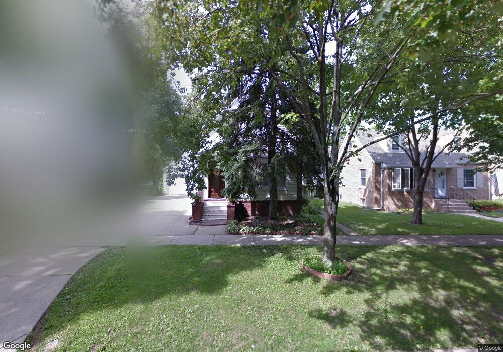
1574 E Walnut Ave Des Plaines, IL 60016
Estimated Value: $353,000 - $480,000
4
Beds
3
Baths
2,112
Sq Ft
$211/Sq Ft
Est. Value
About This Home
This home is located at 1574 E Walnut Ave, Des Plaines, IL 60016 and is currently estimated at $446,576, approximately $211 per square foot. 1574 E Walnut Ave is a home located in Cook County with nearby schools including Central Elementary School, Chippewa Middle School, and Maine West High School.
Ownership History
Date
Name
Owned For
Owner Type
Purchase Details
Closed on
May 18, 2006
Sold by
Marasa Lucille V and Shillington Gertrude
Bought by
Hosu Daniel and Hosu Diana
Current Estimated Value
Home Financials for this Owner
Home Financials are based on the most recent Mortgage that was taken out on this home.
Original Mortgage
$224,000
Interest Rate
6.71%
Mortgage Type
New Conventional
Create a Home Valuation Report for This Property
The Home Valuation Report is an in-depth analysis detailing your home's value as well as a comparison with similar homes in the area
Home Values in the Area
Average Home Value in this Area
Purchase History
| Date | Buyer | Sale Price | Title Company |
|---|---|---|---|
| Hosu Daniel | $280,000 | Cti |
Source: Public Records
Mortgage History
| Date | Status | Borrower | Loan Amount |
|---|---|---|---|
| Previous Owner | Hosu Daniel | $224,000 |
Source: Public Records
Tax History
| Year | Tax Paid | Tax Assessment Tax Assessment Total Assessment is a certain percentage of the fair market value that is determined by local assessors to be the total taxable value of land and additions on the property. | Land | Improvement |
|---|---|---|---|---|
| 2025 | $8,734 | $45,000 | $6,750 | $38,250 |
| 2024 | $8,734 | $31,196 | $6,000 | $25,196 |
| 2023 | $8,497 | $36,442 | $6,000 | $30,442 |
| 2022 | $8,497 | $36,442 | $6,000 | $30,442 |
| 2021 | $7,171 | $26,658 | $4,875 | $21,783 |
| 2020 | $7,118 | $26,658 | $4,875 | $21,783 |
| 2019 | $7,048 | $29,620 | $4,875 | $24,745 |
| 2018 | $6,635 | $25,622 | $4,312 | $21,310 |
| 2017 | $6,536 | $25,622 | $4,312 | $21,310 |
| 2016 | $7,278 | $28,689 | $4,312 | $24,377 |
| 2015 | $6,482 | $24,063 | $3,750 | $20,313 |
| 2014 | $6,850 | $25,714 | $3,750 | $21,964 |
| 2013 | $6,120 | $25,714 | $3,750 | $21,964 |
Source: Public Records
Map
Nearby Homes
- 1524 Oakwood Ave
- 1630 Henry Ave
- 1638 Oakwood Ave
- 1649 Ashland Ave Unit 501
- 1600 E Thacker St Unit 513
- 905 Center St Unit B208
- 1380 Oakwood Ave Unit 306
- 900 Center St Unit 3A
- 770 Pearson St Unit 808
- 821 Lexington Cir E
- 750 Pearson St Unit 904
- 711 S River Rd Unit 617
- 711 S River Rd Unit 704
- 650 S River Rd Unit 812
- 1277 E Thacker St Unit 303
- 787 Graceland Ave Unit 202B
- 1685 Mill St Unit 409
- 1700 E Forest Ave
- 603 S River Rd Unit 2M
- 1048 E Walnut Ave
- 1582 E Walnut Ave
- 1562 E Walnut Ave
- 1592 E Walnut Ave
- 1554 E Walnut Ave
- 1050 White St
- 1571 Oakwood Ave
- 1563 Oakwood Ave
- 1583 Oakwood Ave
- 1555 Oakwood Ave
- 1589 Oakwood Ave
- 1547 Oakwood Ave
- 1569 E Walnut Ave
- 1579 E Walnut Ave
- 1595 Oakwood Ave
- 1541 Oakwood Ave
- 1589 E Walnut Ave
- 1553 E Walnut Ave
- 1524 E Walnut Ave
- 1529 Oakwood Ave
- 1543 E Walnut Ave
Your Personal Tour Guide
Ask me questions while you tour the home.