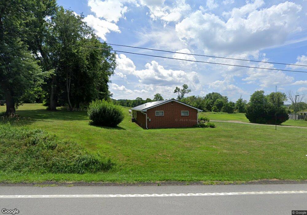
1574 Lucas Rd Mansfield, OH 44903
Estimated Value: $180,000 - $216,000
2
Beds
1
Bath
1,430
Sq Ft
$137/Sq Ft
Est. Value
About This Home
This home is located at 1574 Lucas Rd, Mansfield, OH 44903 and is currently estimated at $195,968, approximately $137 per square foot. 1574 Lucas Rd is a home located in Richland County with nearby schools including Lucas Elementary School, Lucas Heritage Middle School, and Lucas High School.
Ownership History
Date
Name
Owned For
Owner Type
Purchase Details
Closed on
Oct 22, 2018
Sold by
Stacy Dixie
Bought by
Stacy Tony P
Current Estimated Value
Purchase Details
Closed on
Nov 3, 2003
Sold by
Stacy Tony P and Stacy Lisa A
Bought by
Stacy Claude J and Stacy Dixie
Purchase Details
Closed on
Jun 20, 2001
Sold by
Hunt Thomas D
Bought by
Stacy Tony P
Home Financials for this Owner
Home Financials are based on the most recent Mortgage that was taken out on this home.
Original Mortgage
$59,000
Outstanding Balance
$22,425
Interest Rate
7.11%
Mortgage Type
New Conventional
Estimated Equity
$173,543
Create a Home Valuation Report for This Property
The Home Valuation Report is an in-depth analysis detailing your home's value as well as a comparison with similar homes in the area
Home Values in the Area
Average Home Value in this Area
Purchase History
| Date | Buyer | Sale Price | Title Company |
|---|---|---|---|
| Stacy Tony P | -- | None Available | |
| Stacy Claude J | $80,000 | -- | |
| Stacy Tony P | $80,000 | -- |
Source: Public Records
Mortgage History
| Date | Status | Borrower | Loan Amount |
|---|---|---|---|
| Open | Stacy Tony P | $59,000 |
Source: Public Records
Tax History
| Year | Tax Paid | Tax Assessment Tax Assessment Total Assessment is a certain percentage of the fair market value that is determined by local assessors to be the total taxable value of land and additions on the property. | Land | Improvement |
|---|---|---|---|---|
| 2024 | $2,151 | $41,730 | $10,030 | $31,700 |
| 2023 | $2,150 | $41,730 | $10,030 | $31,700 |
| 2022 | $1,713 | $30,110 | $8,040 | $22,070 |
| 2021 | $1,716 | $30,110 | $8,040 | $22,070 |
| 2020 | $1,739 | $30,110 | $8,040 | $22,070 |
| 2019 | $1,528 | $25,530 | $6,760 | $18,770 |
| 2018 | $1,007 | $25,530 | $6,760 | $18,770 |
| 2017 | $1,001 | $25,530 | $6,760 | $18,770 |
| 2016 | $990 | $25,220 | $6,420 | $18,800 |
| 2015 | $989 | $25,220 | $6,420 | $18,800 |
| 2014 | $993 | $25,220 | $6,420 | $18,800 |
| 2012 | $509 | $26,550 | $6,760 | $19,790 |
Source: Public Records
Map
Nearby Homes
- 0 State Route 39 & I-71 Northeast Quadrant
- 2011 Ohio 39
- 0 State Route 39 & I-71 Southeast Quadrant
- 1715 Mansfield Lucas Rd
- 1851 State Route 39
- 0 Mcelroy Rd
- 0 Peterson Rd
- 0 McBride Road Parcel # 1 Unit 9066028
- 1303 Park Ave E
- 794 Mansfield Washington Rd
- 1476 Park Ave E
- 2130 State Route 39
- 2420 Mansfield Washington Rd
- 832 Park Ave E
- 822 Park Ave E
- 0 Woodville Rd Unit Lot 14952, 14953
- 0 Woodville Rd Unit Lot 14954, 14955
- 0 Woodville Rd Unit Lot 14956, 14957,
- 62 Bahl Ave
- 291 Stewart Rd N
- 1578 State Route 39
- 1572 Lucas Rd
- 1577 Lucas Rd
- 1566 St Rt 39
- 1582 Lucas Rd
- 1581 Lucas Rd
- 3000 Lucas Rd
- 1566 Springmill Rd
- 1586 Lucas Rd
- 1588 Springmill Rd
- 1587 Lucas Rd
- 1590 Lucas Rd
- 1010 Wallace Rd
- 1594 Springmill Rd
- 894 Wallace Rd
- 1078 Wallace Rd
- 1229 Wallace Rd
- 1647 Chew Rd
- 1657 Chew Rd
- 1597 Chew Rd
Your Personal Tour Guide
Ask me questions while you tour the home.