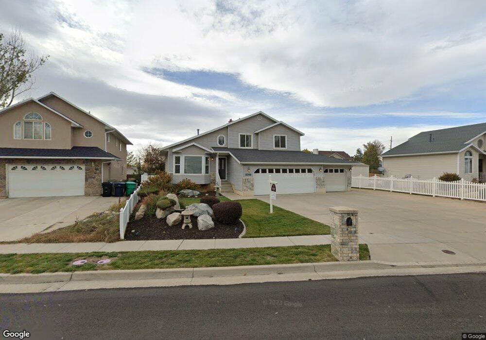
1574 S 1220 W Woods Cross, UT 84087
Estimated Value: $503,000 - $532,000
3
Beds
3
Baths
1,435
Sq Ft
$362/Sq Ft
Est. Value
About This Home
This home is located at 1574 S 1220 W, Woods Cross, UT 84087 and is currently estimated at $519,845, approximately $362 per square foot. 1574 S 1220 W is a home located in Davis County with nearby schools including Woods Cross Elementary School, South Davis Junior High School, and Woods Cross High School.
Ownership History
Date
Name
Owned For
Owner Type
Purchase Details
Closed on
Dec 9, 2022
Sold by
Corpa Richard
Bought by
Carps Richard and Mcclanahan Shannon
Current Estimated Value
Home Financials for this Owner
Home Financials are based on the most recent Mortgage that was taken out on this home.
Original Mortgage
$394,383
Outstanding Balance
$382,441
Interest Rate
7.08%
Mortgage Type
FHA
Estimated Equity
$137,404
Purchase Details
Closed on
Dec 8, 2022
Sold by
Douglas Ray Shimizu Trust
Bought by
Cerpa Richard
Home Financials for this Owner
Home Financials are based on the most recent Mortgage that was taken out on this home.
Original Mortgage
$394,383
Outstanding Balance
$382,441
Interest Rate
7.08%
Mortgage Type
FHA
Estimated Equity
$137,404
Purchase Details
Closed on
Mar 22, 2021
Sold by
Shimizu Douglas Ray and Shimizu Lynda Ann
Bought by
Shimizu Douglas R and The Douglas Ray Shimizu Trust
Purchase Details
Closed on
May 17, 2018
Sold by
Shimizu Doug R
Bought by
Shimizu Doug R and Shimizu Trust
Purchase Details
Closed on
Sep 20, 2006
Sold by
Shimizu Danny S
Bought by
Shimizu Doug R
Purchase Details
Closed on
Oct 31, 1996
Sold by
Carroll Alan L and Carroll Bonnie
Bought by
Shimizu Danny S
Home Financials for this Owner
Home Financials are based on the most recent Mortgage that was taken out on this home.
Original Mortgage
$135,750
Interest Rate
8.11%
Purchase Details
Closed on
May 20, 1996
Sold by
Carroll Alan L
Bought by
Carroll Alan L and Carroll Bonnie
Home Financials for this Owner
Home Financials are based on the most recent Mortgage that was taken out on this home.
Original Mortgage
$97,000
Interest Rate
7.8%
Purchase Details
Closed on
Apr 24, 1996
Sold by
Rich Lands Llc
Bought by
Carroll Alan
Home Financials for this Owner
Home Financials are based on the most recent Mortgage that was taken out on this home.
Original Mortgage
$97,000
Interest Rate
7.8%
Create a Home Valuation Report for This Property
The Home Valuation Report is an in-depth analysis detailing your home's value as well as a comparison with similar homes in the area
Home Values in the Area
Average Home Value in this Area
Purchase History
| Date | Buyer | Sale Price | Title Company |
|---|---|---|---|
| Carps Richard | -- | Fidelity National Title | |
| Cerpa Richard | -- | Us Title | |
| Shimizu Douglas R | -- | Aspen Title Insura | |
| Shimizu Douglas Ray | -- | Aspen Title Insurance | |
| Shimizu Doug R | -- | None Available | |
| Shimizu Doug R | -- | Western States Title Company | |
| Shimizu Danny S | -- | Associated Title Company | |
| Carroll Alan L | -- | Blacks Title Inc | |
| Carroll Alan | -- | Blacks Title Inc |
Source: Public Records
Mortgage History
| Date | Status | Borrower | Loan Amount |
|---|---|---|---|
| Open | Cerpa Richard | $394,383 | |
| Previous Owner | Shimizu Danny S | $135,750 | |
| Previous Owner | Carroll Alan L | $97,000 |
Source: Public Records
Tax History Compared to Growth
Tax History
| Year | Tax Paid | Tax Assessment Tax Assessment Total Assessment is a certain percentage of the fair market value that is determined by local assessors to be the total taxable value of land and additions on the property. | Land | Improvement |
|---|---|---|---|---|
| 2025 | $3,130 | $251,350 | $131,089 | $120,261 |
| 2024 | $3,042 | $242,001 | $144,073 | $97,928 |
| 2023 | $2,717 | $420,000 | $194,692 | $225,308 |
| 2022 | $2,626 | $238,150 | $84,382 | $153,768 |
| 2021 | $2,458 | $342,000 | $125,539 | $216,461 |
| 2020 | $2,096 | $298,000 | $120,017 | $177,983 |
| 2019 | $2,064 | $289,000 | $110,023 | $178,977 |
| 2018 | $1,957 | $272,000 | $107,791 | $164,209 |
| 2016 | $1,594 | $121,441 | $51,486 | $69,955 |
| 2015 | $1,491 | $109,946 | $51,486 | $58,460 |
| 2014 | $1,506 | $114,836 | $51,486 | $63,350 |
| 2013 | -- | $103,556 | $42,292 | $61,264 |
Source: Public Records
Map
Nearby Homes
- 1334 W 1300 S
- 1309 W 1200 S
- 1422 W 1300 S
- 1288 S 1050 W
- 1255 W 2050 S
- 1137 S 1050 W
- 1384 W 2175 S
- 1984 S 1500 W
- Swiss 2 - Urban Plan at The Audrey - theAUDREY
- Swiss 3 - Urban Plan at The Audrey - theAUDREY
- Swiss 1 - Cottage Plan at The Audrey - theAUDREY
- Swiss 4 - Cottage Plan at The Audrey - theAUDREY
- Swiss 2 - Cottage Plan at The Audrey - theAUDREY
- Swiss 3 - Cottage Plan at The Audrey - theAUDREY
- Swiss 4 - Urban Plan at The Audrey - theAUDREY
- Swiss 1 - Urban Plan at The Audrey - theAUDREY
- 1069 W Linden Ln Unit 31
- 1072 W Audrey Ln Unit 17
- 1064 W Audrey Ln Unit 15
- 1056 W Audrey Ln Unit 14