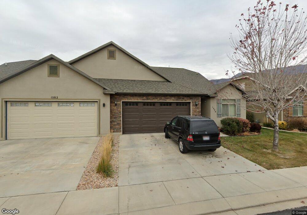
1574 W 480 N Unit 4 Lindon, UT 84042
Estimated Value: $506,000 - $527,399
2
Beds
2
Baths
2,369
Sq Ft
$220/Sq Ft
Est. Value
About This Home
This home is located at 1574 W 480 N Unit 4, Lindon, UT 84042 and is currently estimated at $520,350, approximately $219 per square foot. 1574 W 480 N Unit 4 is a home located in Utah County with nearby schools including Lindon Elementary School, Oak Canyon Junior High School, and Pleasant Grove High School.
Ownership History
Date
Name
Owned For
Owner Type
Purchase Details
Closed on
Nov 18, 2016
Sold by
Prim & Proper Llc
Bought by
Juarez Sergio J and Juarez Rebecca D
Current Estimated Value
Purchase Details
Closed on
May 10, 2013
Sold by
Juarez Sergio J and Juarez Rebecca D
Bought by
Prim & Proper Llc
Home Financials for this Owner
Home Financials are based on the most recent Mortgage that was taken out on this home.
Original Mortgage
$180,196
Interest Rate
3.51%
Mortgage Type
New Conventional
Purchase Details
Closed on
May 3, 2013
Sold by
Lindon Creekside Llc
Bought by
Juarez Sergio J and Juarez Rebecca D
Home Financials for this Owner
Home Financials are based on the most recent Mortgage that was taken out on this home.
Original Mortgage
$180,196
Interest Rate
3.51%
Mortgage Type
New Conventional
Create a Home Valuation Report for This Property
The Home Valuation Report is an in-depth analysis detailing your home's value as well as a comparison with similar homes in the area
Home Values in the Area
Average Home Value in this Area
Purchase History
| Date | Buyer | Sale Price | Title Company |
|---|---|---|---|
| Juarez Sergio J | -- | Surety Title Agency Coastal | |
| Prim & Proper Llc | -- | None Available | |
| Juarez Sergio J | -- | United Title Services |
Source: Public Records
Mortgage History
| Date | Status | Borrower | Loan Amount |
|---|---|---|---|
| Previous Owner | Juarez Sergio J | $180,196 |
Source: Public Records
Tax History Compared to Growth
Tax History
| Year | Tax Paid | Tax Assessment Tax Assessment Total Assessment is a certain percentage of the fair market value that is determined by local assessors to be the total taxable value of land and additions on the property. | Land | Improvement |
|---|---|---|---|---|
| 2025 | $2,319 | $518,100 | $149,300 | $368,800 |
| 2024 | $2,319 | $285,395 | $0 | $0 |
| 2023 | $2,238 | $295,900 | $0 | $0 |
| 2022 | $2,333 | $297,990 | $0 | $0 |
| 2021 | $1,740 | $335,000 | $135,000 | $200,000 |
| 2020 | $1,767 | $335,000 | $135,000 | $200,000 |
| 2019 | $1,694 | $335,000 | $135,000 | $200,000 |
| 2018 | $1,788 | $333,200 | $135,000 | $198,200 |
| 2017 | $1,752 | $175,010 | $0 | $0 |
| 2016 | $1,616 | $149,380 | $0 | $0 |
| 2015 | $1,618 | $141,350 | $0 | $0 |
| 2014 | $1,620 | $140,250 | $0 | $0 |
Source: Public Records
Map
Nearby Homes
- Washington Farmhouse Plan at Anderson Farms
- 3810 W Valley Dr
- 1434 W Watson Ln
- 1424 Gala Ln
- 264 N Old Farm Ln
- 611 N Briarwood Ln
- 1362 W Valley Dr
- 1430 W Kelsey Way
- 574 N Cornstalk Ln
- 556 N Cornstalk Ln
- 1277 W Sweet Corn Ln
- 557 N Buffalo Grass Ln
- 575 N Buffalo Grass Ln
- 554 N Buffalo Grass Ln
- 556 N Buffalo Grass Ln
- 564 N Buffalo Grass Ln Unit 1250
- 558 N Buffalo Grass Ln
- 560 N Buffalo Grass Ln
- 929 W 670 S Unit 9
- 963 W 670 S Unit 20
- 1582 W 480 N Unit 3
- 1582 W 480 N
- 1552 W 480 N Unit 5
- 1596 W 480 N Unit 2
- 1596 W 480 N
- 1538 W 480 N
- 1612 W 480 N
- 1612 W 480 N Unit 1
- 1577 W 480 N
- 1589 W 480 N Unit 38
- 1589 W 480 N
- 1561 W 480 N Unit 40
- 1526 W 480 N Unit 7
- 1526 W 480 N Unit 17
- 1543 W 480 N
- 1605 W 480 N Unit 37
- 1568 W 500 N
- 1552 W 500 N
- 1514 W 480 N Unit 8
- 1531 W 480 N Unit 42