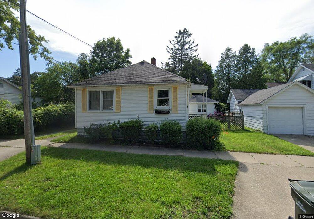
1575 Franklin St Muskegon, MI 49441
Nims NeighborhoodEstimated Value: $138,000 - $179,000
1
Bed
1
Bath
876
Sq Ft
$182/Sq Ft
Est. Value
About This Home
This home is located at 1575 Franklin St, Muskegon, MI 49441 and is currently estimated at $159,352, approximately $181 per square foot. 1575 Franklin St is a home located in Muskegon County with nearby schools including Muskegon Covenant Academy, Muskegon Catholic Central School, and St. Michael Elementary School.
Ownership History
Date
Name
Owned For
Owner Type
Purchase Details
Closed on
Apr 29, 2008
Sold by
Margaret Mulder Revocable Trust
Bought by
Shears Jill
Current Estimated Value
Home Financials for this Owner
Home Financials are based on the most recent Mortgage that was taken out on this home.
Original Mortgage
$50,597
Outstanding Balance
$32,127
Interest Rate
5.93%
Mortgage Type
FHA
Estimated Equity
$127,225
Purchase Details
Closed on
Feb 17, 2005
Sold by
Mulder Margaret and Mulder Marge
Bought by
Mulder Margaret and Margaret Mulder Revocable Trust
Create a Home Valuation Report for This Property
The Home Valuation Report is an in-depth analysis detailing your home's value as well as a comparison with similar homes in the area
Home Values in the Area
Average Home Value in this Area
Purchase History
| Date | Buyer | Sale Price | Title Company |
|---|---|---|---|
| Shears Jill | $51,000 | None Available | |
| Mulder Margaret | -- | Rei |
Source: Public Records
Mortgage History
| Date | Status | Borrower | Loan Amount |
|---|---|---|---|
| Open | Shears Jill | $50,597 |
Source: Public Records
Tax History Compared to Growth
Tax History
| Year | Tax Paid | Tax Assessment Tax Assessment Total Assessment is a certain percentage of the fair market value that is determined by local assessors to be the total taxable value of land and additions on the property. | Land | Improvement |
|---|---|---|---|---|
| 2025 | $1,137 | $60,400 | $0 | $0 |
| 2024 | $299 | $49,300 | $0 | $0 |
| 2023 | $286 | $43,100 | $0 | $0 |
| 2022 | $1,063 | $35,500 | $0 | $0 |
| 2021 | $1,045 | $31,100 | $0 | $0 |
| 2020 | $1,014 | $27,300 | $0 | $0 |
| 2019 | $995 | $24,500 | $0 | $0 |
| 2018 | $973 | $24,000 | $0 | $0 |
| 2017 | $940 | $22,700 | $0 | $0 |
| 2016 | $243 | $21,700 | $0 | $0 |
| 2015 | -- | $21,900 | $0 | $0 |
| 2014 | $239 | $21,700 | $0 | $0 |
| 2013 | -- | $20,500 | $0 | $0 |
Source: Public Records
Map
Nearby Homes
- 995 W Southern Ave
- 1636 Franklin St
- 933 W Southern Ave
- 923 W Southern Ave
- 1465 Barclay St
- 972 W Dale Ave
- VL Washington
- 905 W Forest Ave
- 902 W Southern Ave
- 952 Boardwalk Cove Dr
- 929 Ireland Ave
- 1135 W Dale Ave
- 988 W Larch Ave
- 1151 W Dale Ave
- 1497 Division St
- 1270 Palmer Ave
- 790 W Southern Ave
- 1776 Division St
- 827 W Larch Ave
- 1007 Boardwalk Cove Dr
- 1047 W Southern Ave
- 1055 W Southern Ave
- 1046 W Forest Ave
- 1063 W Southern Ave
- 1060 W Forest Ave
- 1027 W Southern Ave
- 1594 Franklin St
- 1069 W Southern Ave
- 1070 W Forest Ave
- 1019 W Southern Ave
- 1079 W Southern Ave
- 1028 W Southern Ave
- 1020 W Forest Ave
- 1078 W Forest Ave
- 1011 W Southern Ave
- 1020 W Southern Ave
- 1012 W Forest Ave
- 1087 W Southern Ave
- 1003 W Southern Ave
- 1029 W Forest Ave