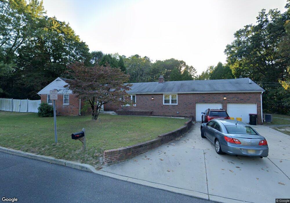
1575 Kearsley Rd Sicklerville, NJ 08081
Erial NeighborhoodEstimated Value: $389,095 - $472,000
4
Beds
3
Baths
1,880
Sq Ft
$222/Sq Ft
Est. Value
About This Home
This home is located at 1575 Kearsley Rd, Sicklerville, NJ 08081 and is currently estimated at $416,774, approximately $221 per square foot. 1575 Kearsley Rd is a home located in Camden County with nearby schools including Timber Creek High School and Erial Community Church Christian School.
Ownership History
Date
Name
Owned For
Owner Type
Purchase Details
Closed on
Sep 13, 2024
Sold by
Atkins Ernestine F and Atkins James N
Bought by
Atkins Ernestine F
Current Estimated Value
Home Financials for this Owner
Home Financials are based on the most recent Mortgage that was taken out on this home.
Original Mortgage
$26,165
Interest Rate
6.35%
Mortgage Type
New Conventional
Purchase Details
Closed on
May 19, 2010
Sold by
Cataldi Mary H
Bought by
Atkins James N and Atkins Ernestine F
Purchase Details
Closed on
Jan 12, 1998
Sold by
Bankers Trust Co Trustee
Bought by
Cataldi Frank and Cataldi Mary
Home Financials for this Owner
Home Financials are based on the most recent Mortgage that was taken out on this home.
Original Mortgage
$40,000
Interest Rate
7.11%
Create a Home Valuation Report for This Property
The Home Valuation Report is an in-depth analysis detailing your home's value as well as a comparison with similar homes in the area
Home Values in the Area
Average Home Value in this Area
Purchase History
| Date | Buyer | Sale Price | Title Company |
|---|---|---|---|
| Atkins Ernestine F | -- | 2020 Title | |
| Atkins James N | $165,000 | -- | |
| Cataldi Frank | $80,000 | -- |
Source: Public Records
Mortgage History
| Date | Status | Borrower | Loan Amount |
|---|---|---|---|
| Previous Owner | Atkins Ernestine F | $26,165 | |
| Previous Owner | Cataldi Frank | $40,000 |
Source: Public Records
Tax History Compared to Growth
Tax History
| Year | Tax Paid | Tax Assessment Tax Assessment Total Assessment is a certain percentage of the fair market value that is determined by local assessors to be the total taxable value of land and additions on the property. | Land | Improvement |
|---|---|---|---|---|
| 2025 | $8,711 | $204,000 | $52,800 | $151,200 |
| 2024 | $8,470 | $204,000 | $52,800 | $151,200 |
| 2023 | $8,470 | $204,000 | $52,800 | $151,200 |
| 2022 | $8,417 | $204,000 | $52,800 | $151,200 |
| 2021 | $7,981 | $204,000 | $52,800 | $151,200 |
| 2020 | $8,225 | $204,000 | $52,800 | $151,200 |
| 2019 | $8,056 | $204,000 | $52,800 | $151,200 |
| 2018 | $8,025 | $204,000 | $52,800 | $151,200 |
| 2017 | $7,766 | $204,000 | $52,800 | $151,200 |
| 2016 | $7,599 | $204,000 | $52,800 | $151,200 |
| 2015 | $7,056 | $204,000 | $52,800 | $151,200 |
| 2014 | $7,009 | $204,000 | $52,800 | $151,200 |
Source: Public Records
Map
Nearby Homes
- 1588 Kearsley Rd
- 1 Carrie Place
- 49 Hazeltop Dr Unit HZ049
- 25 Estates Ct
- 90 Shenandoah Dr
- 130 E Clearview Ave
- 108 E 12th Ave
- 104 E Clearview Ave
- 28 Mary Ellen Ln
- 109 E 11th Ave
- 12 Loft Mountain Dr Unit LM012
- 108 Estates Rd
- 73 Hazeltop Dr
- 33 Mac Knight Dr
- 118 Shenandoah Dr Unit SH118
- 37 Loft Mountain Dr
- 34 Skyline Dr
- 68 Sturbridge Dr
- 40 Mac Knight Dr
- 300 Turnerville Rd
- 1600 Jarvis Rd
- 5 Hazeltop Dr
- 16 Hazeltop Dr
- 1600 Kearsley Rd
- 1580 Jarvis Rd
- 1544 Kearsley Rd
- 1541 Kearsley Rd
- 1590 Kearsley Rd
- 1493 Kearsley Rd
- 12 Hazeltop Dr
- 21 Turnerville Rd
- 1570 Jarvis Rd
- 1527 Kearsley Rd
- 1534 Kearsley Rd
- 1489 Kearsley Rd
- 1524 Kearsley Rd
- 1560 Jarvis Rd
- 1485 Kearsley Rd
- 1518 Kearsley Rd
- 900 Turnerville Rd